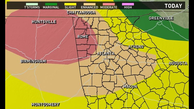
A line of severe thunderstorms is making its way towards Georgia on Monday that can bring severe weather, hail and possible tornadoes. The risk for parts of North Georgia has been upgraded to moderate, which only happens a couple of days per year.
There are five levels of risk levels for severe weather and moderate is 4 out of 5.
We will start to see isolated thunderstorms throughout the state. Some of those isolated storms could be supercell storms. This could potentially mean we can see some damaging winds of up to 50-60 mph and some weak tornadoes.
These isolated storms can also produce hail, so be vigilant and be careful.
Here is a timeline of what to expect:
9 p.m.
Isolated showers and thunderstorms will become widespread and intense during the late evening hours throughout Northwest Georgia and metro-Atlanta.
10 p.m.
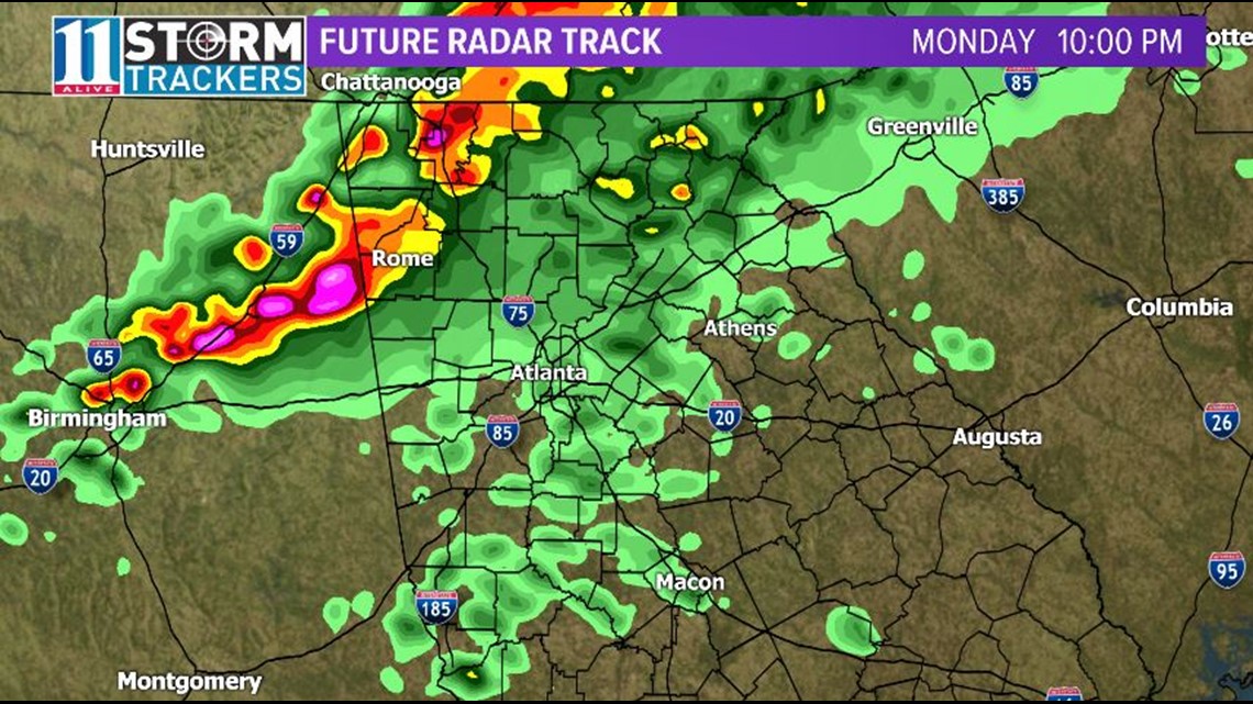
Rome will be getting the brunt of the storm as a line of severe thunderstorms will make its way into the north corner of the state at around 10:00 p.m.
11 p.m.
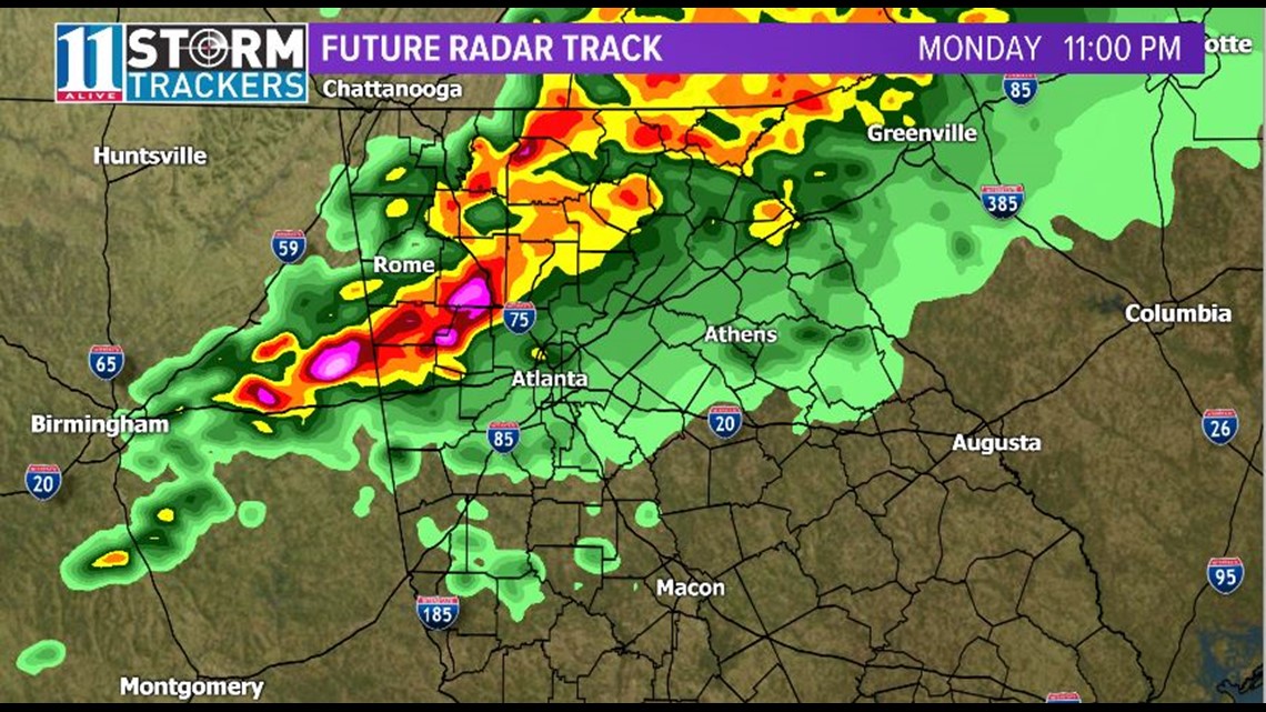
The storm begins to head southeast towards Atlanta.
Midnight
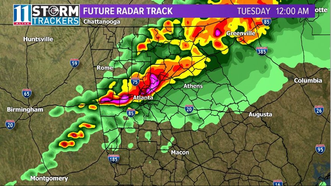
Metro Atlanta will see the impacts of the severe thunderstorms beginning around midnight and through 2:00 a.m.
2 a.m.
The storm is expected to have passed through Athens and should have begun to dissipate by 2 a.m. on Tuesday.
Be sure to keep your weather radio handy, if you have one, and keep updated with alerts from 11Alive's Weather App on iTunes and Google Play.