
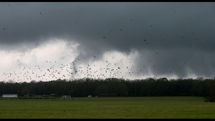
ATLANTA — A significant severe weather outbreak occurred west of us and storms continue working through Georgia Thursday morning. When it's all said and done, the National Weather Service says roughly 16 million people in the Southeast could see powerful storms through Thursday. Storm damage was reported in Alabama, Mississippi and Texas.
Downpours and thunderstorms will continue working through North Georgia Thursday morning. A few could be strong with gusty winds, heavy rain and lightning. A brief tornado cannot be ruled out. Winds pick up behind the storms and could gust to 35 miles per hour this afternoon.
Have a way to get important weather information and warnings!
11Alive's StormTrackers are closely tracking this evolving weather situation. Here are the latest weather updates:
LIVE UPDATES
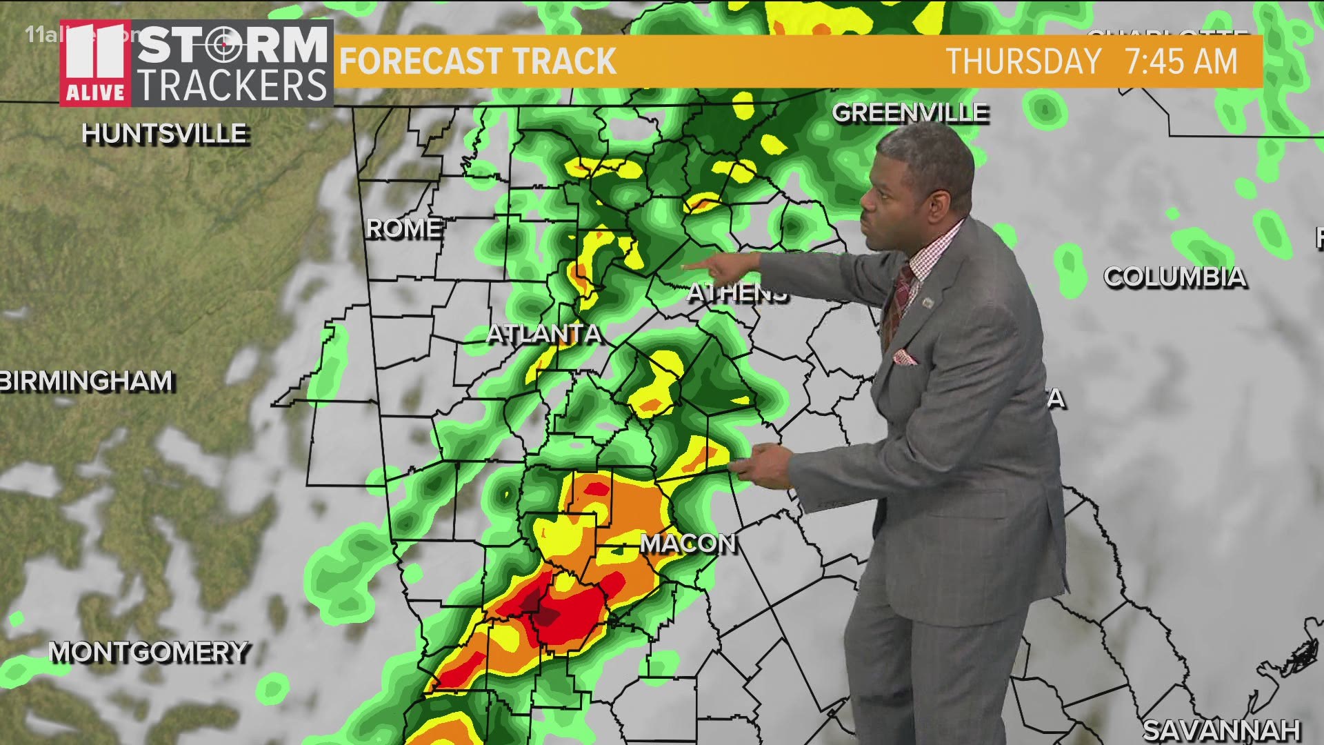
10:00 a.m. | There is one last line of downpours and storms across the Eastern side of the metro. Repeated rounds of heavy rain is impacting some areas, so localized street flooding is possible.
9:30 a.m.| Street flooding reported in Atlanta on North Avenue east of the downtown Connector near Central Place. Some cars were flooded with water up to the windows. The flood waters quickly receded.
9:00 a.m. | The tornado watch for Upson county has expired.
8:30 a.m. | Showers and storms are tracking through the heart of the Atlanta metro. They are producing heavy rain and lightning. Some gusty winds are possible as well.
8:00 a.m. | A new tornado watch was issued for southwest Georgia until 1 p.m. This does not include any of our viewing area.
6:55 a.m. | Rumbles of thunder near our Atlanta studios. We are not out of the woods, yet! Showers and thunderstorms will continue tracking through the area through mid morning. Our severe risk is not as high as it could have been, thanks to a wedge of cool air that kept us more stable. Still, a few of these storms could be strong, and an isolated severe storm is possible as well.
6:40 a.m. | While most of the tornado watches have been canceled, the one in Upson County and south have been extended until 9 a.m. Storms moving into the state are hitting our more stable air and weakening.
5 a.m. | A heads up if you have an appointment today for a COVID-19 vaccine at any of the state-run mass vaccination sites. They are delaying opening some locations.
4:30 a.m. | We are still tracking some thunderstorms over the next couple of hours -- some of which could be strong or severe.
4:15 a.m. | A Wind Advisory has been issued for all of north Georgia from 11 a.m. to 8 p.m. Gusts up to 35 mph are possible.
4 a.m. | An early edition of Morning Rush is live on 11Alive right now. We are tracking the latest and when to expect the next round of storms. You can also watch it here:
3:35 a.m. | The tornado watch that was in effect until 7 a.m. was canceled early for several counties by the National Weather Service. It remains for Upson County and points south.
3:15 a.m. | We're in a lull in Atlanta right now -- but more storms are back to our west and southwest, according to meteorologist Melissa Nord.
2:10 a.m. | A new severe outlook was just issued. Level 1 and 2 for parts of our viewing area.
2 a.m. | Here's the latest from Chief Meteorologist Chris Holcomb talking about what to expect for the rest of the morning -- and for the remainder of the week.
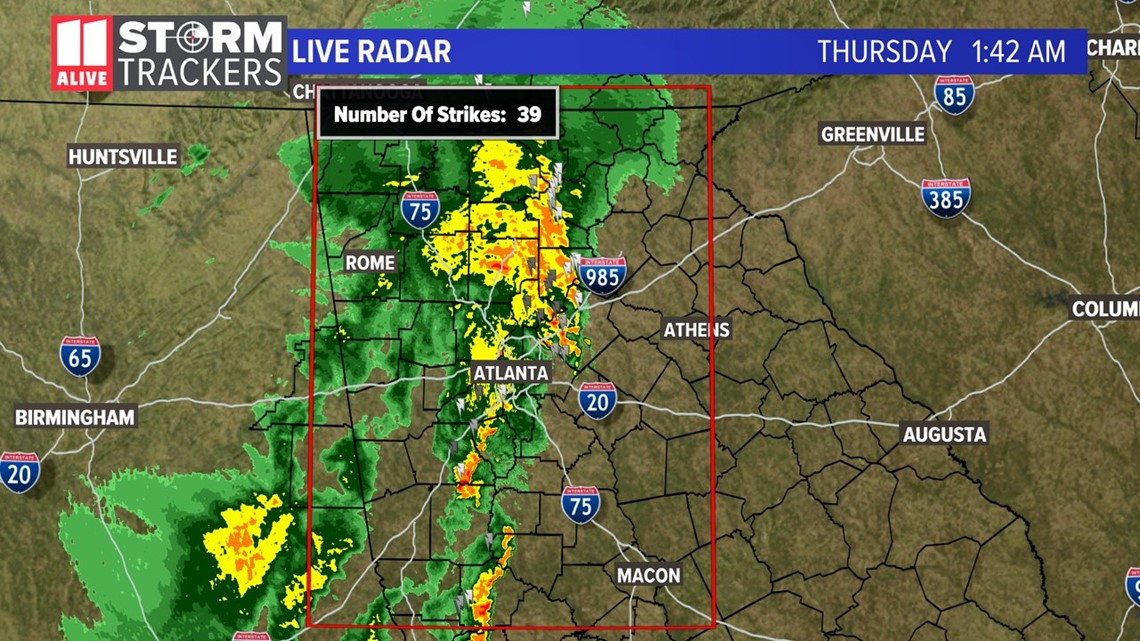
1:45 a.m. | You may be waking up hearing some heavy rain, thunder and seeing some lightning flashes. We have about 39 lightning strikes in the last 15 minutes along this line of storms. Nothing severe at this point.

1:30 a.m. | Although there are no warnings at the moment, strong storms with gusts 40 - 50, intense lightning and heavy rain are moving through the Atlanta metro, including near our station in Midtown.
11Alive Meteorologist Melissa Nord says we can thank our wedge of cool air from the day for the weakening trend in the storms. It kept our atmosphere stable. She said we still have some strong storms, but not the potential they could've been as of now.
1 a.m. | Check out the heavy rain falling in Floyd County captured by photojournalist Tyson Paul.
12:10 a.m. | A Severe Thunderstorm Warning has been issued for Floyd, Bartow, Gordon, Paulding, Polk, Haralson, Chattooga until 1 a.m. The National Weather Service says 60 mph winds and penny-sized hail is possible.
12 a.m. | The National Weather Service in Peachtree City has issued a Tornado Watch for some counties along - and south of I-20 until 7 a.m. on Thursday. The full list of counties is:
Baker, Bibb, Butts, Calhoun, Carroll, Chattahoochee, Clay, Coweta, Crawford, Crisp, Dooly, Dougherty, Douglas, Early, Fayette, Haralson, Harris, Heard, Houston, Lamar, Lee, Macon, Marion, Meriweather, Miller, Monroe, Muscogee, Paulding, Peach, Pike, Polk, Quitman, Randolph, Schley, Seminole, Spalding, Stewart, Sumter, Talbot, Taylor, Terrell, Troup, Upson and Webster.
WEDNESDAY
11:35 p.m. | The line of severe thunderstorms is just west of the GA/AL line moving this way. There are no tornado warnings at this time. We'll keep tracking it as it moves closer.
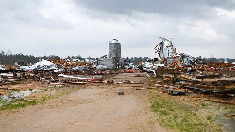
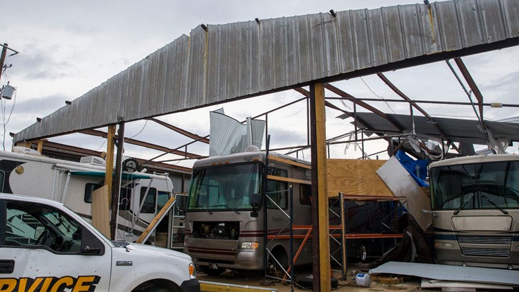
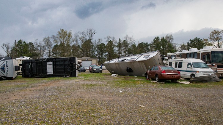
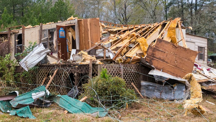
11 p.m. | We are getting our first look at some of the damage these storms brought to parts of Alabama.
Photos: Tornado damage in Alabama


10:30 p.m. | We've got the live radar loop running for you to check out the latest. 11Alive will have team coverage for you throughout the night bringing you the latest updates and warnings. As of now, there are no active warnings in Georgia, but the main event is nearing the state.
5:52 p.m. | A flash flood watch has been issued for Bartow, Catoosa, Chatooga, Cherokee, Dade, Fannin, Floyd Gilmer, Gordon, Murray, Pickens, Polk, Walker, Whitfield and is in effect until March 18 at 8 a.m.
5:00 p.m. | Atlanta Public Schools says they will hold an virtual teaching and learning day on Thursday in anticipation for severe weather. All after-school activities are also canceled for tomorrow.
4:48 p.m. - Cobb County Schools says it is monitoring the weather situation, and is in "active conversations" with the National Weather Service and Georgia Emergency Management Agency.
"To protect students and staff who could be traveling to school during dangerous weather conditions, we are continuing to monitor conditions and will provide an update to all students, parents, and staff by this evening," the district said.
► Download the FREE 11Alive app now in the iTunes store or on Google Play.
► POWER OUTAGES CHECK | Georgia Power customers, check here. Georgia EMC customers check here.
► Have a news tip? Email news@11alive.com, visit our Facebook page or Twitter feed.