ST. PETERSBURG, Fla. -- As meteorologists keep an eye on Alberto, you can follow along!
Download the FREE 11Alive News app for breaking weather alerts on Alberto.
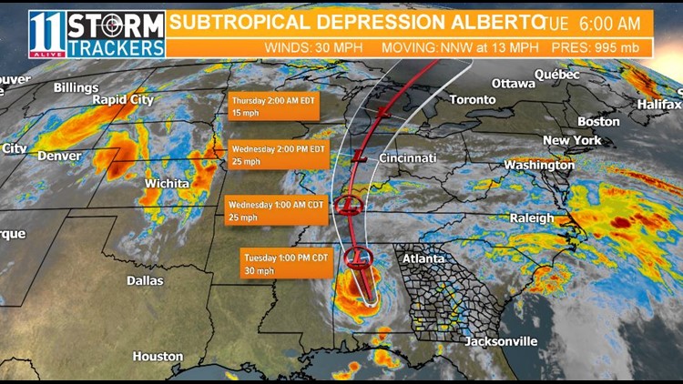
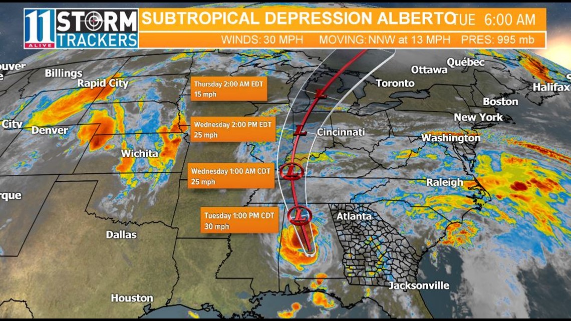
Tropical track
This is the latest "cone of uncertainty," which shows an area where the center of the storm could go, when and how strong it might be at the given time. Alberto made landfall at around 5 p.m. Monday, May 28, 2018.
By 11 p.m., the system was downgraded to a subtropical depression.
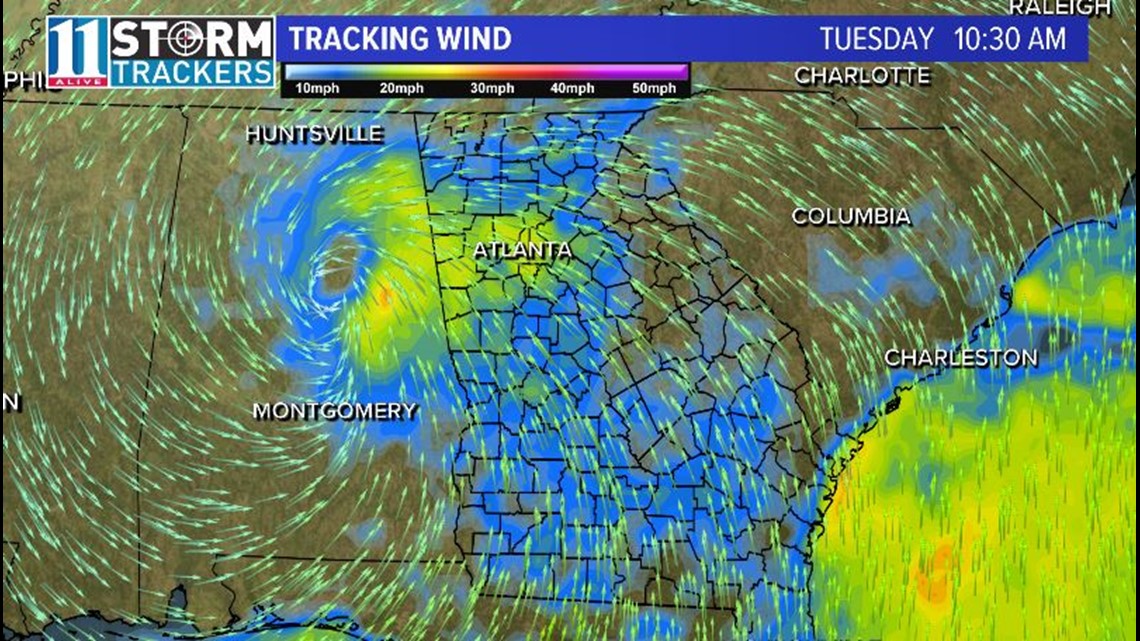
Wind Threat
As Alberto moves northward into Alabama, we will see winds increasing Tuesday morning in the metro area.
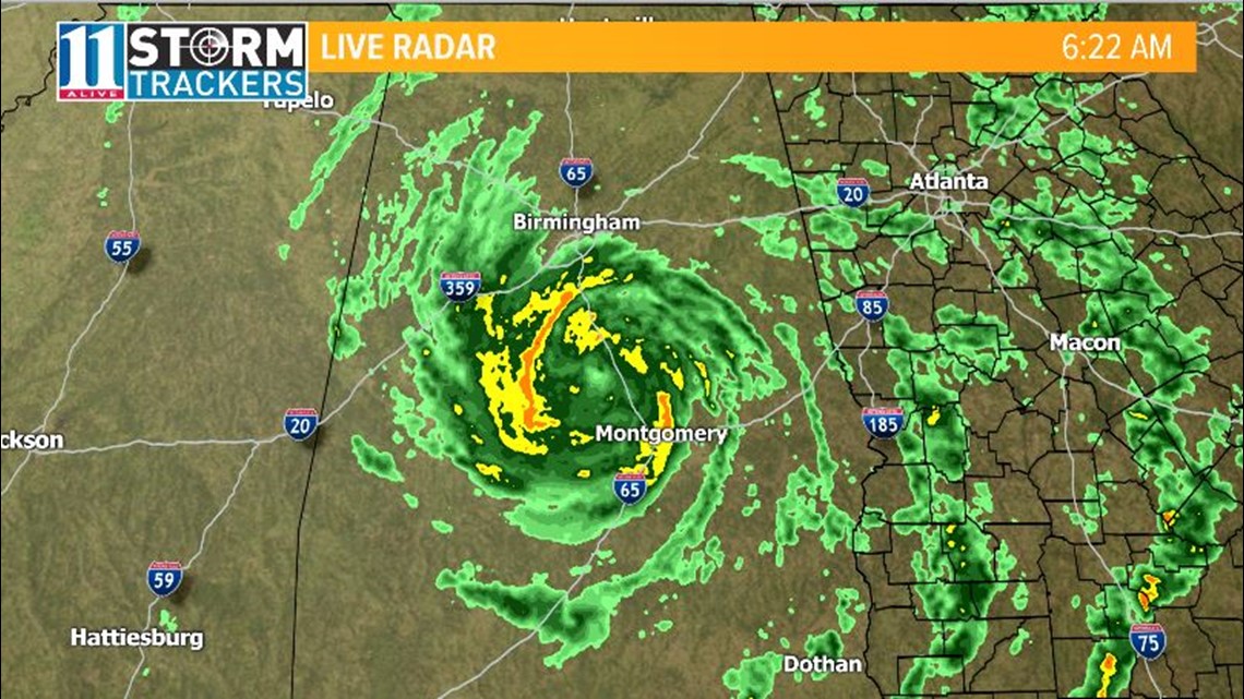
Satellite and radar
The latest satellite and radar image for the Gulf of Mexico and Atlantic Ocean.
► Download the FREE 11Alive News app now in the iTunes store or on Google Play to receive updates on Alberto.
Have a news tip? Email news@11alive.com, visit our Facebook page or Twitter feed.