Another day of heavy rains resulted in numerous tornado, severe thunderstorm and flash flood warnings throughout north and central Georgia on Thursday.
A flash flood watch remains in effect until 8 a.m. Friday morning and 11Alive StormTrackers have been tracking bands of heavy rain moving through the area. The main threat will be for heavy rain and potential for flooding.
Check back for updates on weather across the region as they become available:
9:03 pm --
A flash flood warning has been issued for Butts; Henry; Lamar; Pike; Spalding and Upson counties until 3 am Friday.
9:02 pm --
Clayton County police said a portion of Upper Riverdale Road was closed due to flooding. The roadway is flooded at Upper Riverdale Road from Garden Walk Boulevard up to Arrowhead Boulevard.
7:54 pm --
Flash flood warnings issued for Clayton; DeKalb; Fayette; Fulton and Henry counties until 1:45 am Friday.
6:08 pm --
Flash flood warning for Coweta; Fayette; Fulton; Meriwether; Pike and Spalding counties until midnight.
5:13 pm --
Severe thunderstorm warnings for Jasper, Morgan and Newton counties until 5:45 pm. National Weather Service says tornadoes possible.
4:58 pm --
Trees and live wires were reported to be down at Turner Road at Lake Jodeco Road in Clayton County.
4:56 pm --
Severe thunderstorm warning for Jasper, Morgan and Putnam counties until 5:30 pm.
4:42 pm --
Tornado warning issued for Butts, Jasper and Newton counties until 5:15 pm.
4:39 pm --
Flash flood warning extended for Floyd County until 10:30 pm.
4:27 pm --
Tornado warning issued for Jasper and Putnam counties until 5 pm.
4:05 pm
A tornado warning has been issued for Butts, Jasper and Monroe counties until 4:45 pm.
3:55 p.m.
Tornado warning issued for Jasper, Jones and Putnam counties until 4:30 p.m.
2:37 p.m.
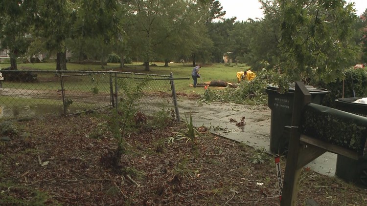
Clarke County Emergency Manager reports tree down on powerline on Live Oak Place in Athens, Georgia due to severe thunderstorms.
2:29 p.m.
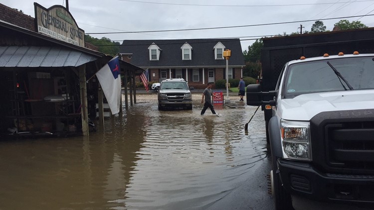
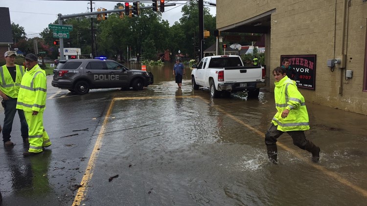
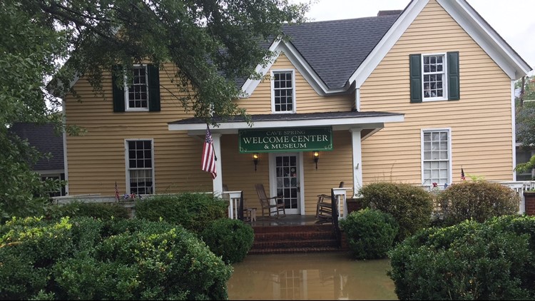
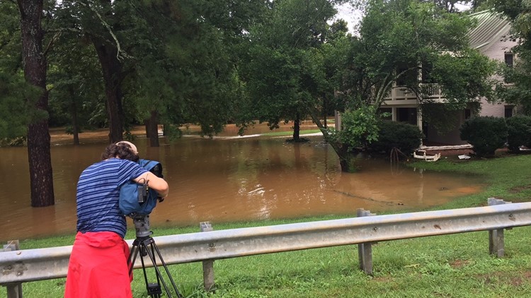
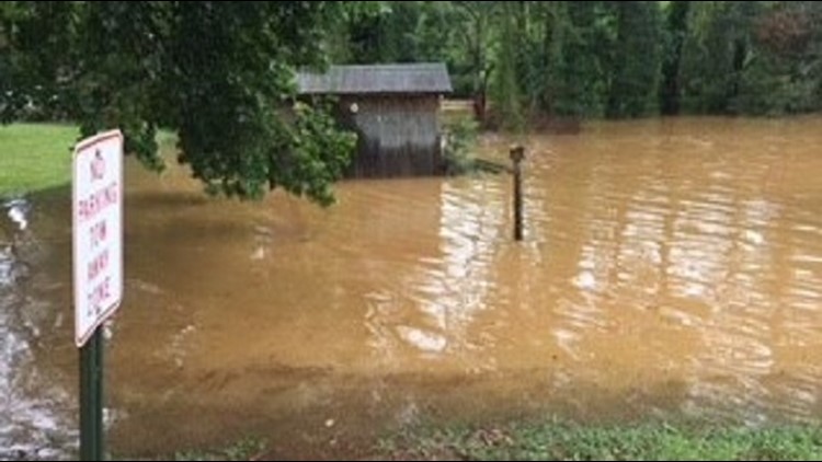
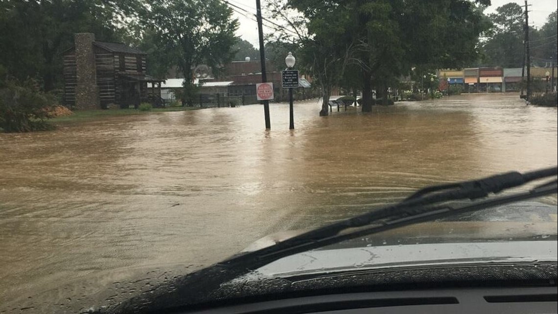
Hours after flash floods were reported in Cave Springs, Georgia, water is still flooding the area.
Deluge floods Cave Springs, Georgia
11:54 p.m.
Cave Spring Elementary closed at 12 p.m. Students that go to Coosa Middle and Coosa High schools who live in Cave Spring were allowed to go home at 12 p.m. as well.
11:13 a.m.
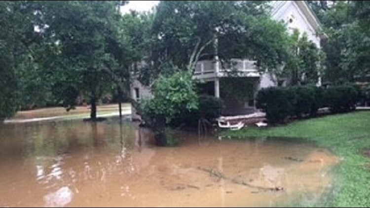
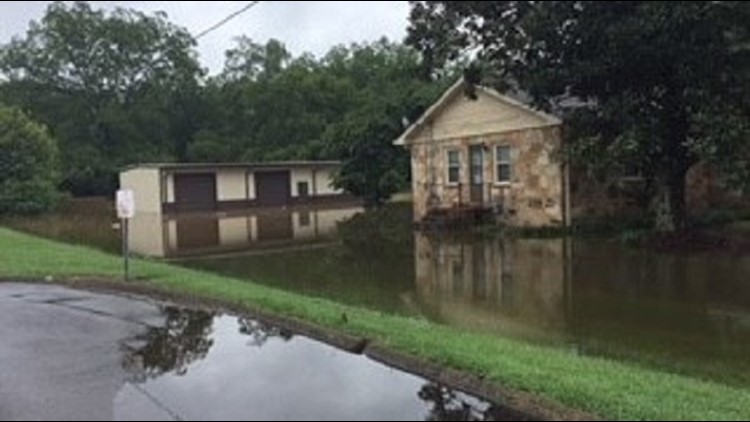
The National Weather Service issued a flash flood warning for southwestern Floyd County until 5:15 p.m. Authorities said flash flooding has already occurred with two inches of rain falling already.
This includes the areas around Big Cedar Creek and Little Cedar Creek. Several roads have been closed in the Cave Spring area.
11:08 a.m.
The Floyd County Police Department shares photos of flooding in Cave Spring, Georgia.
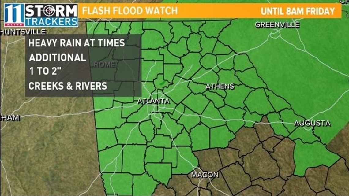
11Alive Meteorologist Chesley McNeil said areas could see, on average, an additional 2 to 4 inches of rain through Friday.
As always, watch for ponding on roadways and a rise in rivers, creeks, and streams will rise with all of the rain and runoff.
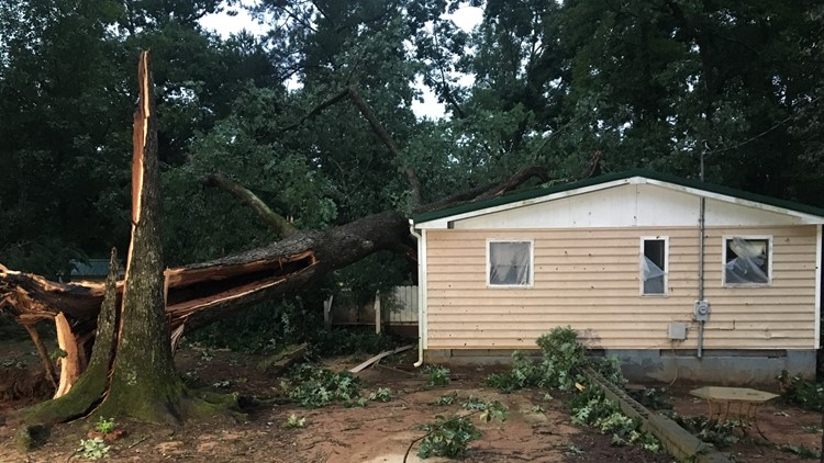
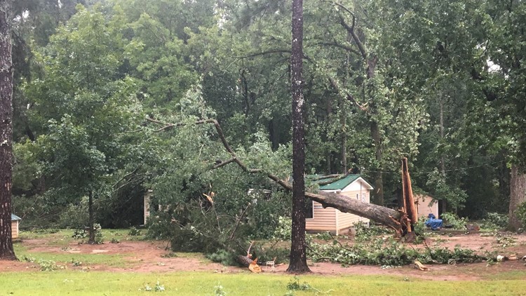
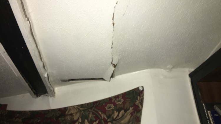
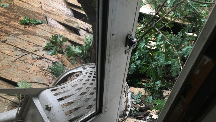
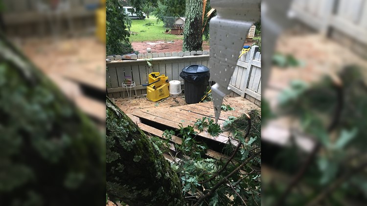
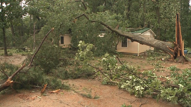
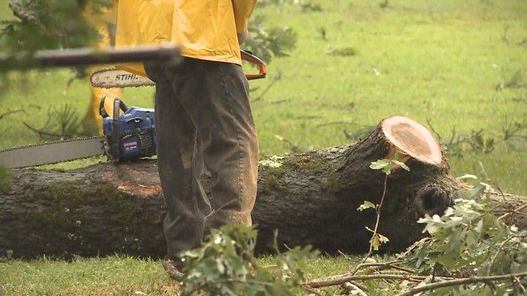
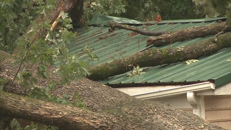
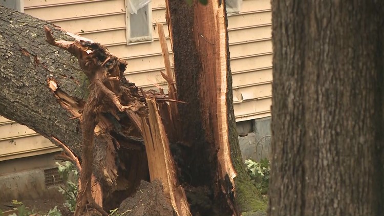
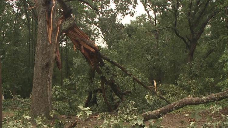
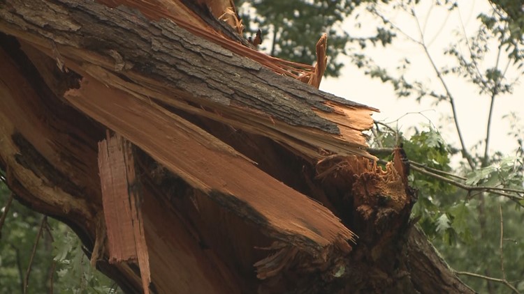
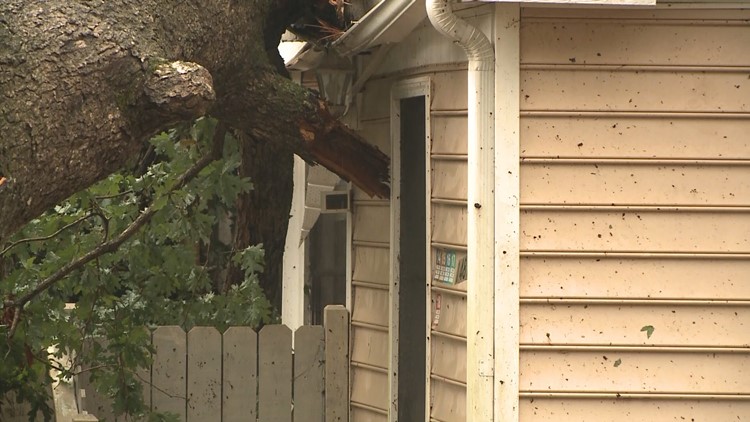
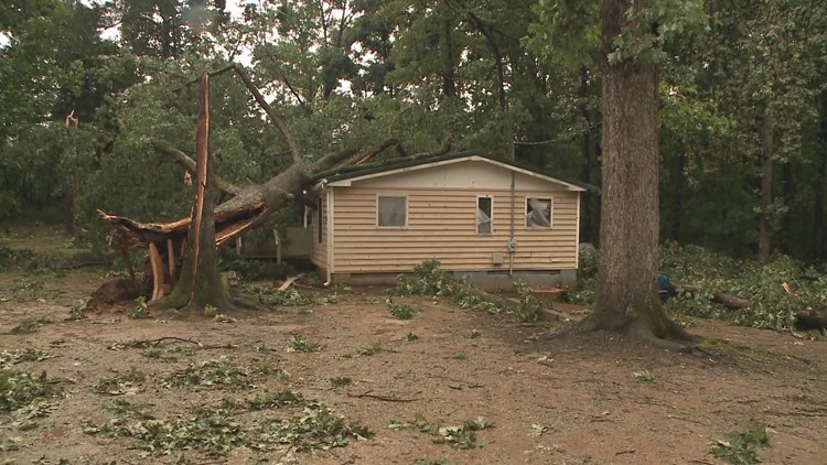
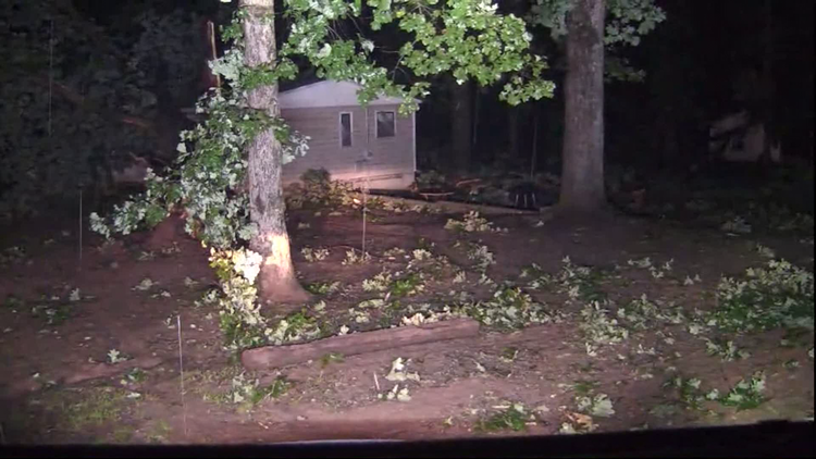
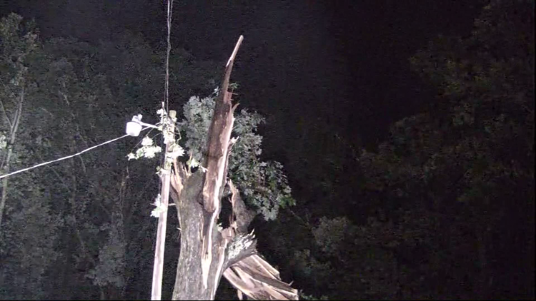
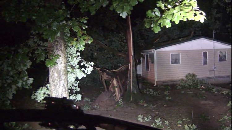
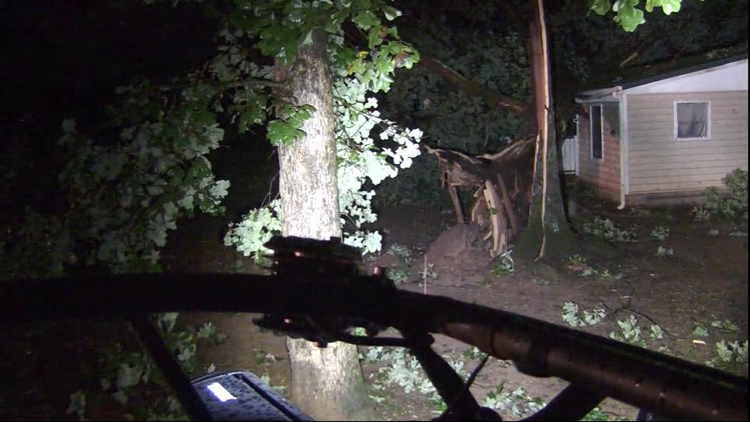
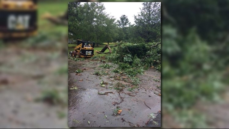
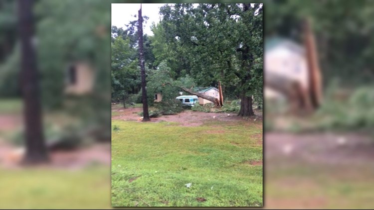
Strong storms that moved through parts of the state Wednesday evening left behind some damage and may have even produced a tornado. Severe thunderstorm and tornado warnings were issued for several counties, including parts of Walton, Madison, Newton, Clarke and more.
PHOTOS | Tornado damage in Social Circle on Aug. 1


► UPLOAD | Send us your weather pictures here
► Download the FREE 11Alive News app now in the iTunes store or on Google Play.
► POWER OUTAGES CHECK | Georgia Power customers, check here. Georgia EMC customers check here.
► Have a news tip? Email news@11alive.com, visit our Facebook page or Twitter feed.