ATLANTA — Though winter doesn’t start for several more weeks, it’ll feel like we are in the heart of January very soon.
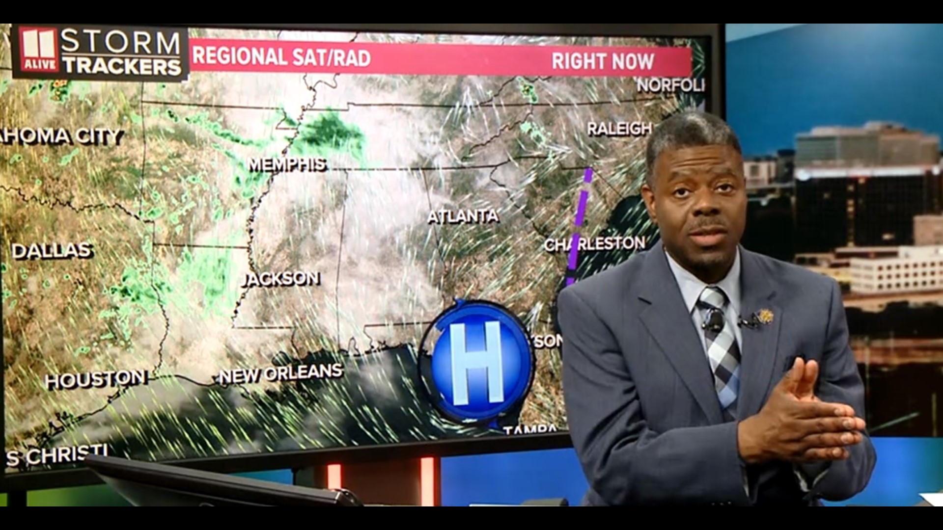
The East Coast’s first blockbuster weather maker is gathering strength over the southeast, which will bring cloudy skies to the area today and heavy rain and storms late tonight.
Some of that rain will still be around as you head to work Monday morning. However, the system will be north of the area by Noon.
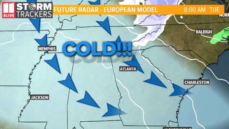
This is when the coldest air since last winter begins funneling into Georgia.
Our high temperature of nearly 60° on Monday will actually occur just after midnight. Temperatures only tumble from there and by the overnight hours of Monday into early Tuesday, temperatures will bottom out in the 20s.
As these temperatures drop like a rock, moisture behind the system will cause snow flurries over north Georgia late Monday into early Tuesday. Little to no accumulation is expected. Only about 1.5” will fall over the extreme higher elevations of the north Georgia mountains.
Temperatures will stay cold. Highs on Tuesday will barely get above 40°.
We do see temperatures start to moderate and warm after midweek. Isolated rain is also possible Friday into Saturday as another weather maker gives the area a passing blow.