
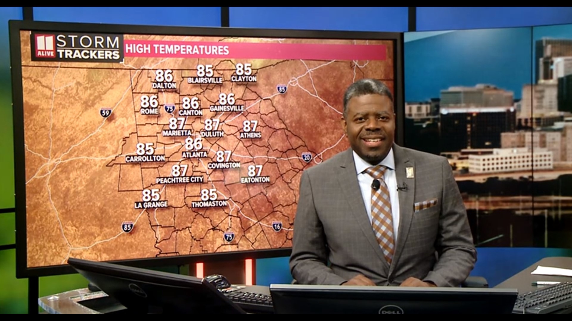
ATLANTA —
Quick Forecast:
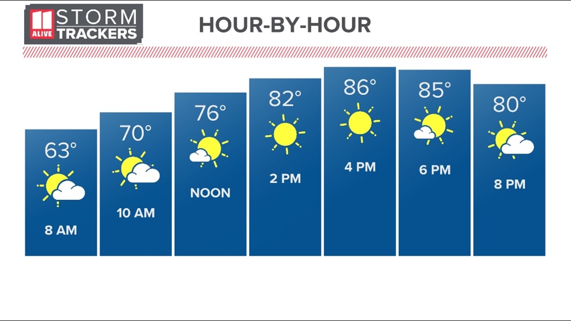
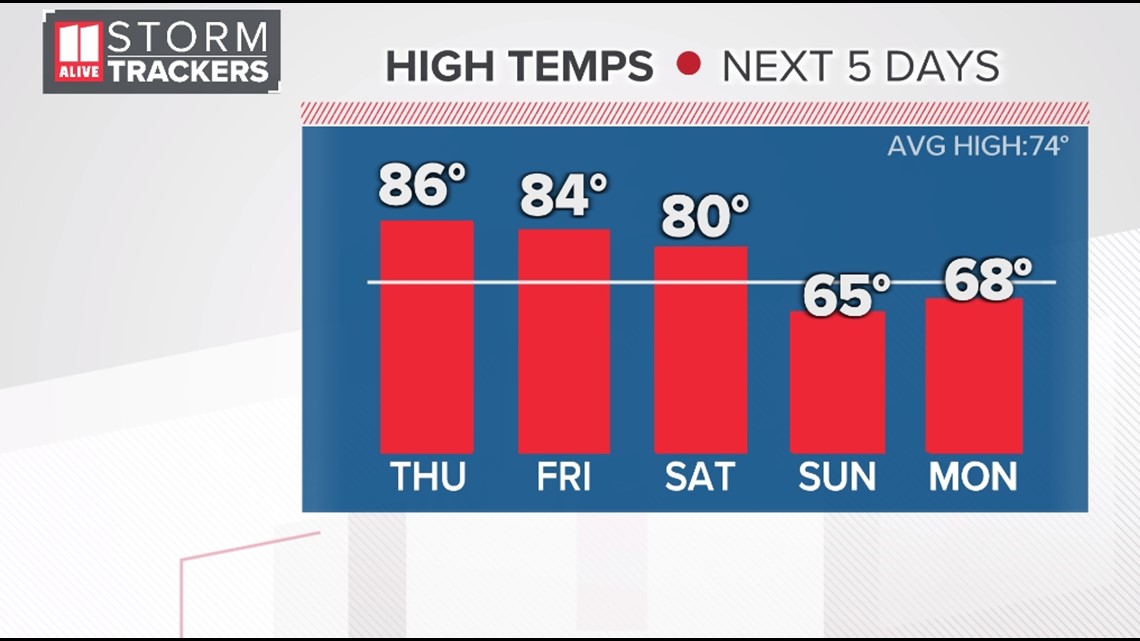
Today: Mostly sunny and warm. High: 86°.
Tonight: Scattered showers return. Low: 65°.
Friday: Showers end early, then scattered showers in the afternoon. High: 84°.
Saturday: Most areas staying dry. High of 80°.
Discussion:
We started out with a few clouds, but the clouds are gone, leaving us with plenty of sunshine for much of the afternoon. Highs will be in the mid to upper 80s.

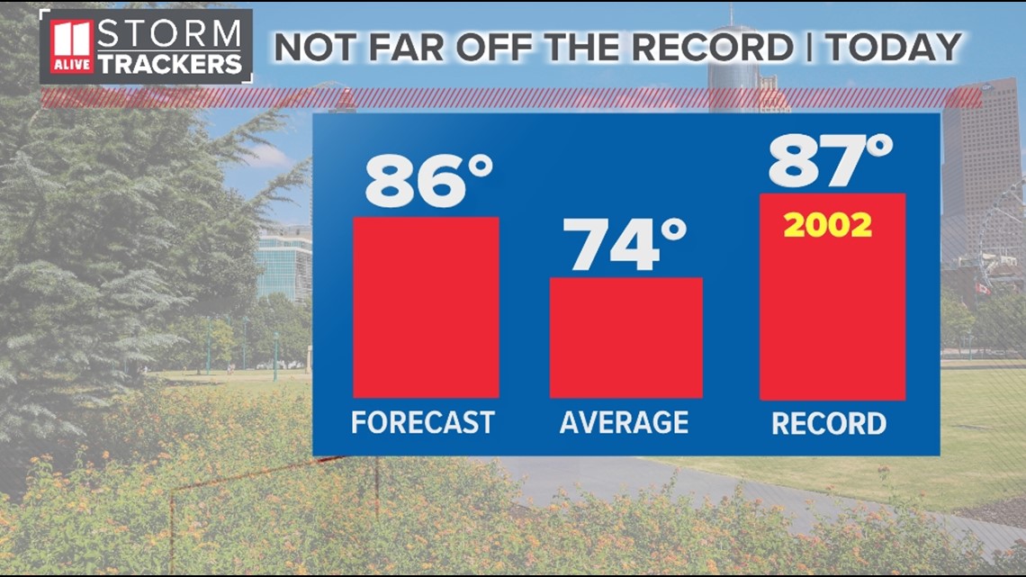
This is borderline HOT for this time of year. Our average highs should be in the low 70s. We are forecasting a high of 86 degrees this afternoon. Today's record is 87 degrees set in 2002.

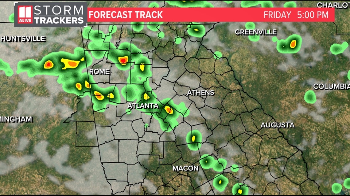
Clouds will increase later this evening with a round of showers and thunderstorm possible tonight into Friday morning.

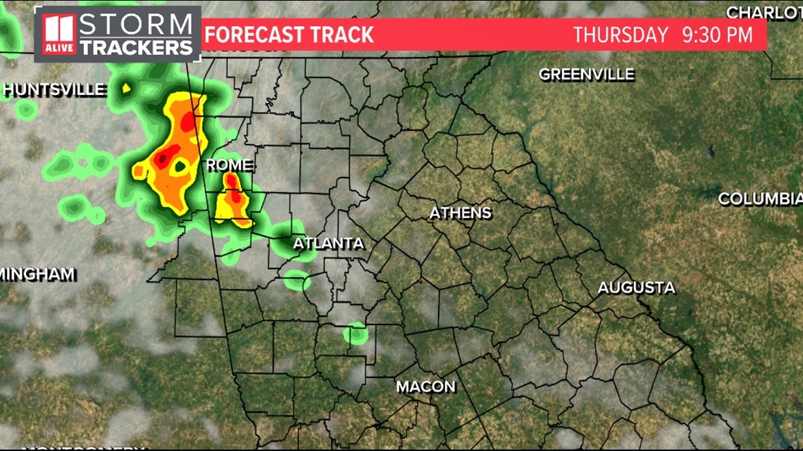
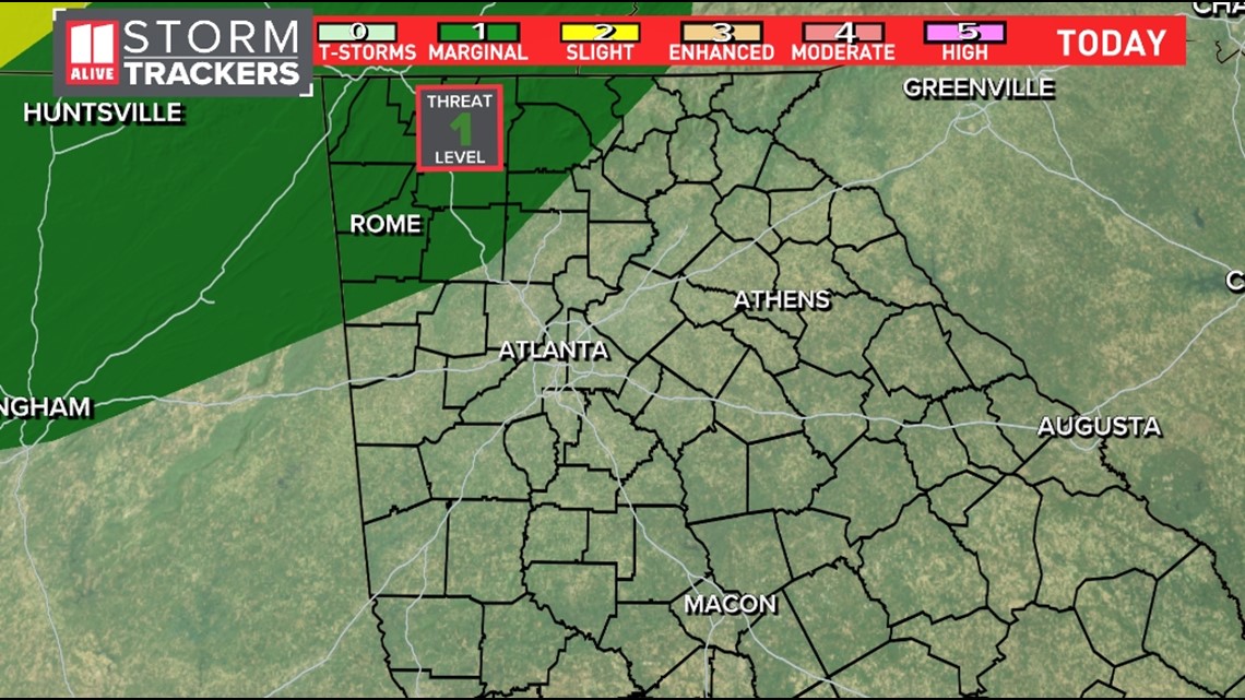
The Storm Prediction Center has placed a Marginal Risk (level 1) for severe weather over our northwest counties for tonight.

The level 1 threat for severe storms continues on Friday as a front will move toward our area.

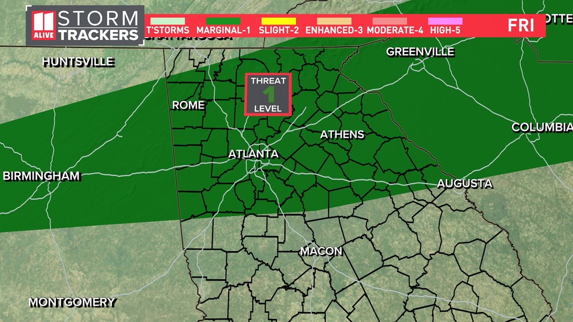
Isolated strong to severe storms could produce brief heavy rain and gusty winds.

We will catch a break from the rain Saturday, then more wide spread showers will return to the area by Sunday.

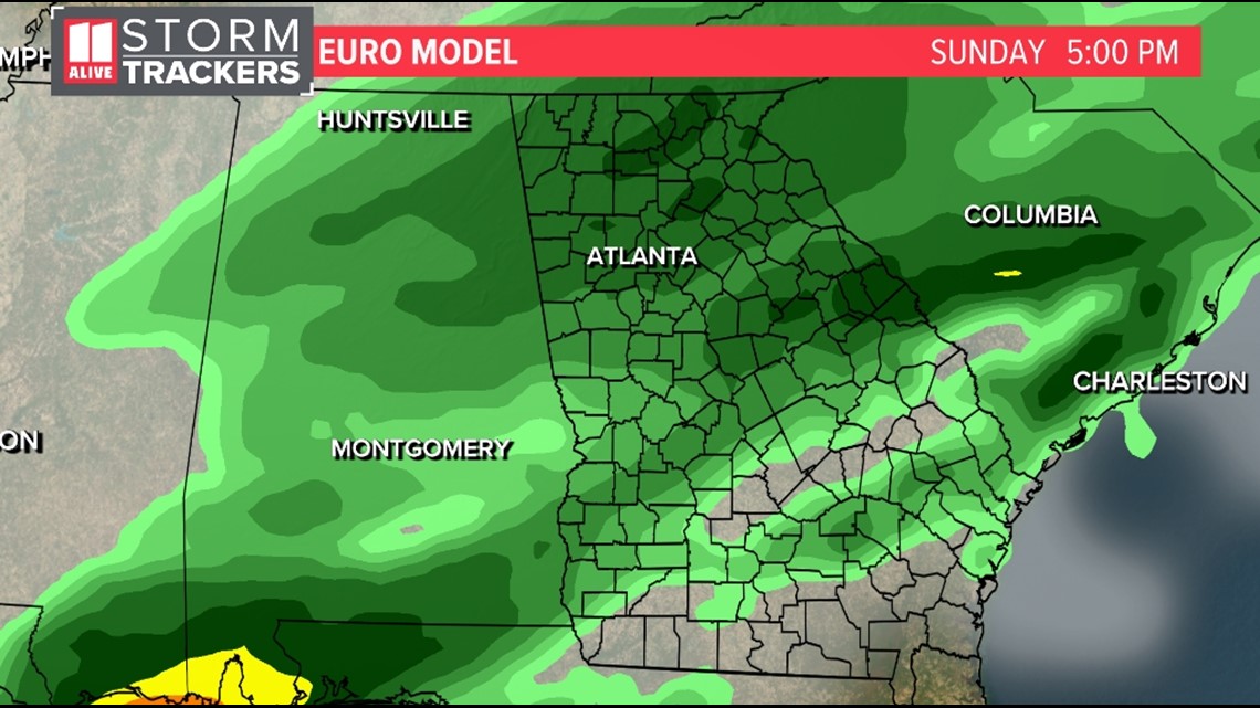
Temperatures will cool down Sunday and for the start of the work-week next week.

MORE FROM THE 11ALIVE STORMTRACKERS
DOWNLOAD THE 11ALIVE APP:
Set up weather notifications by clicking the Gear icon in the upper right corner of the app. Select Notification -> Notification Settings -> Severe Weather Alerts -> Toggle the Severe Weather Alerts button to the right to turn alerts on.
Send photos and videos through the app by selecting the Near Me feature on the bottom right task bar of the app and entering your information.
TEXT YOUR WEATHER PHOTOS TO US: 404-885-7600
JOIN THE 11ALIVE STORMTRACKERS FACEBOOK GROUP: Nearly 10,000 metro Atlanta and north Georgia weather enthusiasts share their weather photos every day. Click here to join the group!