On Sunday, more strong to possibly severe storms are possible over metro Atlanta and north and central Georgia, developing any time after about 4 p.m. The strongest storms over the state will remain along the Georgia-Florida line.
Here's are the latest warnings and alerts:
7:49 pm -- A severe thunderstorms has been issued for NE Oconee County, Clarke County, SE Jackson County, Oglethorpe County and SW Madison County until 8:30 pm. At 7:49 pm, a severe thunderstorm was located over Athens-Clarke County moving SE at 20 mph. Hazards include 60 mph wind gusts and quarter size hail.
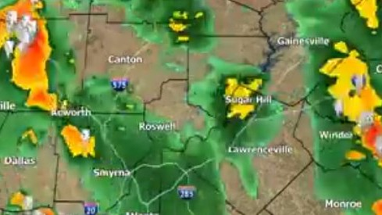
6:53 pm -- A severe thunderstorm warning has been issued for the cities of Winder, Braselton and Auburn until 7:30 pm. It includes Barrow County, east central Gwinnett and southwestern Jackson County. Possible 60 mph wind gusts and quarter size hail.
Saturday left metro Atlanta with two rounds of strong and severe thunderstorms that brought down trees and knocked out power for thousands of people across north Georgia.
The primary threats from Sunday's storms are frequent and vivid lightning, torrential rainfall, damaging wind gusts and large hail.
► UPLOAD | Send us your weather pictures here
► Download the FREE 11Alive News app now in the iTunes store or on Google Play.
► POWER OUTAGES CHECK | Georgia Power customers, check here. Georgia EMC customers check here.
► Have a news tip? Email news@11alive.com, visit our Facebook page or Twitter feed.