
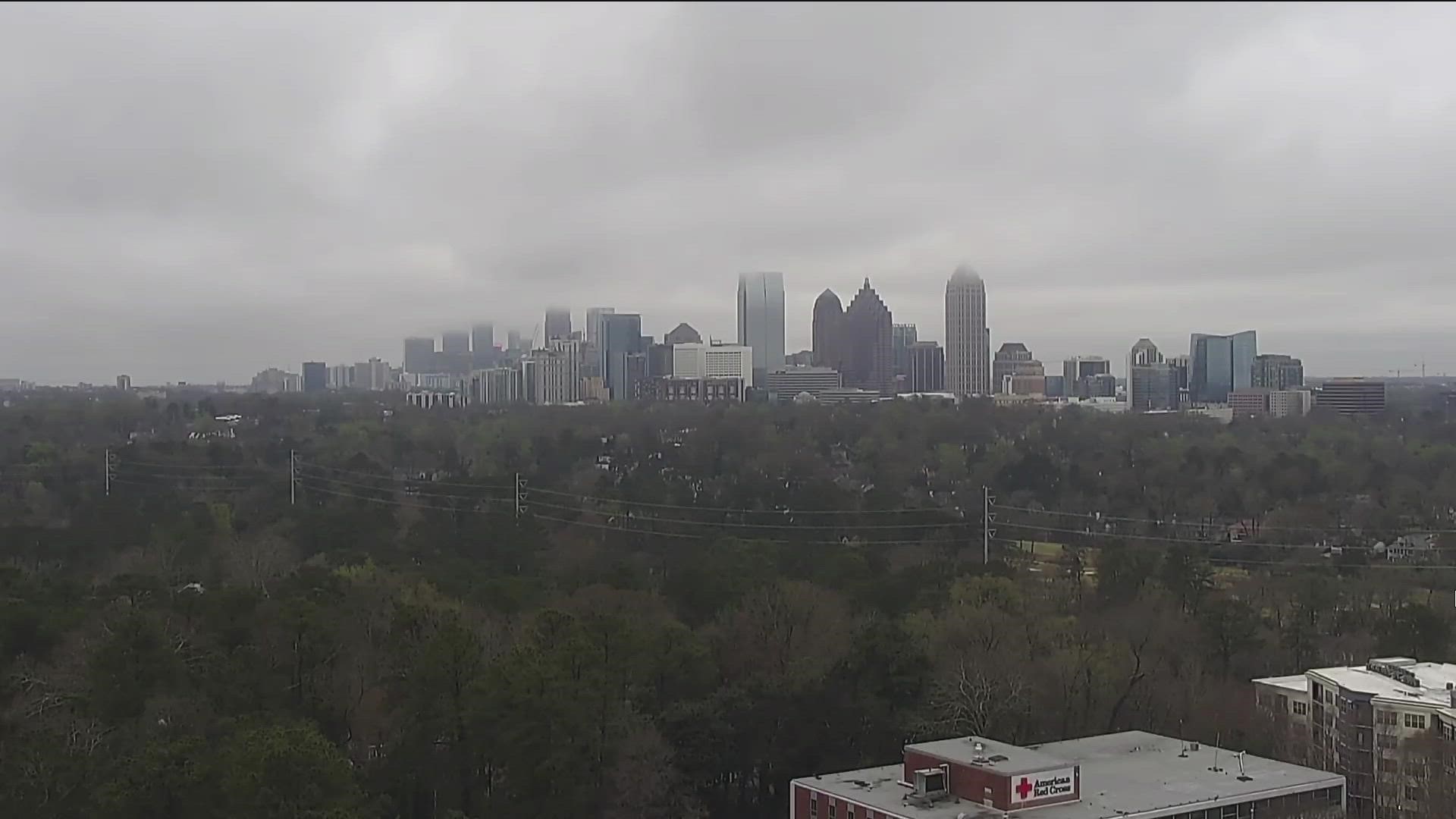
ATLANTA — Another round of storms will be moving through north Georgia on Friday, bringing the threat of damaging wind, large hail and even an isolated tornado.
While the highest threat for severe storms Friday will be well to our south and west, it will be important to keep a close eye on the weather and have a way to receive alerts throughout the day.
Several metro Atlanta counties, such as Heard, Carroll and Coweta, are in the slight risk zone, as are the southernmost tips of Fulton, Douglas and Paulding counties.
Live updates
5:32 p.m. | Parts of Georgia is under marginal severe weather risk as of Friday evening, according to the National Weather Service.
5:00 p.m. | More showers and high winds are in the forecast for later Friday night. 11Alive's Chris Holcomb provided an updated forecast.
3:15 p.m. | We've gotten a statement from Hartsfield-Jackson Atlanta International Airport saying the weather hasn't caused a significant disruption today:
"(Weather) has not impacted the airport today. We recommend all travelers monitor and contact their airlines for the most current flight information."
3:05 p.m. | For more on what a wake low is, see this explanation at a UGA extension website.
3:00 p.m. | The 11Alive StormTrackers report that the heavy rains are set to leave behind what's known as a wake low - basically, the nonscientific way of describing it is a bunch of heavy winds that follow heavy rain.
We're told they're typically very localized and might last an hour or two. The wake low around metro Atlanta today shouldn't produce gusts higher than maybe 30-35mph.
1:36 p.m. | Peachtree City Police reported a large tree blocking the road on Peachtree Parkway at Fountain Head.
1:00 p.m. | This round of weather should largely have passed, we'll look now look ahead to the 3 p.m. and evening commute hours for any further weather today. Here's what the 11Alive StormTrackers have to say:
"By 3 p.m., the first round of storms will move east of the Atlanta metro, but lingering storms along the front will still move through with the threat for severe weather."
12:37 p.m. | Heavy rain is causing several streets in the Buckhead area of Atlanta to flood, 11Alive's Shiba Russell reports.
11:50 a.m. | We've gotten reports of trees down where the storms have already moved through on the Westside, including around North Camp Creek Pkwy. and Cascade Rd.
We've also gotten scattered reports of hail as the storms continue to move east, including in Buford.
11:45 a.m. | As the noon hour approaches the storms should be heading east past the Atlanta city center and into DeKalb and Gwinnett counties, and then as far northeast as Gainesville and as far southeast as Covington.
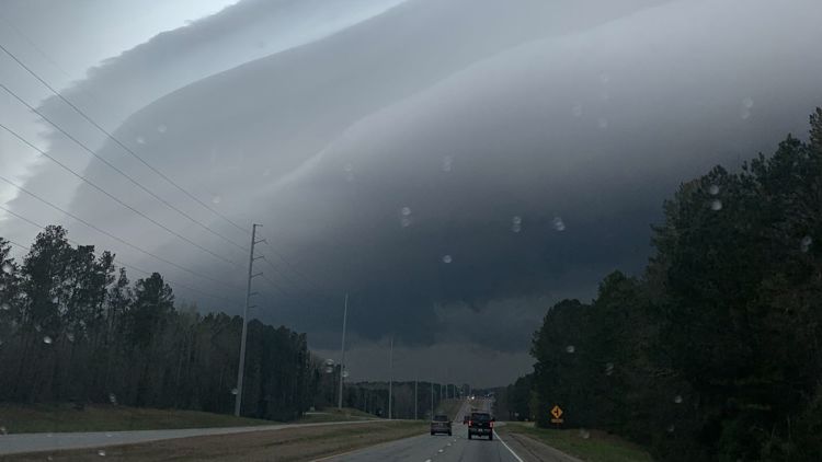
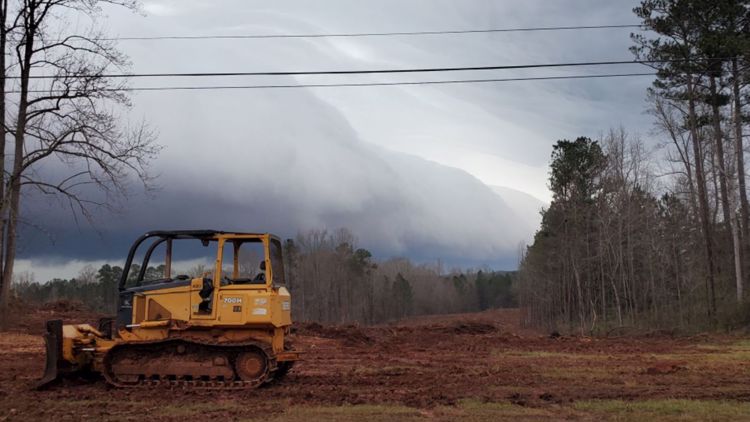
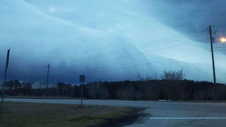
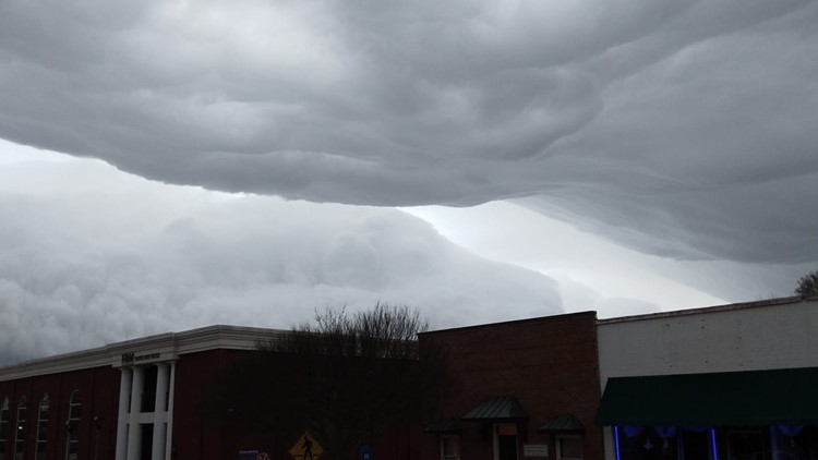
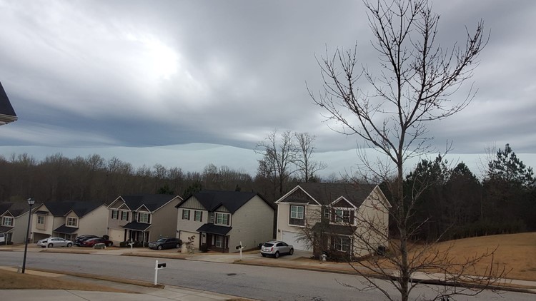
11:35 a.m. | We've gotten some really cool photos of the clouds rolling through with these storms posted to our 11Alive StormTrackers Facebook group (which you can join!)
Wild Atlanta storm clouds


11:25 a.m. | Storms are coming in across the city now.
11:15 a.m. | There are no severe weather warnings out yet, but storms have begun moving into the region. Remember, most of metro Atlanta is under a Level 1 risk today, but parts of the southwest metro and west Georgia are under a Level 2 risk category.
The storms are expected to pick up in the early and mid-afternoon.