After days and days in our hot summer weather pattern, we will get a bit of a cool down this weekend as a cold front moves our way. Unfortunately, we won't get the opportunity to enjoy the cool weather very much for a couple of reasons.
The first being that Saturday looks rather rainy and not suitable for outdoor plans. Secondly, we will revert back to our hot and muggy pattern by next week.
Thursday and Friday will feature warm and humid conditions with afternoon rain chances with the best being on Friday, about a 50 to 60 percent chance. Both days will have heat indices into the middle 90s.
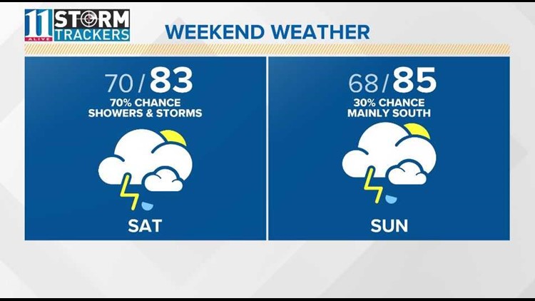
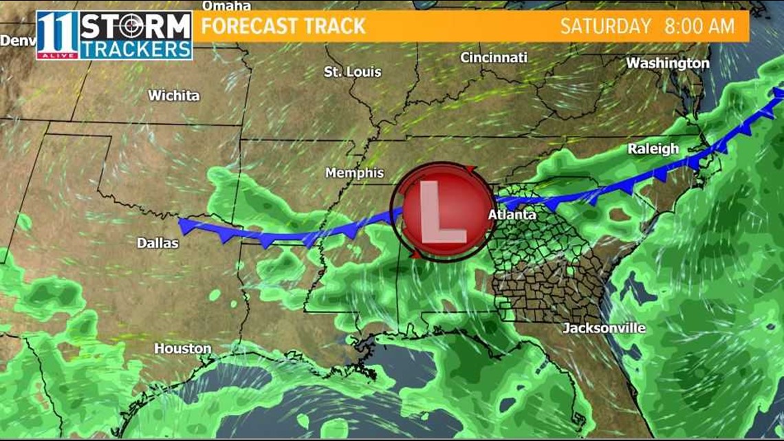
A cold front then looks to move in Saturday morning, bringing widespread showers and storms through the afternoon, tapering off by evening.
As the front pushes toward the South Sunday, so do the better chances of rain. Sunday looks to be the best day of the weekend as it looks mainly dry, only small chances of rain for the metro, and we drop the humidity.
We will enjoy the lower humidity for the beginning of next week as temperatures stay pretty average, highs in the upper 80s.
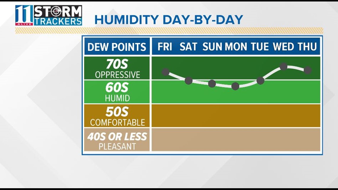
The oppressive heat and humidity, like what we saw late June into July, return the middle of next week but this time the pattern is slightly different.
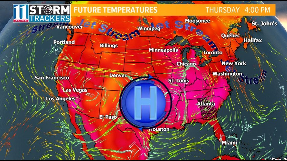
Our previous hot pattern provided the daily chance of scattered showers and storms. With this new pattern, high pressure will act to suppress storm development or it will limit coverage.
That modified pattern looks to hold for the next couple of weeks with highs in the low to middle 90s.