
ATLANTA — Forecasters are watching a series of storm systems that are expected to bring as much as 10 inches of heavy rainfall across portions of north Georgia this week.
11Alive Meteorologist Wes Peery said Sunday morning that the primary threat from this extended weather system is from dangerous torrential rainfall, flash flooding as well as urban and small stream flooding.
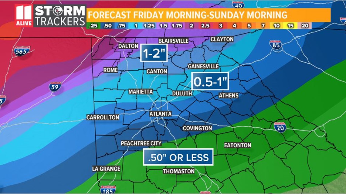
The rainfall total amounts will build throughout the week -- leading to total amounts of up to 10 inches of rainfall in the north Georgia mountains by late Friday or Saturday.
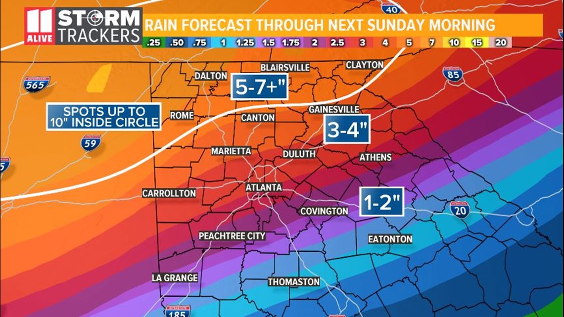
In metro Atlanta, 3-to-5 inch rainfall totals are possible, with flash flooding throughout the region possible.
The probability for rainfall is upward of 70 percent through Friday and dropping back to about 60 percent by Saturday.
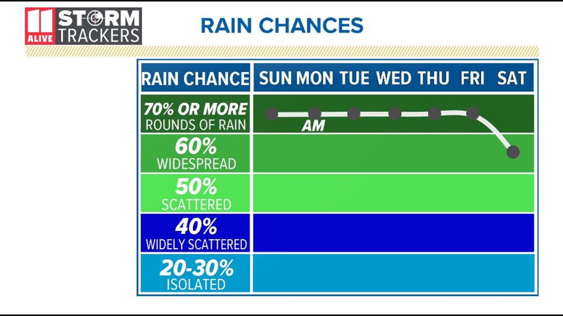
Overall, the rains will not remain steady through the week but come in waves with stretches of calm weather in between. By mid-week, according to Wes, showers and thunderstorms will become more numerous across the region with stretches of heavy rain and lightning moving through the state.
SUNDAY
Wes says all of this starts to ramp up with rainfall beginning on Sunday afternoon across the region.
Up to 2 inches of rainfall is expected across parts of north Georgia on Sunday with the possibility of isolated flooding over portions of the north Georgia mountains.
MONDAY
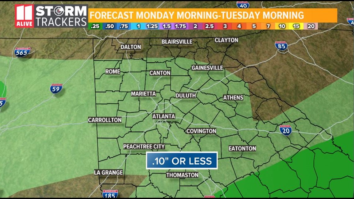
On Monday, additional rain can be expected through the region before a lull Monday afternoon and Monday night.
TUESDAY AND WEDNESDAY
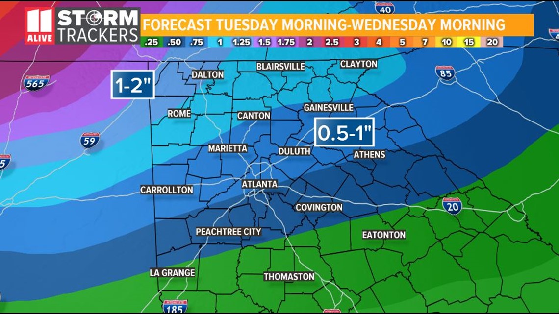
On Tuesday, the threat of rain will begin to enter the state in the morning, before ramping up into Tuesday afternoon. By late Tuesday afternoon, showers will become heavy across the entire region and continue into Wednesday.
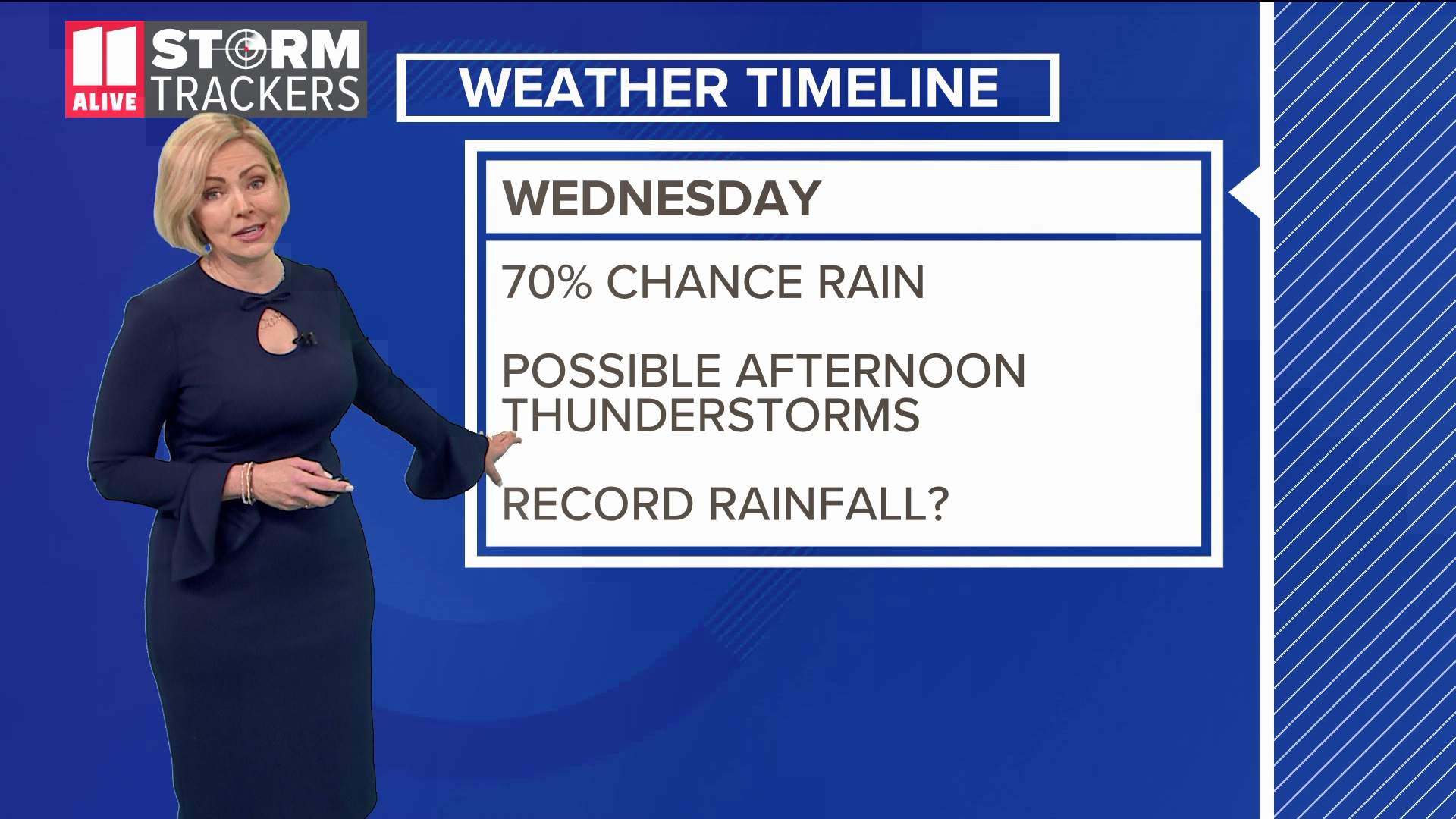
Wes says that at this point, the rainfall on Tuesday night and Wednesday is expected to be the heaviest for the entire week.
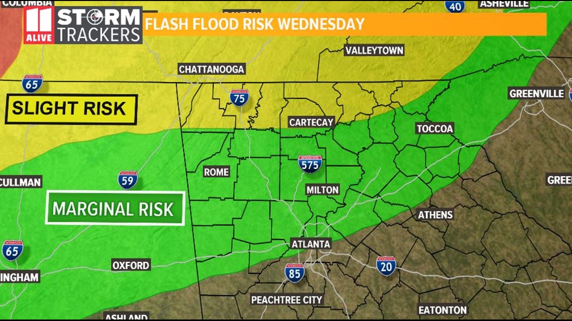
WEDNESDAY THROUGH FRIDAY
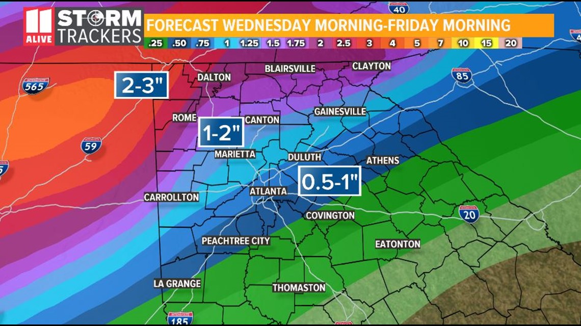
By late Wednesday, some thunderstorms may begin to mix with the showers. Thunderstorms are expected through the rest of the week.
The National Weather Service says that due to the heavy rainfall on already saturated ground, flash flooding, as well as urban and small stream flooding are likely over portions of north Georgia through much of the week -- not only in the north Georgia mountain areas, but in downstream regions as runoff begins to move through metro Atlanta and other areas already impacted by additional heavy rainfall.
Stay with Chris Holcomb and the 11Alive Storm Trackers throughout the week for updates and for any weather statements or warnings as they are issued throughout the period.
► Download the FREE 11Alive News app now in the iTunes store or on Google Play.
► POWER OUTAGES CHECK | Georgia Power customers, check here. Georgia EMC customers check here.
► Have a news tip? Email news@11alive.com, visit our Facebook page or Twitter feed.