The 11Alive StormTrackers are tracking rain and storms moving through on Sunday
MORE WEATHER | Tracking approaching storm system
SUNDAY AFTERNOON
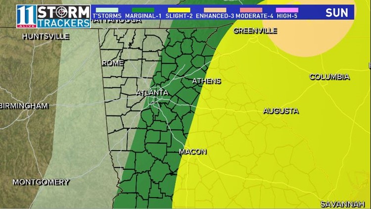
We've been tracking showers with some thunder and lightning moving from west to east so far on Sunday. We've had some thunder and lightning and gusty winds with some of these storms. So far, they have been below "severe" criteria. The heaviest rain and most of the lightning has been on the southside before dawn. That will continue moving east and northeast. Expect pockets of moderate to heavy rain at times with thunder and lightning possible with some gusty winds.
SUNDAY LATE AFTERNOON

Some areas well to the east and in central Georgia will see some of these storms firing up again during the late afternoon hours. The Storm Prediction Center puts areas east of a line from Athens to Eatonton to Macon in a "slight" risk for some severe storms to redevelop. Those areas will see a better chance of strong winds and lightning. The back edge of the rain will push east by late afternoon. The rain will end from west to east. Cooler air moves in with temperatures falling into the 50s.
SUNDAY EVENING
It gets colder and breezy as we start the clearing out process. Temperatures by Monday morning will be in the upper 30s.