
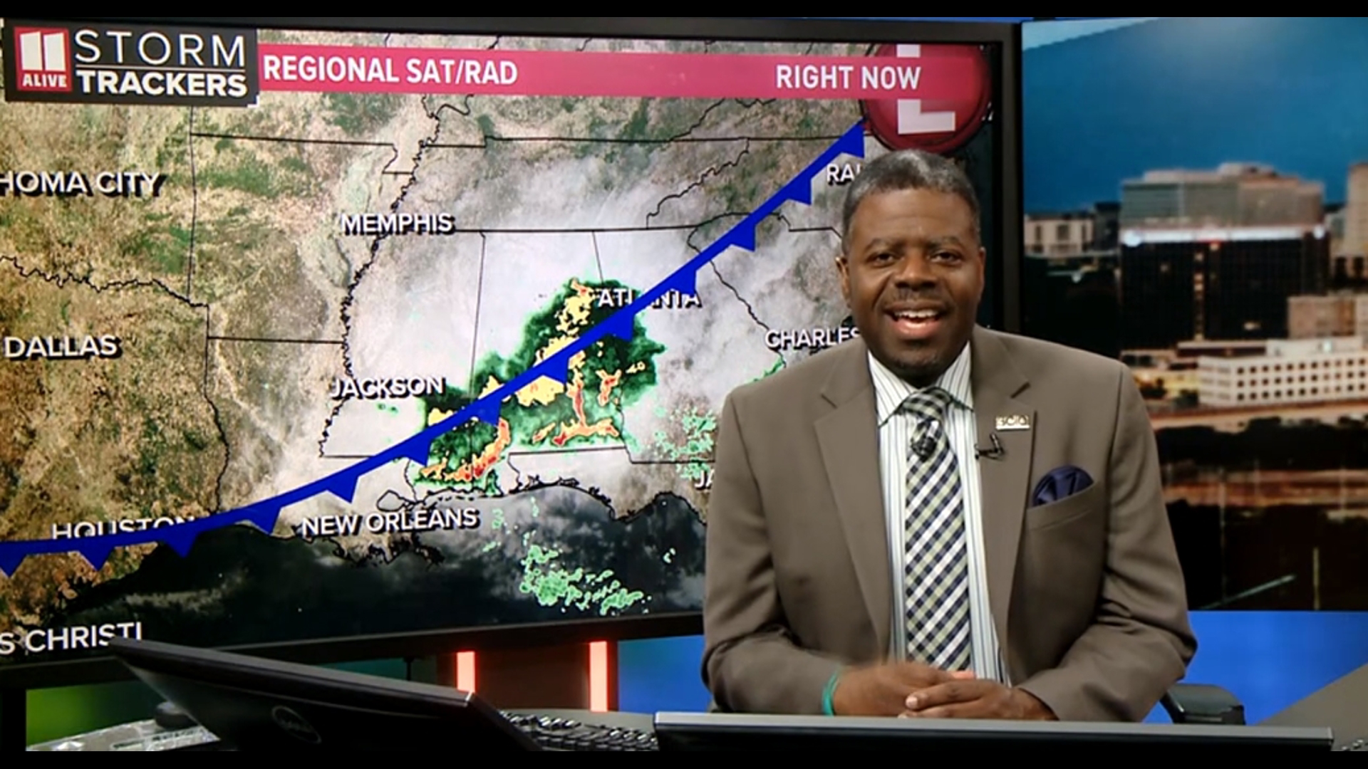
ATLANTA —
Quick Forecast:
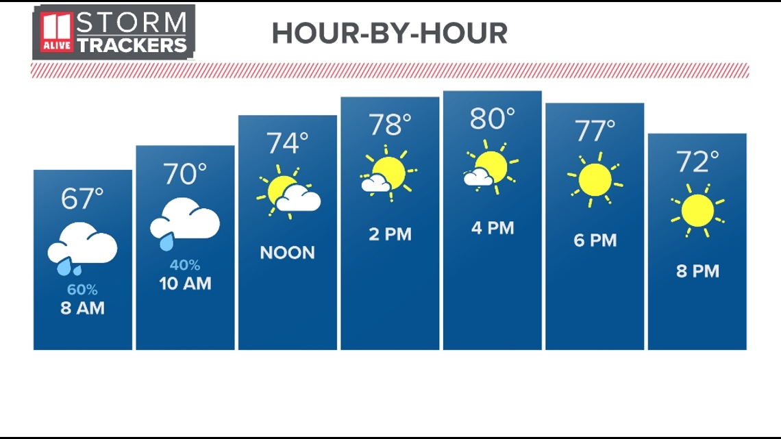
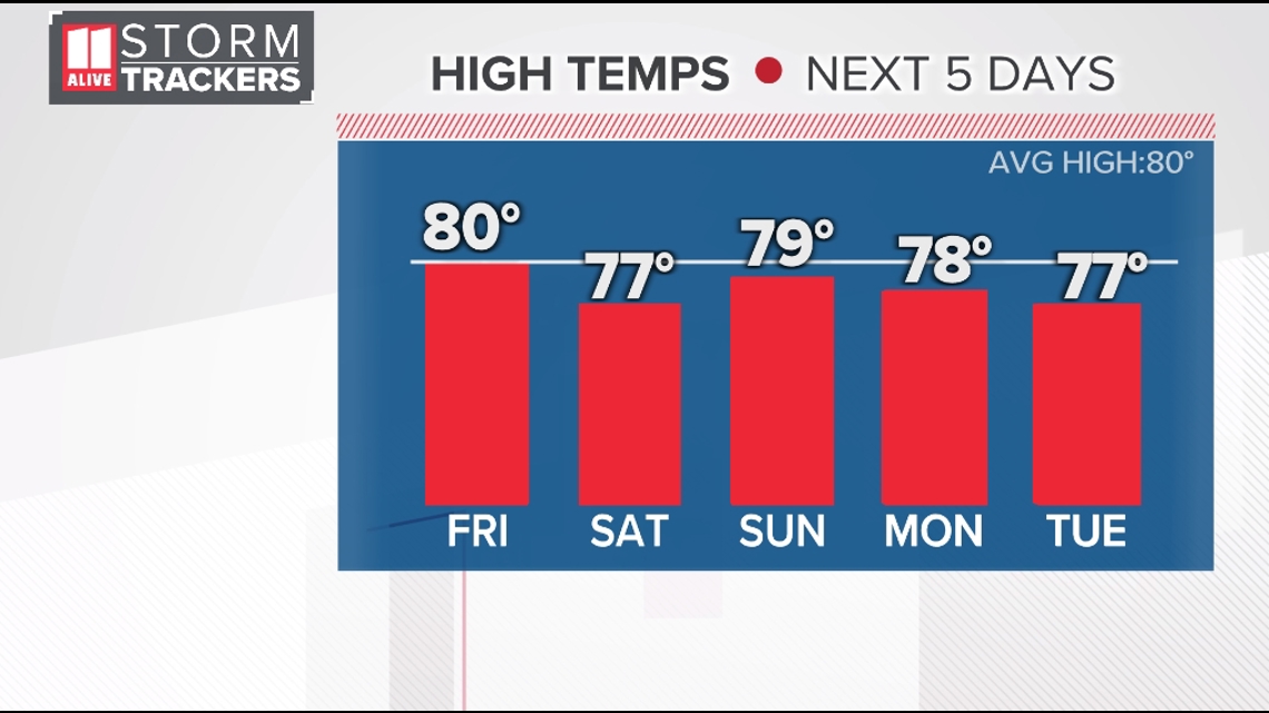
Today: Early showers/storms. Clearing and cooler afternoon. Breezy. High: 80°.
Tonight: Clear skies. Low: 54°.
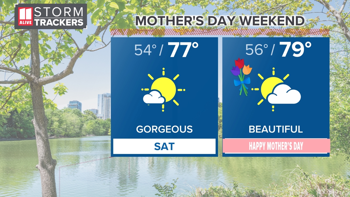
Saturday: A comfortably cool start. Sunny, breezy and beautiful. High: 77°.
Sunday: Partly cloudy and pleasant. High: 79°.
Discussion:
Another round of showers and few thunderstorms of the metro this morning. The rain will move out by mid morning, and the clouds will follow by early afternoon. Temperatures starting off in the 60s, will warm to near 80 today.

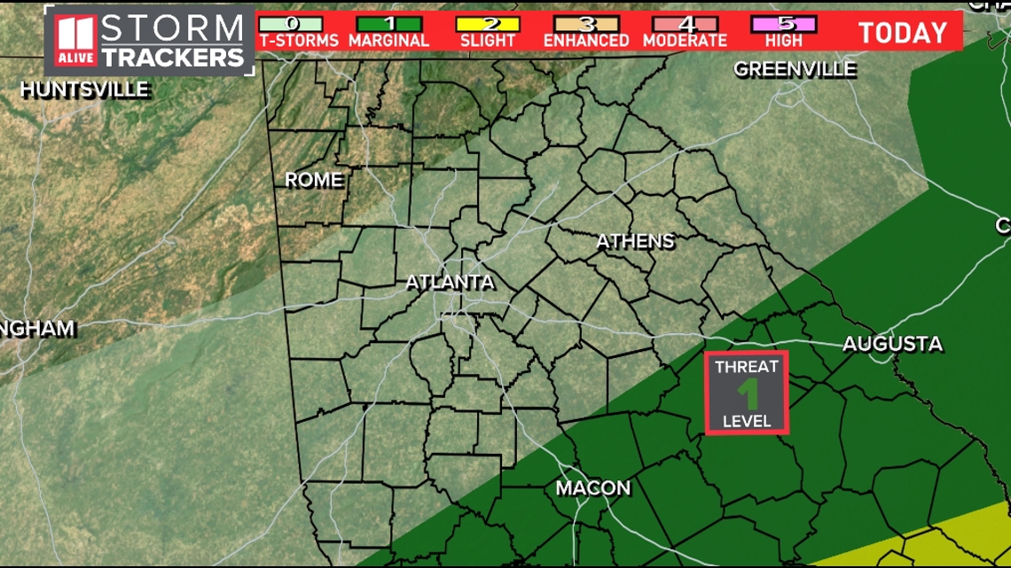
The severe weather threat will remain over the southern parts of our state through the afternoon. The Storm Prediction Center has placed a Marginal Risk (level 1) over the central parts of our state (Macon). Most of the strong storms will remain south.

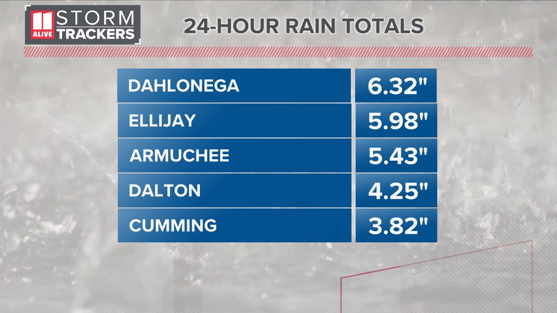
Ellijay picked up significant damage from strong winds and a possible tornado. The National Weather Service from Peachtree City will be out surveying damage the damage today.

Temperatures fall to the 50s for lows and 70s for highs from Saturday through Monday under a mostly sunny to partly cloudy sky each day. This will make for great conditions arriving in time for Mother's Day.

Temps early next week stay in the upper 70s with increasing daily showers and storms by Tuesday.

MORE FROM THE 11ALIVE STORMTRACKERS
DOWNLOAD THE 11ALIVE APP:
Set up weather notifications by clicking the Gear icon in the upper right corner of the app. Select Notification -> Notification Settings -> Severe Weather Alerts -> Toggle the Severe Weather Alerts button to the right to turn alerts on.
Send photos and videos through the app by selecting the Near Me feature on the bottom right task bar of the app and entering your information.
TEXT YOUR WEATHER PHOTOS TO US: 404-885-7600
JOIN THE 11ALIVE STORMTRACKERS FACEBOOK GROUP: Nearly 10,000 metro Atlanta and north Georgia weather enthusiasts share their weather photos every day. Click here to join the group!