
ATLANTA —
Quick Forecast:
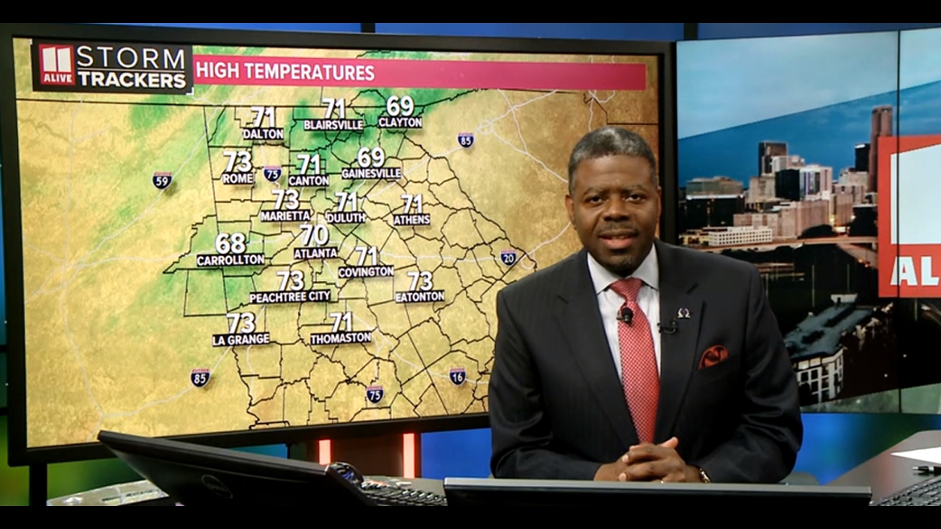
Tonight: Cloudy skies. Low: 62°.
Tuesday: Scattered showers, isolated storms. High: 77°.
Wednesday: 20% chance for a shower. High: 80°
Discussion:
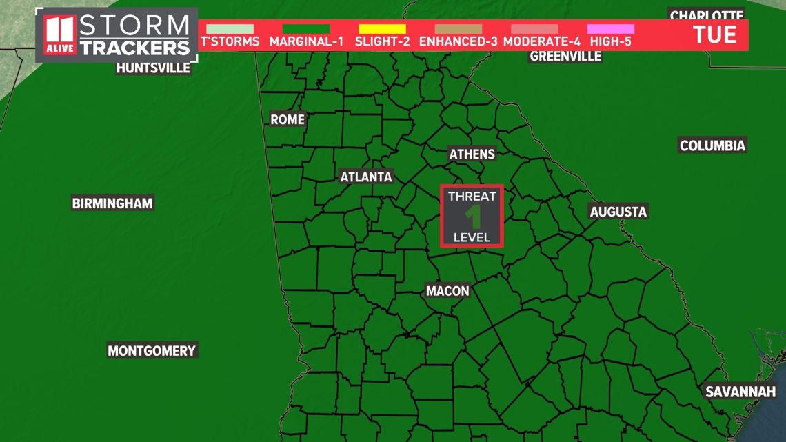
Scattered showers and isolated storms remain in the forecast ahead of an incoming storm system. A warm front is pushing in warmer, more humid air, and an incoming cold front will provide better lift for storm development Tuesday.
The storm threat is slightly higher for Tuesday but still limited. The Storm Prediction Center has place a marginal (level 1) risk for severe weather across the state tomorrow.
Isolated storms may be capable of producing heavy rain, gusty winds, and hail.

Although rain will be hit-and-miss Monday afternoon, activity picks back up overnight.

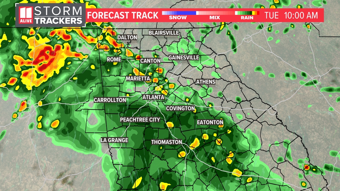
You'll want to keep an eye on the radar and keep an umbrella close by if you have outdoor plans on Tuesday. The day won't be a washout, but showers are possible at any point.

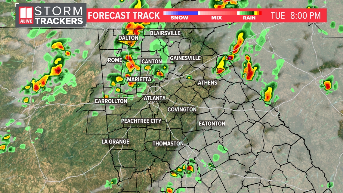
A few showers may linger into Wednesday as well, but we dry out for the middle of the week. Clouds and rain gradually give way to more sunshine by Thursday.


As sun returns, temperatures warm. Highs climb into the upper 70s by Wednesday and the low to mid 80s on Thursday. Humidity will also be on the rise, and much muggier conditions are expected for the end of the week.


MORE FROM THE 11ALIVE STORMTRACKERS
DOWNLOAD THE 11ALIVE APP:
Set up weather notifications by clicking the Gear icon in the upper right corner of the app. Select Notification -> Notification Settings -> Severe Weather Alerts -> Toggle the Severe Weather Alerts button to the right to turn alerts on.
Send photos and videos through the app by selecting the Near Me feature on the bottom right task bar of the app and entering your information.
TEXT YOUR WEATHER PHOTOS TO US: 404-885-7600
JOIN THE 11ALIVE STORMTRACKERS FACEBOOK GROUP: Nearly 10,000 metro Atlanta and north Georgia weather enthusiasts share their weather photos every day. Click here to join the group!