ATLANTA — Scattered showers and thunderstorms are moving through parts of metro Atlanta Thursday afternoon and evening.
The Storm Prediction Center has placed a slight risk, a Level 2 out of 5, over counties Floyd, Polk, Haralson, Gordon, Bartow, and Paulding Counties. Much of north and central Georgia is under a Level 1 risk. This means one or two of the storms that form over the area could become strong or severe.
Heavy rain and even damaging winds can be expected, and while very low, there is the threat of an isolated spin-up, tornado-wise.
People can get weather alerts from 11Alive's meteorologists on the 11Alive+ app on Roku and Amazon Fire TV. Download 11Alive News app and sign up to receive alerts for the latest.
Latest updates
7:15 p.m. | A tree is down near 1678 Martin Luther King Jr. Dr. in Atlanta Thursday night. Drivers are encouraged to be cautious on the roadways following storms.
6:59 p.m. | The Troup County Sheriff's Office is warning that Interstate 85 Southbound at MM 18 and 16 is closed due to trees down.
6:45 p.m. | Severe thunderstorm warning has been issued for Bibb, Crawford, Monroe, Upson until 7:15 p.m.
5:37 p.m. | As storms continue to move through north Georgia, the NWS has issued a severe thunderstorm warning for Fayette, Troup, Coweta, Meriwether, Pike, and Spalding counties until 6:15 p.m.
5:31 p.m. | A severe thunderstorm warning has been issued for Putnam, Morgan, Greene, Jasper, Newton, and Hancock counties until 6:15 p.m.
5:10 p.m. | The National Weather Services has issued a severe thunderstorm warning for Coweta, Fulton, Douglas, Heard, Carroll counties until 5:45 p.m.
5:02 p.m. | People watched the clouds roll in as they tried to avoid the rain Thursday afternoon.
Summer storms move through north Georgia | PHOTOS


4:48 p.m. | A severe thunderstorm warning has been issued for Oconee, Greene, Taliaferro, Wilkes, and Oglethorpe County until 5:30 p.m.
4:42 p.m. | A severe thunderstorm warning has been issued for DeKalb, Cobb, Douglas, Fulton, and Clayton County until 5:30 p.m.
4:37 p.m. | A severe thunderstorm warning has been issued for Haralson, Carroll, Douglas, Heard County until 5:15 p.m.
4:32 p.m. | A severe thunderstorm warning has been issued for Paulding, Cobb, Douglas, and Fulton County until 5 p.m.
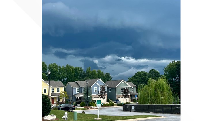
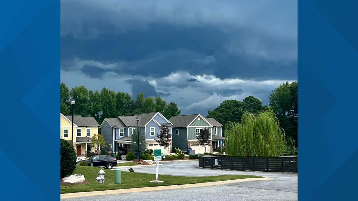
4:20 p.m. | An 11Alive viewer shared a photo of storms rolling into Lawrenceville.

4:06 p.m. | A severe thunderstorm warning has been issued for southeastern Banks County, east central Jackson County, and Madison County until 4:45 p.m.
3:52 p.m. | Several more counties have been put under a severe thunderstorm watch in north Georgia.

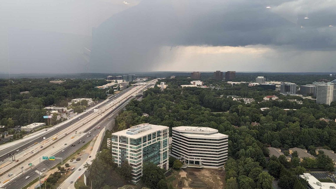
3:30 p.m. | An 11Alive viewer shared a photo of storms rolling into Sandy Springs from the King Tower Thursday.
Join the 11Alive Stormtrackers Facebook group to let us know what's happening in your area.

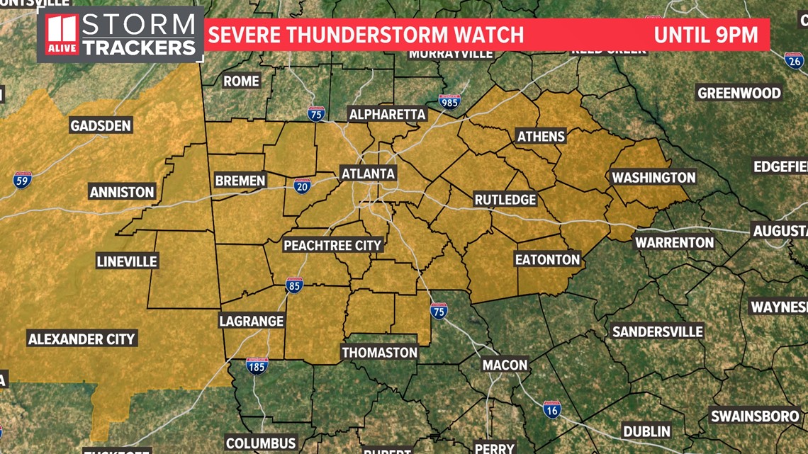
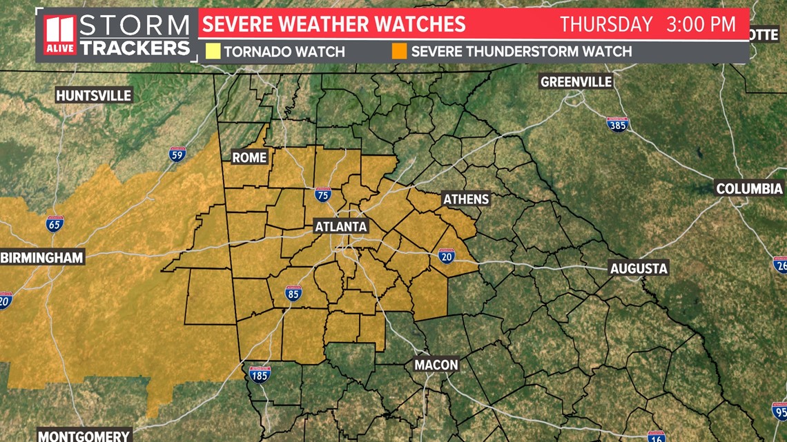
3:15 p.m. | A severe thunderstorm watch has been issued for Fulton County until 9 p.m.

Live radar
MORE FROM THE 11ALIVE STORMTRACKERS
DOWNLOAD THE 11ALIVE APP:
- Download the app on your Apple or Android device.
- Set up weather notifications by clicking the Gear icon in the upper right corner of the app. Select Notification -> Notification Settings -> Severe Weather Alerts -> Toggle the Severe Weather Alerts button to the right to turn alerts on.
- Send photos and videos through the app by selecting the Near Me feature on the bottom right taskbar of the app and entering your information.
TEXT YOUR WEATHER PHOTOS TO US: 404-885-7600
JOIN THE 11ALIVE STORMTRACKERS FACEBOOK GROUP: Nearly 10,000 metro Atlanta and north Georgia weather enthusiasts share their weather photos every day. Click here to join the group!