ATLANTA — We are closely watching a dynamic weather system moving in. That system will bring us some wind, rain and a storm threat. Here's the breakdown of the timing of all of those threats.
Three Main Threats:
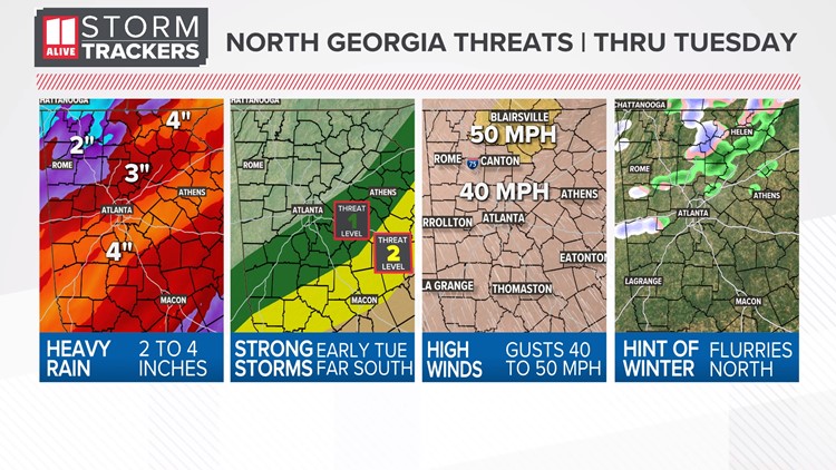
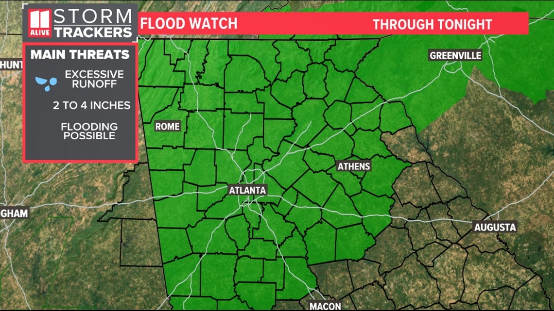
1) Heavy rain - Rain totals will be 2 to 4 inches but could locally exceed 4 inches. This could lead to creek and stream levels rising and standing water on roads. There is a Flash Flood Watch that will be in effect for northeast Georgia.
2) Gusty Winds - Winds increase Monday afternoon and last through Tuesday. There is a High Wind Warning for the north Georgia mountains, where gusts to 50 mph are possible. There is a Wind Advisory for the rest of north Georgia, where gusts to 40 mph are possible. The strong winds could be enough to cause isolated trees/limbs to go down and power outages.
3) Storm Threat - South of Atlanta, there is a risk of stronger storms early Tuesday. Severe threats include damaging winds and a very low chance of a brief spin-up tornado.
Wind threats
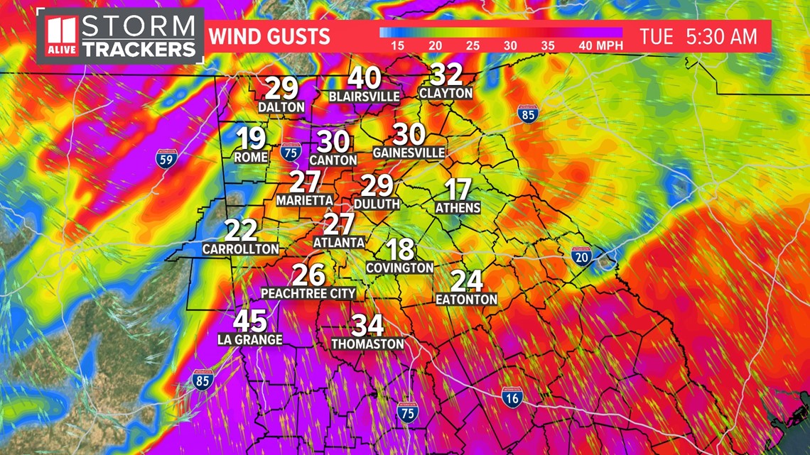
The wind will be the first thing people notice as this system approaches. With this wind threat, we are talking about more than just thunderstorm winds. These are winds that will be strong even when it's not storming. A Wind Advisory will take effect this afternoon and last through 7 p.m.
The High Wind Warning is in effect through this afternoon. It includes Murray, Fannin, Gilmer, Union, Towns, Dawson, Lumpkin and White counties. Winds will be from the southeast at 20-30mph, with some wind gusts up to 50mph.

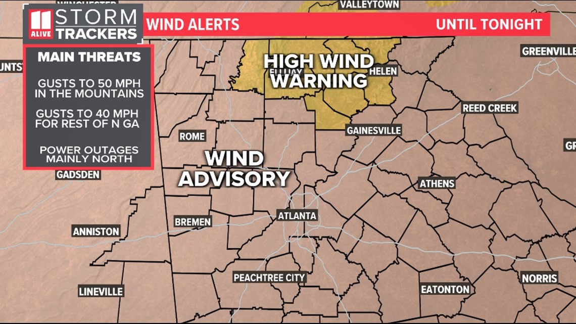
Winds get stronger this morning. Wind gusts this strong could bring down some trees and powerlines and cause power outages.

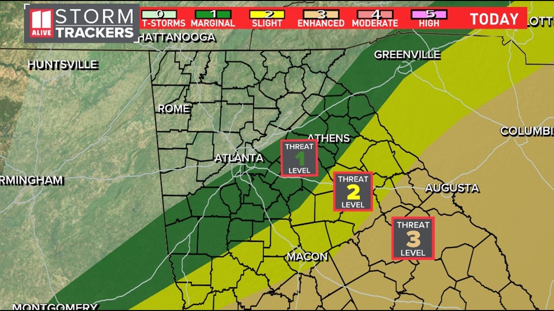
Severe Risk
We still think the highest chances for severe storms and tornadoes will be south of us in central and southwest Georgia. However, the level 1 risk for severe storms does run roughly along the I-85 corridor and south and east of the interstate. A level 2 risk is a little more south but does include counties like Putnam, Butts, Jasper, Pike, Lamar and Upson. The main severe risks include wind and a low tornado risk.

Rain/Flood risk
This system has a lot of rain with it. We could see 2-4 inches of rain during the day Tuesday. Some localized areas could see a little more. We will need to watch for some isolated areas of flash flooding possible in some spots.

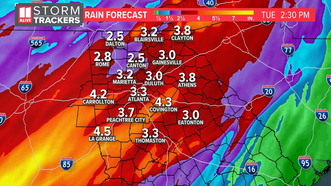
A Flood Watch remains in effect for our entire viewing area through tonight.

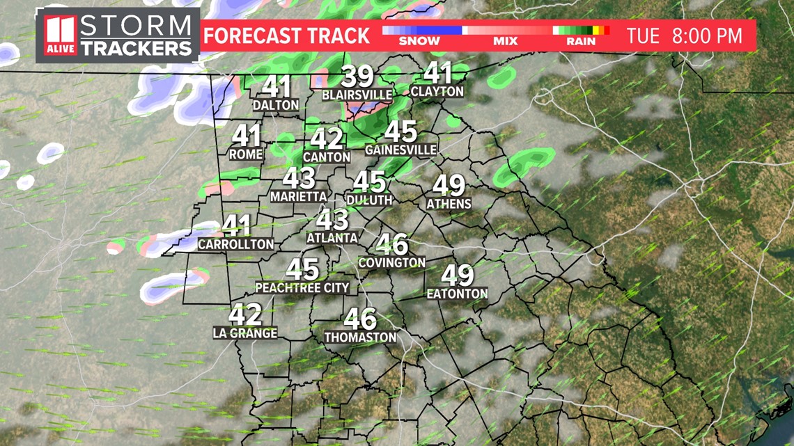
Timeline
Here's the timeline of the arrival of the rain and the potential storms.
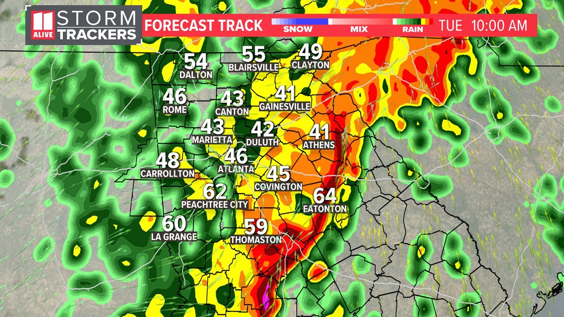
Tuesday early morning
The line of storms and heaviest rain will be over the metro Atlanta area between 5 a.m. and 8 a.m.

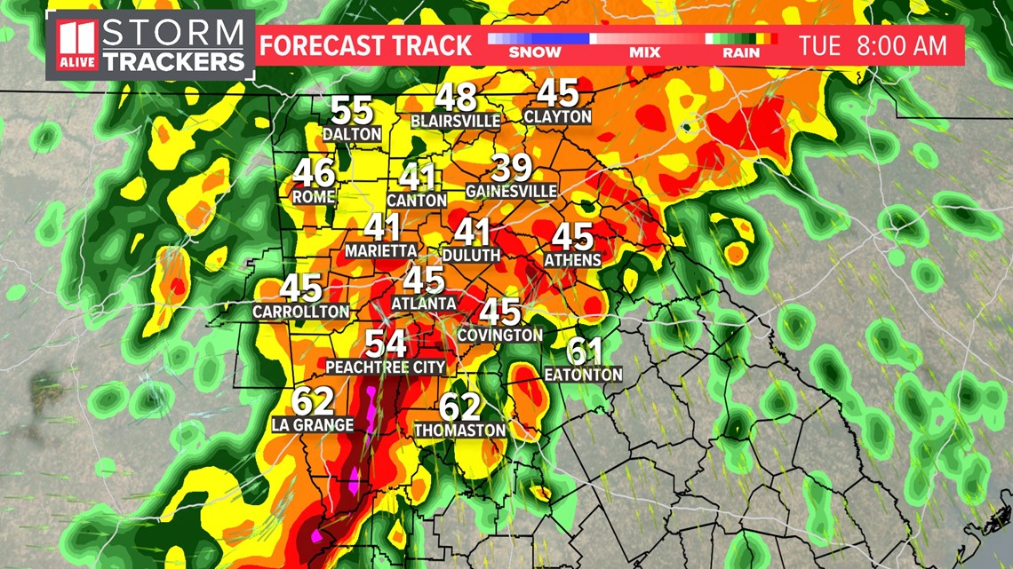
Tuesday midmorning:
By around 9 a.m., the stronger storms will be east of Atlanta, closer to Athens, through Butts County, and south toward Thomaston.

Tuesday PM Flurries north?
By afternoon, the rain will be gone from the area. There will still be enough moisture left as it cools Tuesday night for a few flurries to shake out of the clouds late Tuesday night. At this point, it doesn't look like anything to be concerned about.