11Alive Chief Meteorologist Chris Holcomb says the set-up for Wednesday's severe weather actually looks worse than Monday's.
The Storm Prediction Center has now upgraded much of north and central Georgia -- including metro Atlanta -- to a Moderate Risk area for severe weather for Wednesday.
That level of risk is a 4 out of 5, according to the NWS risk categories.
The expected severe weather has already led some school officials to scrap classes. The Griffin-Spalding County School System announced that classes would be closed for students and staff on Wednesday.
Here's the timeline:

Tuesday night
We're keeping an eye on the next weather system just off to the west, as it brings severe weather to parts of Mississippi and Alabama and into the Florida panhandle tonight. Some strong thunderstorms could move into far western Georgia after midnight.
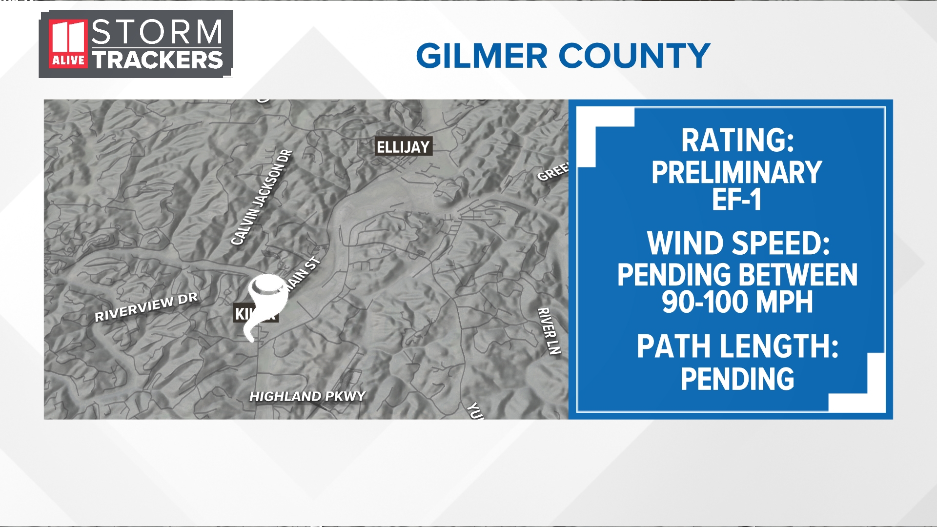
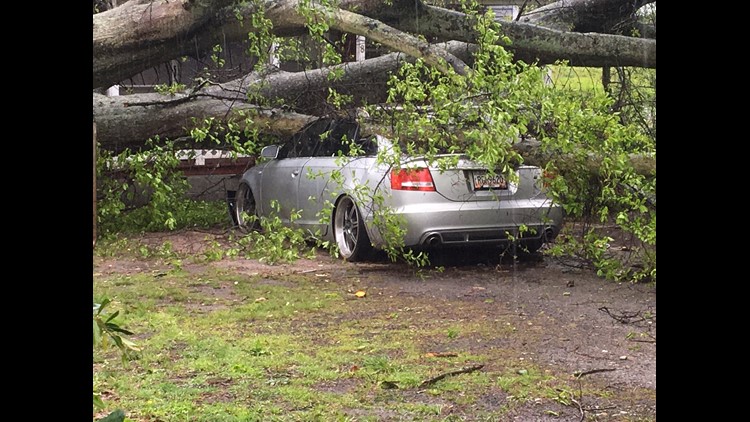
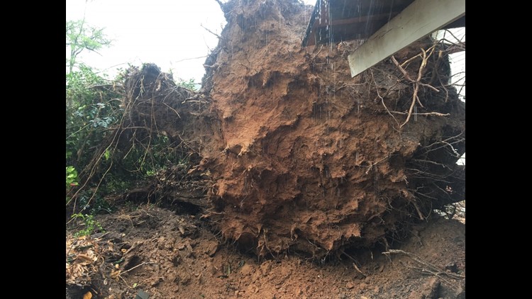
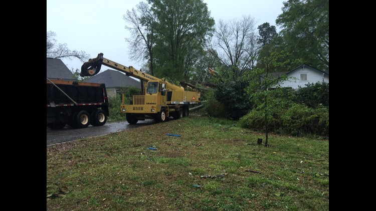
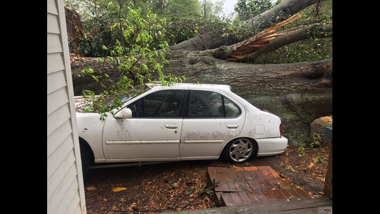
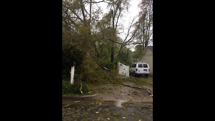
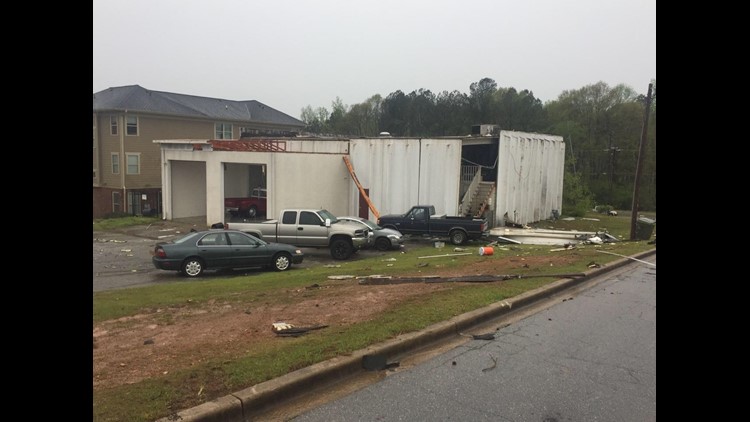
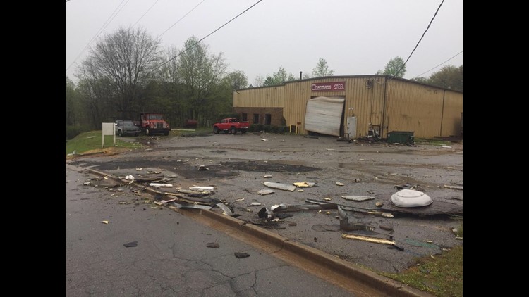
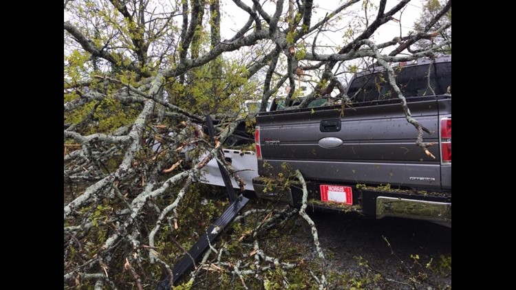
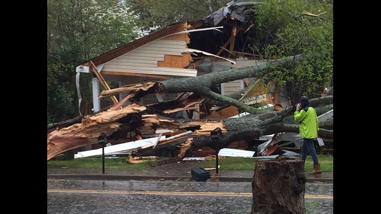
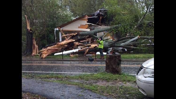
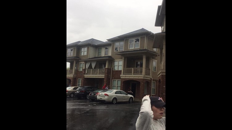
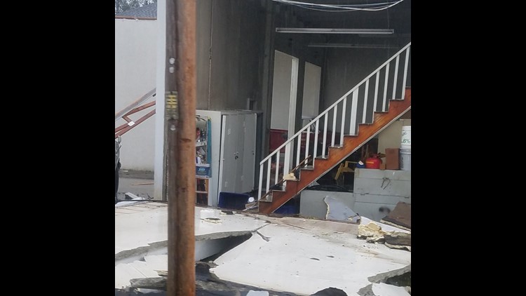
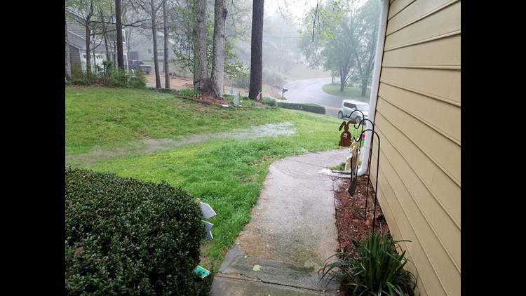
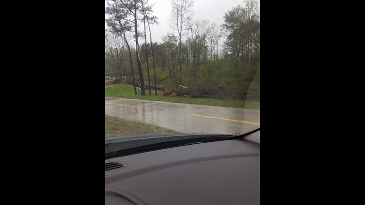
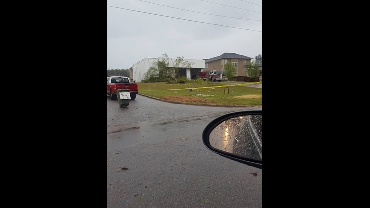
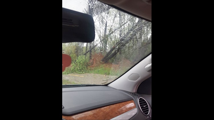
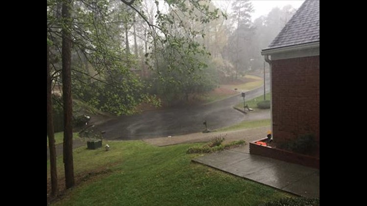
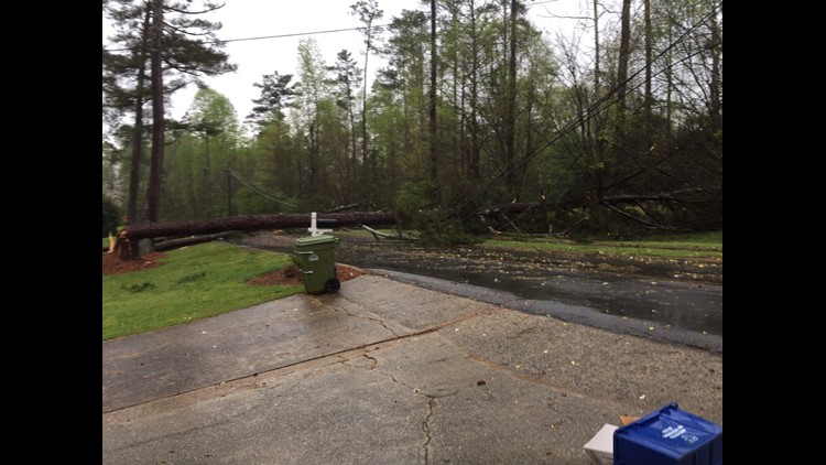
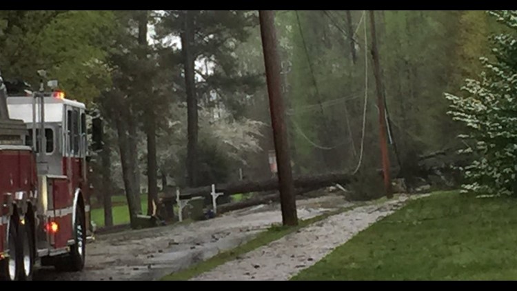
PHOTOS | Monday storm damage - April 3


Wednesday's severe storms
Chris says to watch for three waves of severe storms hitting Georgia on Wednesday -- with the first hitting the state as early as 8 or 9 am. Look for the second wave to get here around lunch time, and the third wave to move through in the late afternoon or early evening hours.
Wednesday's storms are expected to be stronger than Monday's. The main threats are going to be damaging winds of more than 70 mph, large hail, frequent lightning, and significant long-track tornadoes.
The low Wednesday morning will only be 62 degrees, while temperatures will get up to 77 before the rains begin in the late morning hours, much like they did on Monday. The storms will push through the area during the lunchtime hours and into the early afternoon, and some storms may even linger around after lunch before tapering off.
Cooler for Thursday and Friday
Chris says after this next round of storms, it gets a bit cooler for the end of the week, with lows Thursday morning near 50 and a high in the low-60s, and by Friday and Saturday morning, looking at even chillier mornings with lows both mornings at 39 degrees. The high on Friday will be back up to 59 and up to 67 on Saturday before getting back into the mid-70s for Sunday and Monday.
Photos | Severe storm damage 4.3.17

%
The 11Alive StormTrackers will continue to provide updates to the timeline as more information becomes available. Be sure to watch 11Alive News at Five, 6, 10 and 11, as well as Atlanta Alive for the latest.