ATLANTA — The 11Alive StormTrackers are tracking the next rain system moving our way. This system has limited moisture for north Georgia and the metro area, so rainfall will not be widespread.
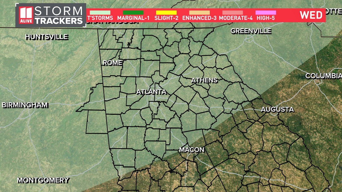
Most of the energy needed to create stronger storms will stay well to the north in the Great Lakes regions. We are no longer included in the Storm Prediction Center's severe weather outlook. While a few rumbles of thunder are possible, storms are expected to stay below severe criteria.

Georgia will be on the southern end of the system that will be much weaker, and will have a harder time holding together once it moves into Georgia.
Here's the timeline for the rain and storm risk.
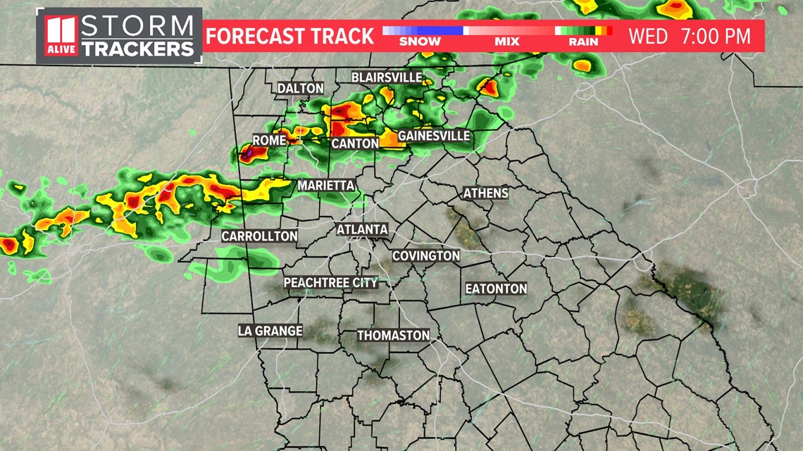
Wednesday late afternoon:
By late afternoon, some of the showers will be over north Georgia and approaching the northern metro area. You can see that the line doesn't look that impressive or widespread.

Wednesday evening:
The line of showers and possible storms continues to weaken as it gets closer to I-20 during the evening hours.

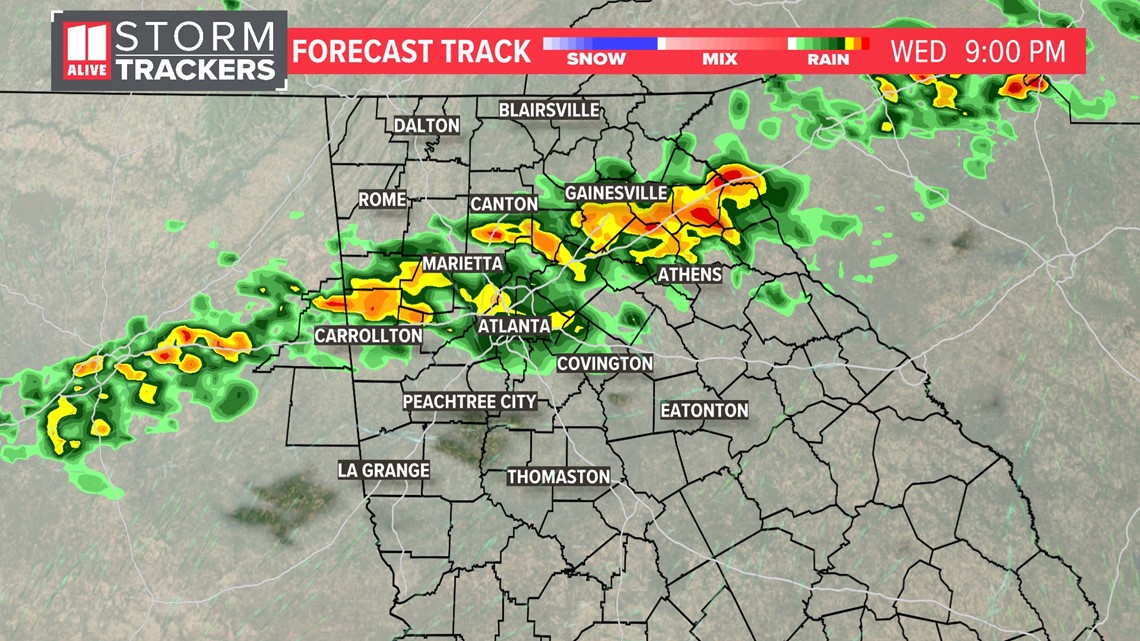
The severe weather risk will be even lower by this time frame. This system will just give a few isolated showers as it continues to push to the south and east.

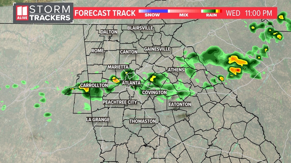
Rain potential is even more limited on Thursday, but we will need to watch the next round of rain that will move into our area on Friday. Based on the latest model output, we are calling for a 30% chance for showers, and a thunderstorm is possible. The risk of any severe storms remains low.
The 11Alive StormTrackers will keep you aware of any changes involving the timing or intensity of this system as it approaches and moves through our area.