
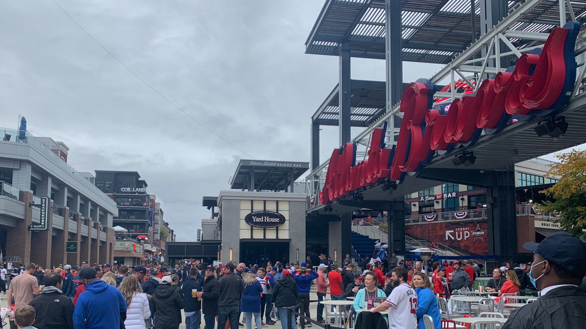
ATLANTA — The Braves are set to parade through Downtown, Midtown and Cobb County on Friday as they celebrate winning the World Series - and, with a massive crowd expected along the parade route, there are going to be lots of road closures.
Here's what we know so far about road closures:
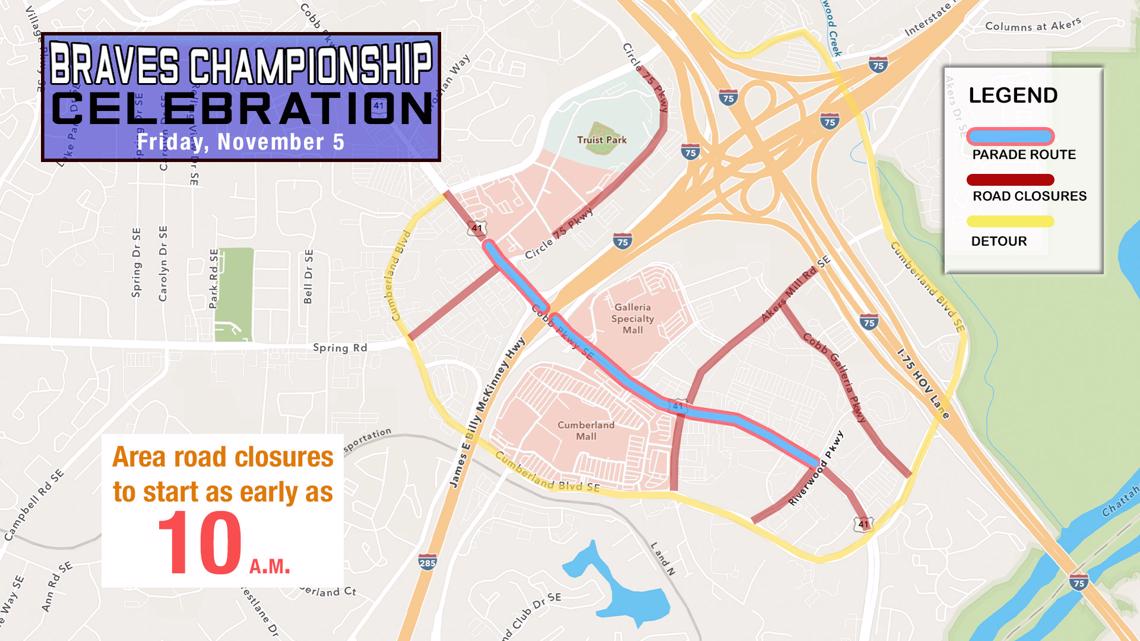
Cobb County
The county released its plans for road closures on Friday. Roads could be closed as early as 10 a.m., according to county guidance.
The Cobb parade route runs along Cobb Parkway up to the entrance to The Battery, from Riverwood Parkway about a mile away.
The roads that will be closed in Cobb include:
- Cobb Parkway itself, from Cumberland Blvd. at the south end back to Cumberland Blvd. at the north end (Cumberland Blvd. sorta circles around Cobb Parkway)
- Riverwood Parkway
- Cobb Galleria Parkway
- Akers Mill Road
- Circle 75 Parkway
- Spring Road from Cumberland Blvd. to Cobb Pkwy.

State Routes and Interstate Exits
The Georgia Department of Transportation has announced several closures of state routes and interstate exits in the area ahead of the festivities. Some areas close as early as 10 a.m. The agency says all roadways open back up at 5 p.m.
- US 41/SR 3/Cobb Parkway from Riverwood Parkway to Akers Mill Road from 10 a.m. to 5 p.m.
- US 41/SR 3/Cobb Parkway from Riverwood Parkway to I-285 (Ramps open, all exiting traffic directed NB) from 11:00 am to 5:00 pm
- US 41/SR 3/Cobb Parkway from Riverwood Parkway to Cumberland Boulevard from noon to 5 p.m.
- Exit 19 (US 41/SR 3/Cobb Parkway) from I-285 Eastbound from noon to 5 p.m.
- Exit 20 from I-285 Westbound from noon to 5 p.m.
The Cumberland Boulevard, Akers Mill HOV lane headed eastbound, and Windy Hill Road interstate interchanges will stay open, with officers on scene to help guide drivers. The Georgia Department of Transportation has a detour map to help guide motorists around Truist Park.
Additionally, Exit 249B and Exit 250 off I-75/85 in Downtown Atlanta will be closed from 11:30 a.m.-1 p.m.
Atlanta
The Atlanta Police Department put out somewhat vague guidance on Thursday, saying that "the surrounding streets will be blocked off... with no access for cars to drive on/near the parade route."
APD also said in a briefing on Wednesday that streets in Atlanta would close at 11 a.m. ahead of the 12 p.m. parade start time.
Despite the lack of specifics, we have a pretty good sense of what we can expect to close.
Obviously, there's the parade route itself: Peachtree Street, from Marietta St. in Downtown up to 10th St. in Midtown.
The Midtown Alliance public interest group also indicated on Facebook that you can expect the east-west intersections along Peachtree Street to close, as well as portions of 10th Street.
With APD saying "surrounding streets" will be closed, it's possible that the east-west closures along Peachtree Street could extend out about a block, which in Downtown would mean the cross streets out to Park Place and then Peachtree Center Avenue for the first part of the route, to the east, and Forsyth Street and then Ted Turner Drive to the west.
Up into Midtown, W. Peachtree Street and Courtland Street run parallel to Peachtree Street a block in either direction.
Courtland Street becomes Juniper Street at North Avenue, and at that point W. Peachtree Street splits farther off, leaving Cypress Street as the closest street a block from Peachtree Street.
Keep in mind north-south arteries that run parallel to Peachtree Street in the areas, such as Piedmont Avenue and Spring Street, could see some congestion spillover.