
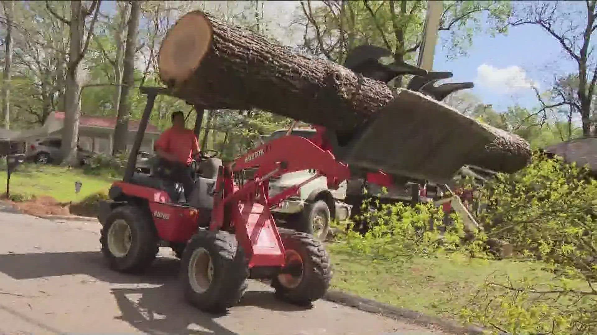
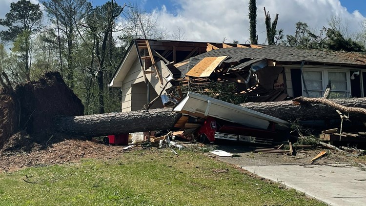
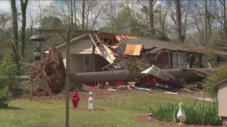
ATLANTA — The community around Conyers is picking up the pieces after a confirmed EF-2 tornado tore through the area early Wednesday morning.
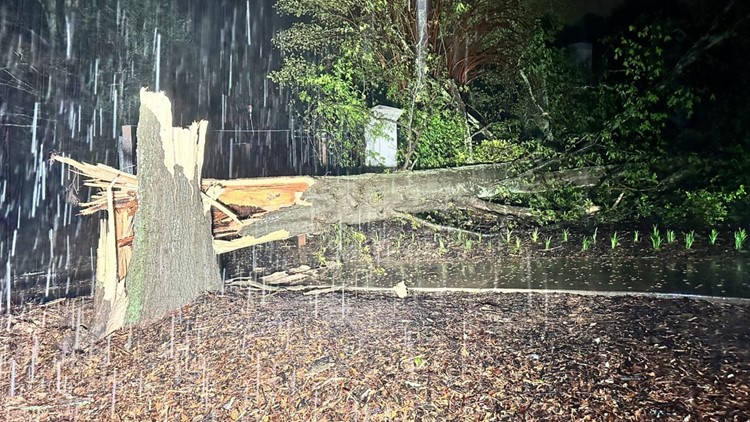
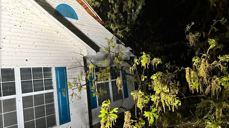
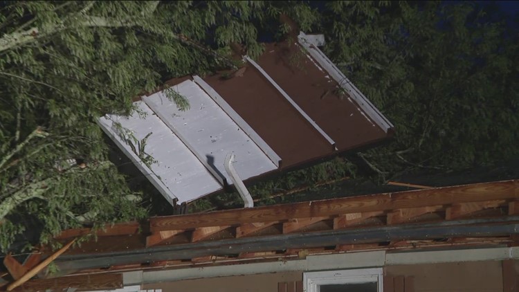
The storm brought down trees that crushed cars and homes and brought down power lines, shutting off power to many residents, primarily in Rockdale County.
Officials reported either possibly two tornadoes or two touchdowns of the same tornado, with widespread damage both west of the Conyers city limits around McDaniel Mill Road and northeast around the Milstead community.
At least two people were reported injured, though fortunately, neither person's injuries were considered life-threatening.
Officials with the National Weather Service are surveying the area Wednesday afternoon to confirm a tornado and assess its strength. In an update, the NWS said it has confirmed an EF-2 tornado with max winds of 115 mph in Conyers.
Live updates
6:15 p.m. | A tree crashed through Kathy Lawrence's living room during the EF-2 tornado in Conyers. Her neighbor Brad helped her recover her priceless photos of her grandparents.
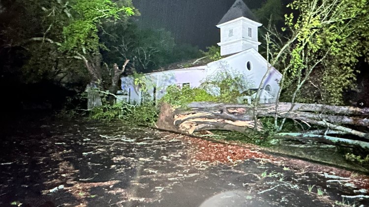
5:27 p.m. | Rockdale County Emergency Management Agency has set up a shelter for residents in need at First United Methodist Church on Main Street in Conyers. Contact Rockdale County EMA at 770-278-8300 for more information.
5:15 p.m. | 11Alive Meteorologist Melissa Nord explained how National Weather Service crews are working to determine the path and strength of the tornado.
5 p.m. | 11Alive's Grace King spoke with residents who live in the Milstead community after dozens of trees came crashing down on their homes.
3:30 p.m. | As damage assessments continue across Rockdale County, the county's Emergency Management Agency provided the following renters insurance tips:
- As always, SAFETY FIRST. Do not enter damaged buildings unless they are deemed safe. Wear appropriate clothing, like sturdy shoes or boots, long sleeves and gloves.
- Inspect your home or apartment for any signs of structure issues and take photos and video inside and outside.
- Contact your insurance agent or company to start the claims process.
2:54 p.m. | The National Weather Service has confirmed there was an EF-2 tornado with max winds of 115 mph in Conyers. It will provide its full report later.


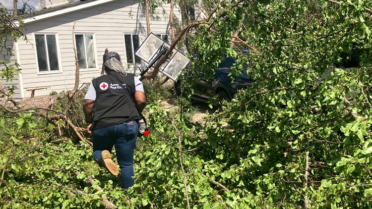
2 p.m. | Georgia Red Cross volunteers continue to help residents impacted by the storm. In the days and weeks ahead, the Red Cross will continue to work with residents to help them through their next steps and provide additional recovery resources. People in need of emergency assistance are asked to call 1-800 Red Cross (1-800-733-2767). More resources are also available online here.
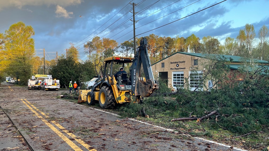
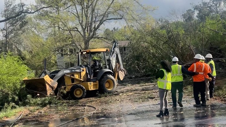
1:30 p.m. | Rockdale County Chairman Oz Nesbitt provided an update as crews continue to clean up across the county.
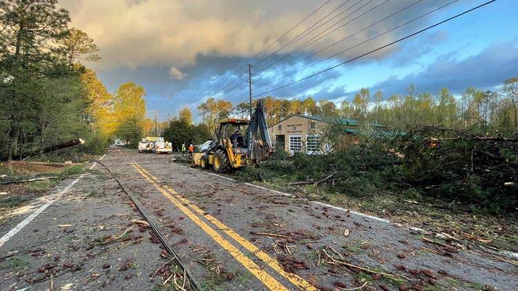
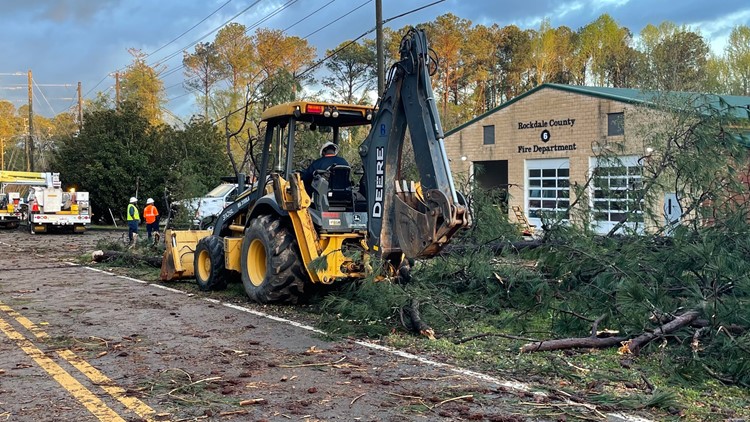
Nesbitt said the Salvation Army will be providing meals at Rockdale County Fire Station #6, located at 2681 Hurst Rd SW in Conyers. Red Cross officials distribute clean-up kits and supplies at the same location.
"Thankfully, there are no severe or life-threatening injuries reported at this time," Nesbitt added. "We're urging all residents to minimize road usage unless absolutely necessary."
You can watch the full update here:
1 p.m. | NWS crews continue to survey the damage left by the storms. They said they hope to have an update soon.
12:47 p.m. | 11Alive Meteorologist Melissa Nord is also out around Conyers and heard from a resident who said a tree crashed into their bedroom but didn't fall all the way through thanks to another big tree out back that stopped its fall.
12:45 p.m. | 11Alive's Liza Lucas reports a tree came down at this house, with the resident saying it crashed into her 11-year-old son's room. He was fortunately not home.

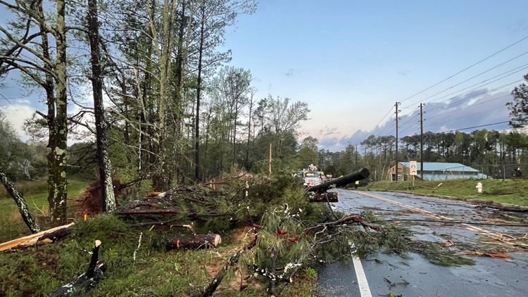
11:50 a.m. | Rockdale County EMA confirms at this time the only road closures are at McDaniel Mill Road and Hurst Road.
11:35 a.m. | The Rockdale County government provides this update:
11:20 a.m. | Some updates from Conyers via 11Alive's Liza Lucas:
- The sheriff's office in Rockdale County confirms two injuries, but they were described as not life-threatening. One person was injured when a tree fell on a house and the other when a tree fell on a vehicle.
- They believe there were possibly two tornadoes, or possibly two touchdowns of the same tornado, with the Milstead community northeast of Conyers city limits impacted and the area along McDaniel Mill Road west of the city limits impacted.
- They're still waiting on a fuller damage assessment from the County EMA, but they're encouraging citizens to take pictures for insurance purposes and disaster relief.
9:15 a.m. | More from 11Alive's Liza Lucas in Conyers:
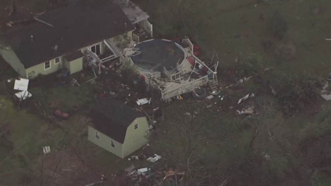
8:35 a.m. | The 11Alive SkyTracker flew over Conyers, getting a bit of a daylight view of damage left behind by the likely tornado.


8:30 a.m. | Some good news: We reached out to Rockdale County Public Schools and they report no serious damage to any schools or facilities.
8:15 a.m. | 11Alive Meteorologist Melissa Nord spoke to the National Weather Service, who confirmed they will be conducting a damage survey in Conyers today.
8:05 a.m. | Some more daylight images, from 11Alive's Liza Lucas who is now also in Conyers. These come from McDaniel Mill Road.


7:25 a.m. | Here are some daylight photos of the damage from 11Alive's Jerry Carnes. These are from West Adrian Circle, west of Conyers city limits.


6:30 a.m. | Here's what we know about the possible tornado impact in Conyers:

5:00 a.m. | Flash flood warnings will remain in effect for two areas until 7:15 a.m. The first stretches across southwest Fulton County, Fayette County and Clayton County, and across Atlanta, DeKalb County, south Gwinnett County, Henry County and Rockdale County, which was particularly hard-hit by the storms overnight.
Then there's another flash flood warning stretching west across south Douglas County, south Carroll County, Coweta County, Heard County and small parts of Troup and Meriwether counties.
4:23 a.m. | Power outages are affecting over 3,500 customers in Fulton County, according to Georgia Power.
4:00 a.m. | All severe thunderstorm and tornado warnings/watches are gone.
3:15 a.m. | A tornado watch for Rockdale, Newton, Butts, Spalding, Lamar, Pike, Walton, Upson and Henry counties has been canceled.
3:05 a.m. | 11Alive Chief Meteorologist Chris Holcomb is tracking the latest tornado warning in several east Georgia counties. Watch LIVE below:
3:02 a.m. | A tornado warning has been issued for Greene and Oglethorpe counties until 3:45 a.m.
2:48 a.m. | A severe thunderstorm warning has been issued for Morgan, Greene, Oglethorpe and Oconee counties until 3:30 a.m.
2:37 a.m. | A tornado watch has been issued until 4 a.m. for Pike, Rockdale, Butts, Oconee, Lamar, Putnam, Morgan, Jasper, Greene, Walton, Upson, Henry, Newton, Oglethorpe and Spalding County.
2:31 a.m. | 11Alive's Cody Alcorn is seeing structural damage to homes on McDaniel Mill Road.
2:29 a.m. | A severe thunderstorm warning has been issued for Newton, Walton and Morgan counties until 3:15 a.m.
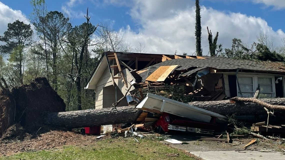
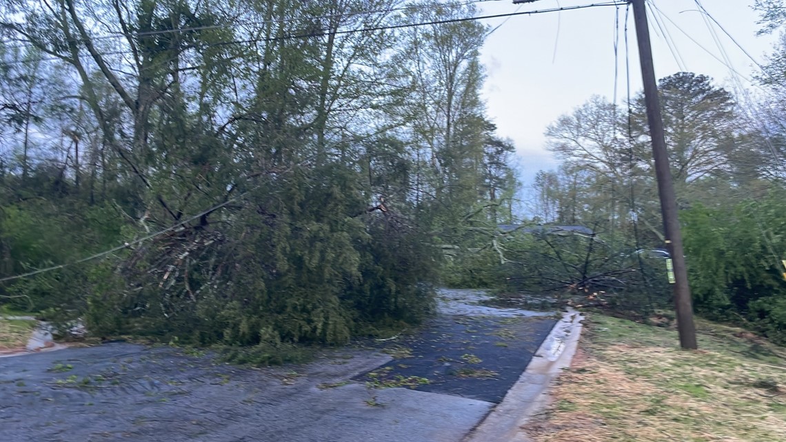
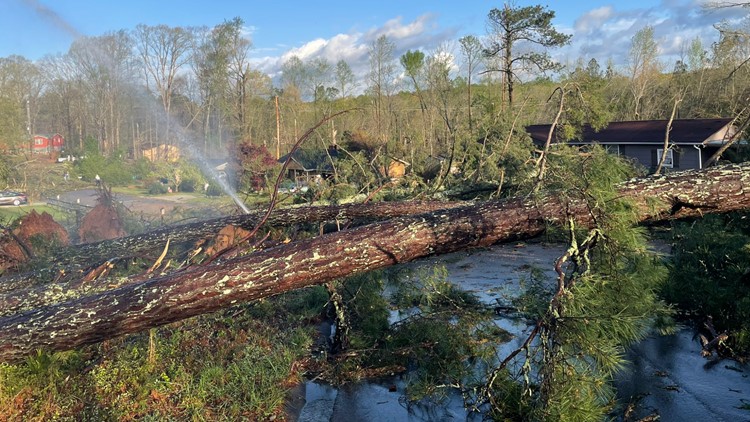
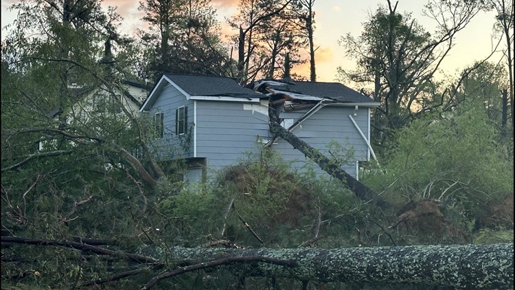
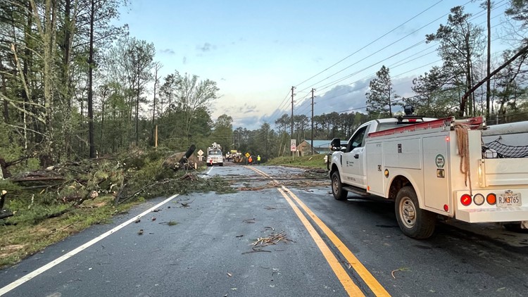
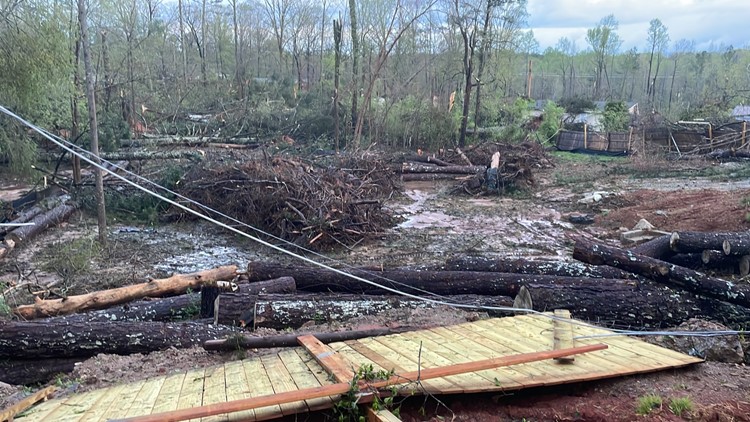
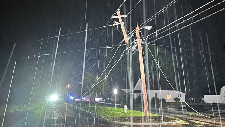
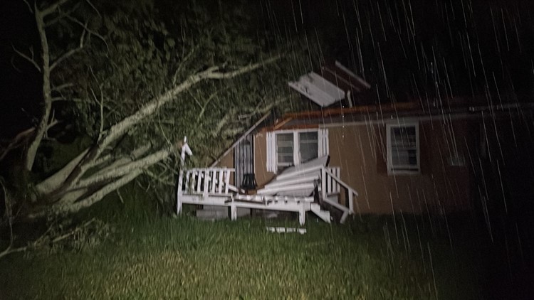
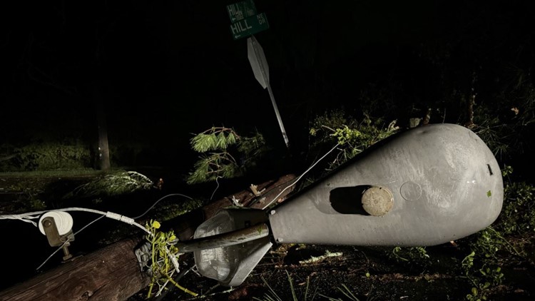
2:24 a.m. | A massive tree collapsed on a home in Rockdale County off McDaniel Mill Road.

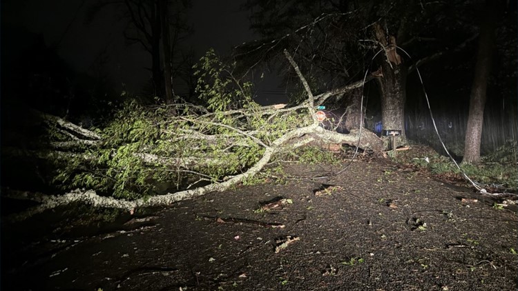
2:21 a.m. | Downed trees, just like this one, are blocking many busy roads around residential areas in Conyers.


1:54 a.m. | Maintenance crews are out working to clear debris from the roads in the Conyers area.
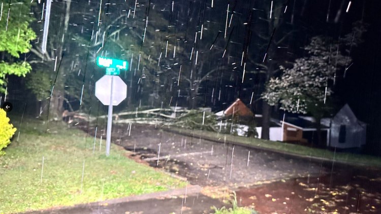
1:52 a.m. | There are trees down blocking Sigman Road near Renaissance Drive in Conyers.
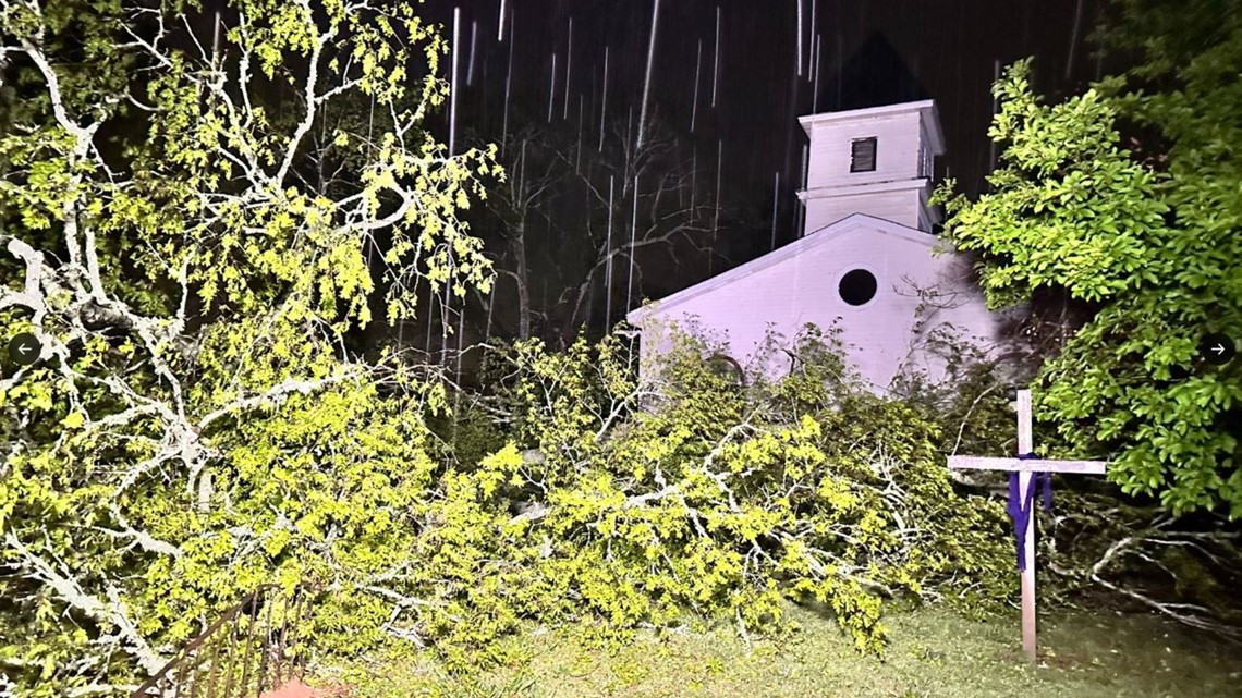
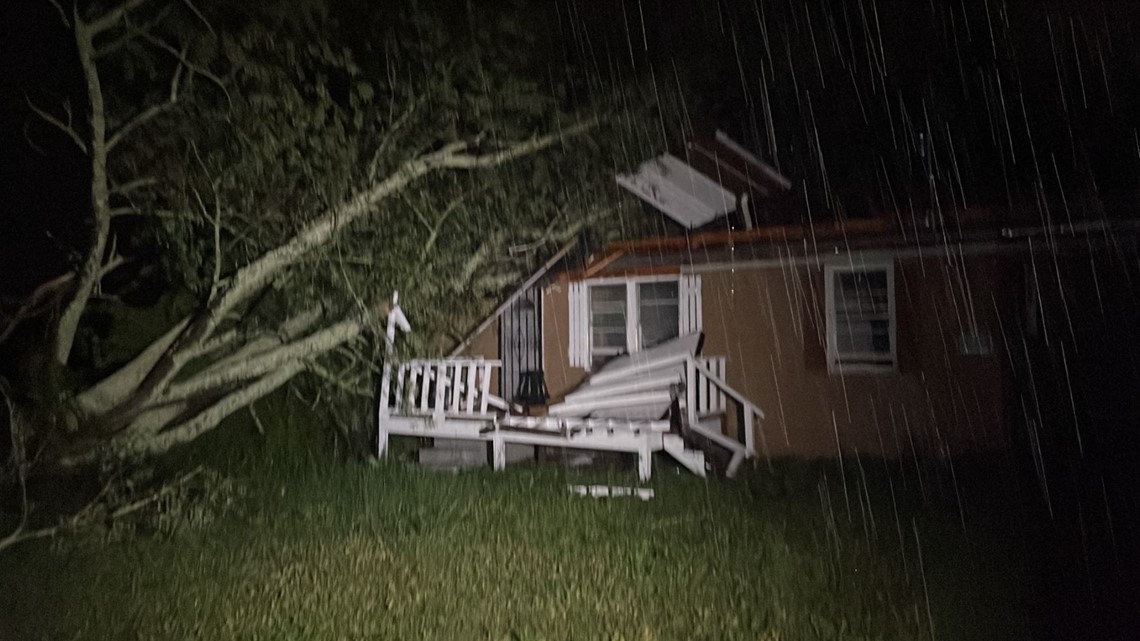
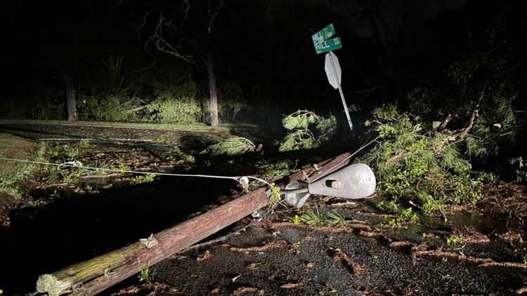
1:28 a.m. | 11Alive's Jerry Carnes talked to an 18-year-old driver who was inside his car when a tree toppled over on top of it off Sigmond Road in Conyers. Police said the tree was sitting in the man's lap and they were able to pull him free. He was taken to Grady Hospital but is expected to be OK. Here are the terrifying photos from his encounter, plus other storm damage in Rockdale County.
PHOTOS | Storm damage in Rockdale County


1:19 a.m. | A flash flood warning has been issued for Fulton County until 7:15 a.m.
1:16 a.m. | 11Alive's Cody Alcorn is in Conyers, where he saw EMS leaving a damaged area from the strong storms.
1:06 a.m. | According to Georgia Power's outage map, there are over 5,000 people affected by power outages in the Conyers area after severe storms rolled through.
12:45 a.m. | The tornado warning issued for Rockdale, Newton and Walton counties has expired.
12:22 a.m. | A severe thunderstorm warning has been issued for Morgan, Walton, Clarke, Oglethorpe, Oconee, Jackson and Barrow counties until 1 a.m.
12:11 a.m. | A severe thunderstorm warning has been issued for Walton and Newton counties until 12:45 a.m.
12:10 a.m. | Follow along LIVE with 11Alive Chief Meteorologist Chris Holcomb as he tracks tornado warnings and severe thunderstorms moving through metro Atlanta and north Georgia.
12:07 a.m. | A tornado watch has been issued for Clarke, Rockdale, Butts, Oconee, Lamar, Putnam, Morgan, Jasper, Greene, Walton, Upson, Newton, and Oglethorpe counties until 3 a.m.
12:03 a.m. | A tornado warning has been issued for Rockdale, Walton and Newton counties until 12:45 a.m.
12:02 a.m. | The National Weather Service said there was a radar-confirmed tornado located over Lakeview Estates, over Conyers, moving northeast at 35 mph. A confirmed tornado touched down in Rockdale County, with lofted debris detected on radar.
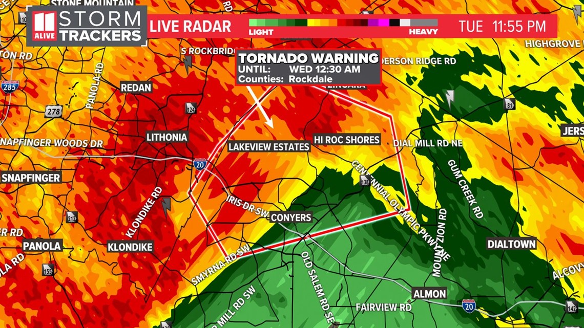
11:52 p.m. | The National Weather Service has issued a tornado warning has been issued for Rockdale County until 12:30 a.m. with pea-sized hail. Those in Rockdale County should get into a tornado-safe position inside their homes.

11:08 p.m. | Here are a few important tips to stay safe in severe weather.
11:05 p.m. | 11Alive's Cody Alcorn is in Carrollton looking at rain ponding up on roads and lightning in west Georgia that is making driving conditions tough.
11 p.m. | 11Alive Chief Meteorologist Chris Holcomb is watching the severe weather moving into west Georgia and making its way into metro Atlanta.
10:55 p.m. | A tornado watch has been extended until 3 a.m. for Fulton, DeKalb, Cobb, Clayton, Cherokee, Fayette, Pike, Coweta, Meriwether, Henry and Spalding counties.
10:15 p.m. | 11Alive's Cody Alcorn and Karys Belger give live reports from Heard and Floyd counties about the weather conditions. Chief Meteorologist Chris Holcomb also talks about the upcoming storm risks as a portion of west Georgia is under a tornado watch until 3 a.m.
9 p.m. | 11Alive Chief Meteorologist Chris Holcomb provided a 9 p.m. weather update, as he is tracking the rain and storms moving our way Tuesday evening into early Wednesday morning.
8 p.m. | A tornado watch has been issued for much of west Georgia until 3 a.m. It includes Bartow, Carroll, Catoosa, Chattooga, Dade, Douglas, Floyd, Gordon, Haralson, Heard, Murray, Paulding, Polk Troup, Walker and Whitfield counties.
11Alive meteorologist Nicole Hartford broke down what that timeline could look like:
7 p.m. | 11Alive is tracking the timeline for severe weather moving into north Georgia and metro Atlanta on Tuesday night into Wednesday morning.
6 p.m. | 11Alive Chief Meteorologist Chris Holcomb is tracking when severe weather is moving into our area on Tuesday night and into Wednesday morning.
MORE FROM THE 11ALIVE STORMTRACKERS
DOWNLOAD THE 11ALIVE APP:
- Download the app on your Apple or Android device.
- Set up weather notifications by clicking the Gear icon in the upper right corner of the app. Select Notification -> Notification Settings -> Severe Weather Alerts -> Toggle the Severe Weather Alerts button to the right to turn alerts on.
- Send photos and videos through the app by selecting the Near Me feature on the bottom right taskbar of the app and entering your information.
People can get weather alerts from 11Alive's meteorologists on the 11Alive+ app on Roku and Amazon Fire TV. Download 11Alive News app and sign up to receive alerts for the latest.
TEXT YOUR WEATHER PHOTOS TO US: 404-885-7600
JOIN THE 11ALIVE STORMTRACKERS FACEBOOK GROUP: Nearly 10,000 metro Atlanta and north Georgia weather enthusiasts share their weather photos every day. Click here to join the group!