
ATLANTA — Waves of heavy rain drenched the Atlanta metro and north Georgia on Monday, the beginning of what's expected to be a very wet week.
According to 11Alive meteorologist Chesley McNeil, we can expect more of the same today.
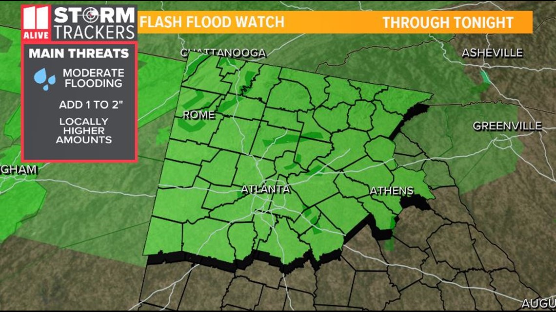
A flood watch for much of north Georgia that went into effect on Monday afternoon and remains in place on Tuesday until 7 p.m.
Here's a timeline of what's coming:
Tuesday
Some good news - today we should be less inundated with rain than yesterday. One wave should hit around mid-morning, 10 a.m. or so, and then it should be more clear aside from some light scattered showers into the afternoon and evening.
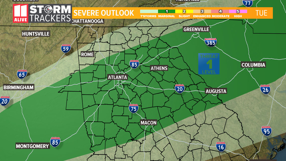
11Alive meteorologist Wes Peery says a severe storm is possible later this afternoon with a cold front coming through. Damaging wind gusts are the main threat, but overall chances are very low.
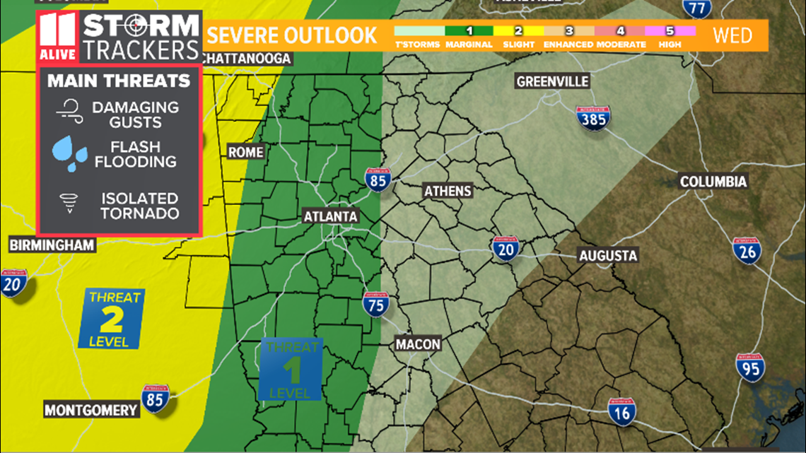
Maps indicate most of the Atlanta area will be under a Level 1 severe weather threat.

A flash flood watch will remain in effect through tonight.

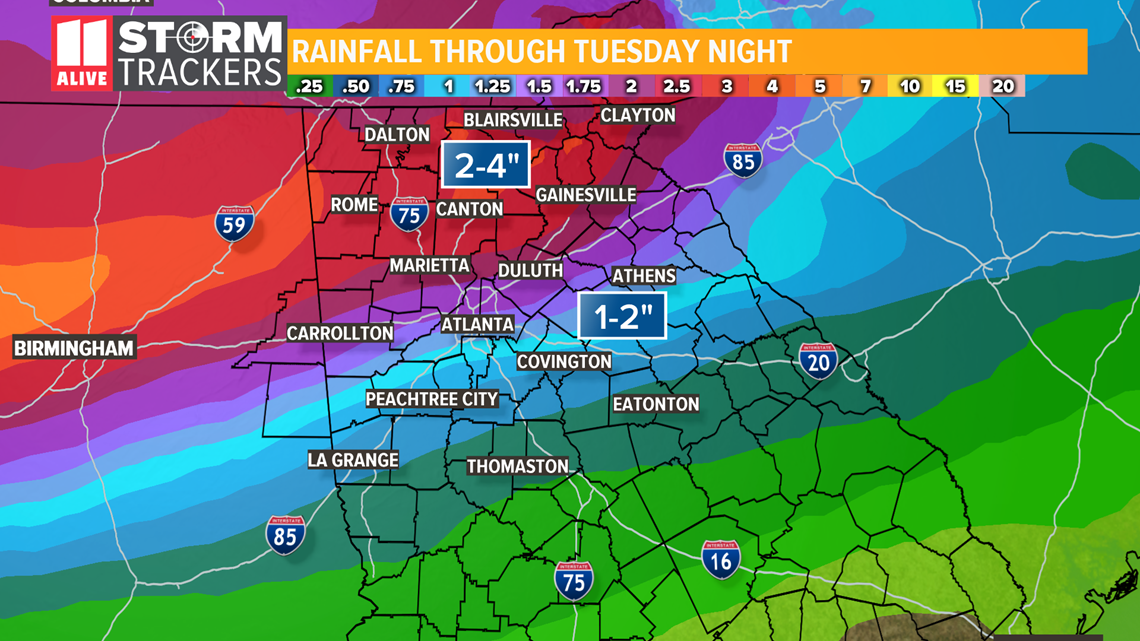
The 11Alive StormTrackers predict our total rainfall to be about 1--2 inches in Atlanta and the south metro and 2-4 inches in the north metro and beyond.

Wednesday
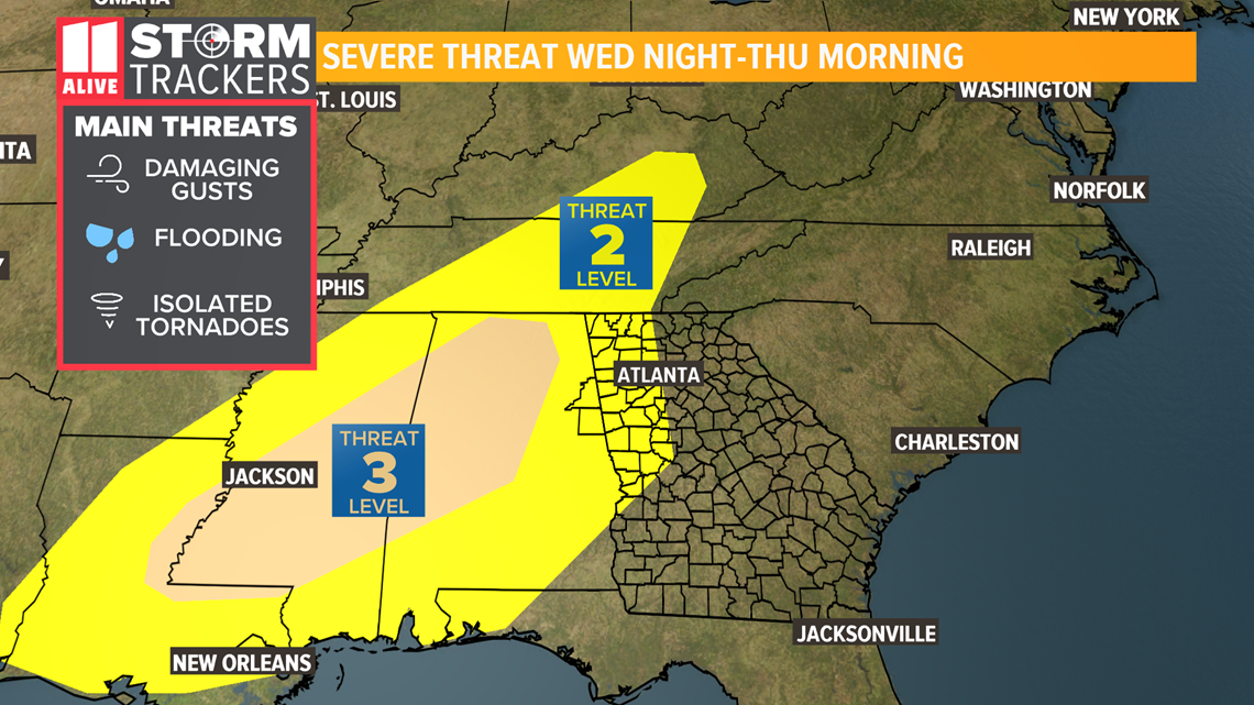
There should be a brief break on Wednesday, but don't get too comfortable - the worst of the weather this week is expected to begin Wednesday night. From then and into Thursday we're expecting severe thunderstorm warnings and possibly even tornado activity.
Maps indicate most of Atlanta will still be under a Level 1 threat, but northwest areas including Rome could see it worse as they'll be under a Level 2 threat.

Thursday
The severe weather threat is expected to linger into the morning before things finally clear up a bit, with a sunny, mild Friday and Saturday waiting for us on the other side.
We can get through this, everyone.

MORE HEADLINES