
ATLANTA — NOAA updated their Atlantic hurricane outlook Thursday, calling for greater odds of an above-average season in the Atlantic.
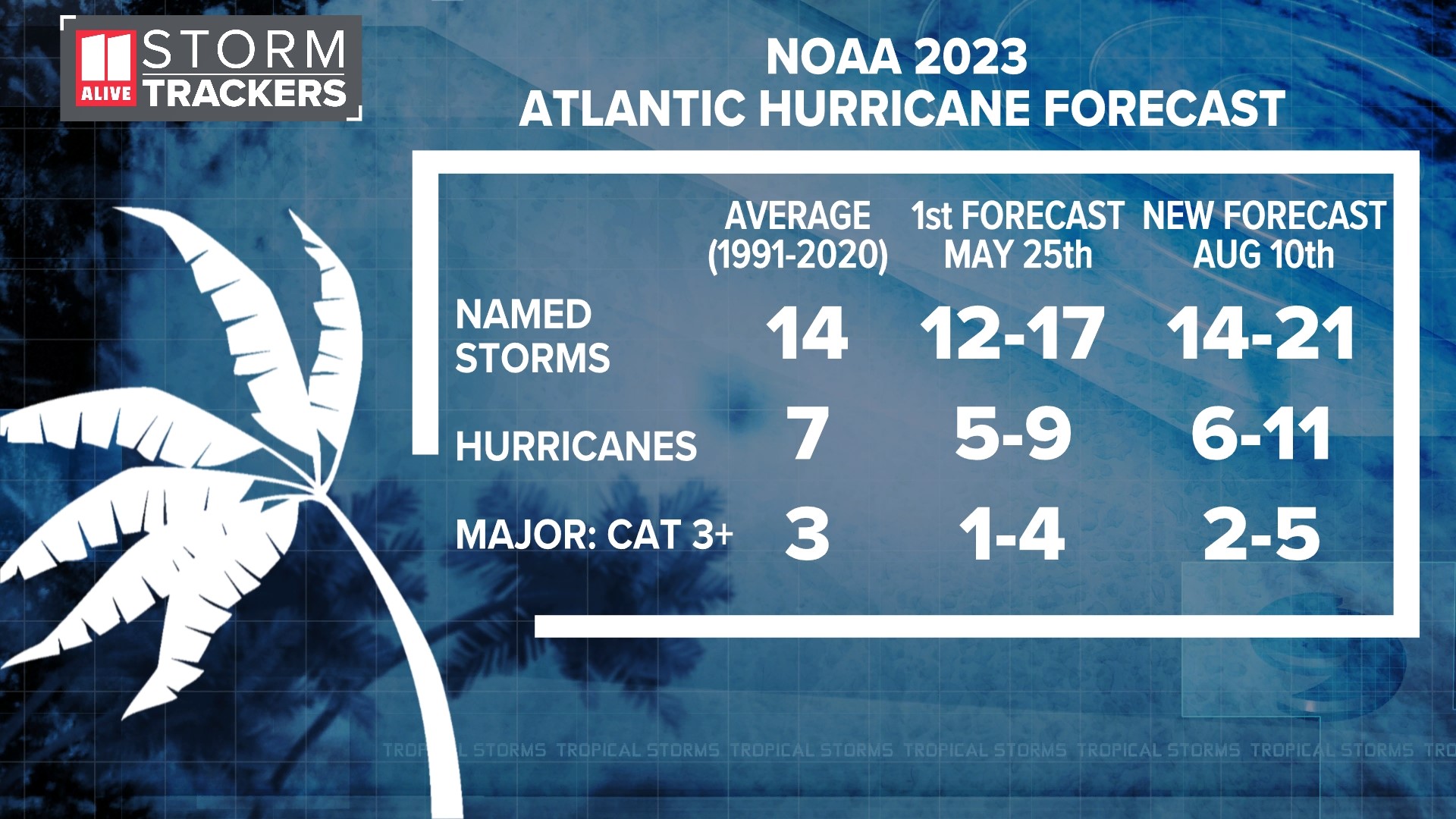
They now say there is a 60 percent chance of above-normal activity. In the new outlook, they call for 14 to 21 named storms, 6 to 11 hurricanes, and 2 to 5 major hurricanes. An "average" season is classified by the 30-year average storm count ending in 2020, and is 14 named storms, 7 hurricanes, and 3 major hurricanes.
Matthew Rosencrans, lead hurricane season forecaster with NOAA’s Climate Prediction Center, explained that the increase in the outlook is due to an influence of record-warm ocean temperatures, and the delayed arrival of El Niño conditions in the Atlantic. El Niño usually leads to more wind shear, changes to vertical stability and moisture profiles in the Atlantic basin and inhibit storm development. So far, these factors have been slower to emerge than expected.


There is a little more uncertainty and wider ranges than the original predicted 12-17 named storms and 5-9 hurricanes, largely because they are awaiting the increase in wind shear to kick in.
So far, there have been 5 storms this season, one of which became a hurricane. Last year, there were 14 named storms. 2022 included the costliest storm on record, Hurricane Ian, which made landfall on September 28th near Costa Cayo, Florida. It was directly responsible for at least 148 fatalities in the United States. According to the NOAA National Centers for Environmental Information, Ian was the third-costliest hurricane on record for the United States, causing an estimated $112.9 billion worth of total damage.
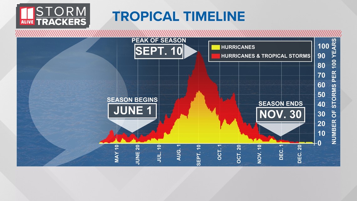
NOAA always updates their hurricane outlooks early in August at the beginning of the peak months of hurricane season. Historically, 90 percent of tropical activity takes places between August, September and October. The Atlantic Hurricane Season ends November 30. The official 'peak' of hurricane season is September 10.

Does this mean we will see more landfalls on the U.S. coastline? An above-normal season does double the chances of an east coast landfalls over average years. But landfalls themselves can only be predicted up to a week out. Synoptic and smaller scale steering currents drive where tropical systems go.
NOAA urges everyone in hurricane-prone areas to have their hurricane plan ready to go. In north Georgia, although we're hundreds of miles away from the coast, we can see impacts from landfalling tropical systems, including strong winds, heavy flooding rains, and inland tornadoes.
Hurricane forecasts are getting better this season. In June, NOAA deployed a new hurricane model. It's being run simultaneously with their old model. It will replace the old one next season.
MORE FROM THE 11ALIVE STORMTRACKERS
DOWNLOAD THE 11ALIVE APP:
- Download the app on your Apple or Android device.
- Set up weather notifications by clicking the Gear icon in the upper right corner of the app. Select Notification -> Notification Settings -> Severe Weather Alerts -> Toggle the Severe Weather Alerts button to the right to turn alerts on.
- Send photos and videos through the app by selecting the Near Me feature on the bottom right taskbar of the app and entering your information.
TEXT YOUR WEATHER PHOTOS TO US: 404-885-7600
JOIN THE 11ALIVE STORMTRACKERS FACEBOOK GROUP: Nearly 10,000 metro Atlanta and north Georgia weather enthusiasts share their weather photos every day. Click here to join the group!