

GRIFFIN, Ga. — When the National Weather Service in Peachtree City finished their initial surveys on the January 12th tornadoes, Meteorologist-In-Charge Keith Stellman had an inkling – they hadn't yet uncovered the full picture.
With all the tools they had available in the first week after the tornadoes, they came up with a total of three tornadoes near the intersection of Meriwether, Pike and Spalding Counties. It was a damaged path that stretched over two miles wide in some instances. That's massive. Was it really just from three tornadoes, or could something else have been happening there?
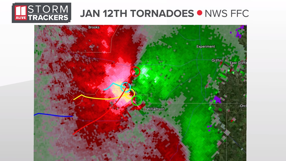
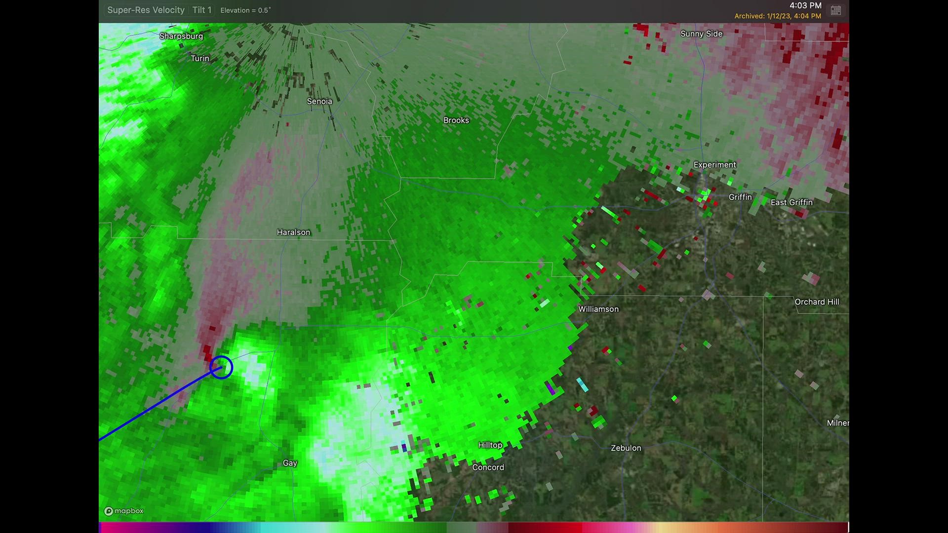
They spent three weeks in an exhaustive reanalysis, looking at radar imagery and new special high-resolution aerial imagery, which was taken on January 13 – one day after the twisters.
What they found was not what you'd ever expect in the Peach State. Stellman along with colleague Kyle Thiem determined that there were multiple tornado vortices (circulations) rotating around a larger circulation.

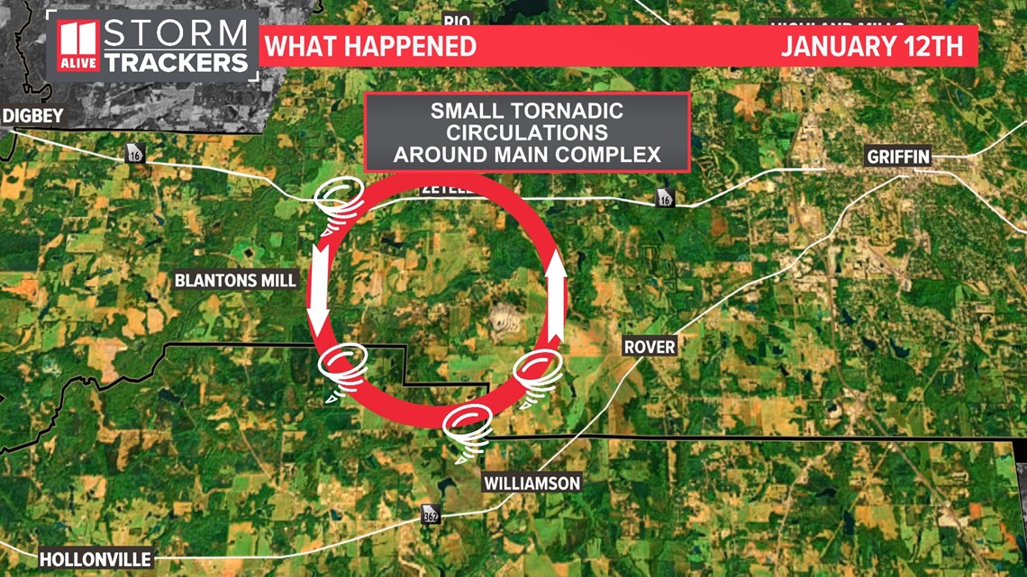
As many as four tornadoes were on the ground at a single time, all rotating around the main circulation. The parent circulation was not a tornado itself.

As the storm evolved, some of these rotations merged. This twirling ballet of merging twisters occurred in three separate instances. After each merger, it helped to intensify the peak wind speeds.
Upon looking at the newer tornado paths, you'll notice a fascinating pattern. The tracks are in a sinusoidal pattern, due to the nature of each twister rotating around the main circulation.


This is a scenario that neither Stellman nor Thiem had ever seen before in Georgia. Thiem did study similar scenarios out in Tornado Alley in his graduate school research, which he was able to apply to this tornado reanalysis.
Looking back at the data, they also believe this tornado pivot and merge phenomenon has also occurred in Wilcox County. It could have also taken place in another cycle as the storm moved into Henry, Butts, Newton and Jasper Counties. However, without the same high-resolution aerial data and lower-level radar data, they were unable to complete a similar reanalysis.
In total, the National Weather Service concludes 14 tornadoes touched down on Jan. 12 – including 10 that occurred from this same main circulation. There was 1 EF-3, 5 EF-2s, 7 EF-1s, and 1 EF-0 tornado. In addition, they increased the maximum wind speeds for the EF-3 tornado in Spalding County to 155 mph, a high-end EF-3.

