
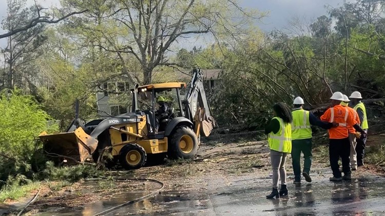
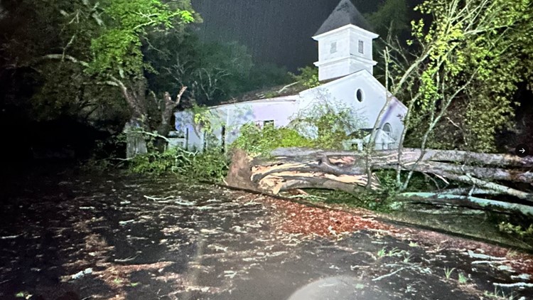
CONYERS, Ga. — National Weather Service meteorologists were out Wednesday in Rockdale County, surveying the damage after the Tuesday night tornado that left a path of damage well into the early Wednesday morning hours.
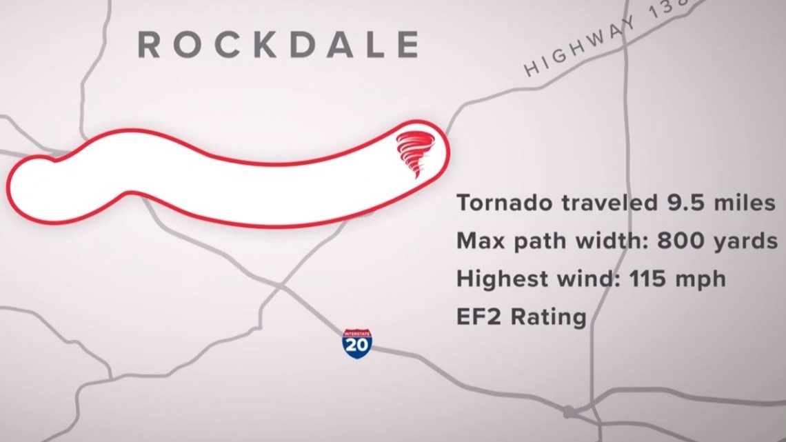
Their preliminary survey determined an EF-2 tornado touched down with max winds of up to 115 mph around Conyers. The survey also determined it had a 9.5-mile path.
We were the only news station in Atlanta to follow them along for the day on their damage survey – to give you more insight into how they figure out the strength of a tornado.
Meteorologist-In-Charge Keith Stellman and Senior Meteorologist Sid King, both with the National Weather Service in Peachtree City, planned on starting off their morning mapping out the hardest hit area – along Briarwood Circle.

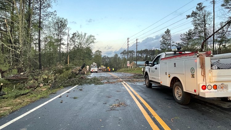
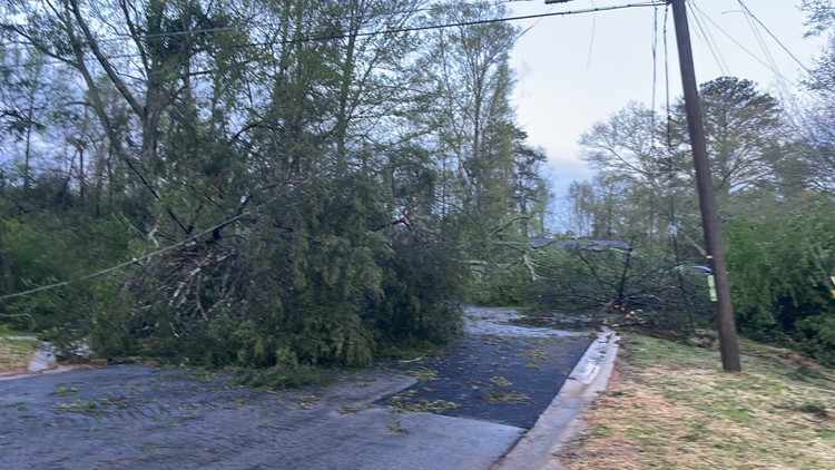
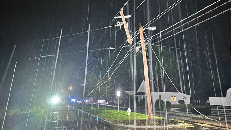
Due to downed trees and wires, they had to park and walk quite a distance early this morning. Some areas were still inaccessible. So, after getting their sight on it briefly, they traveled to the north side of I-20 to map out the northern side of the storm’s core.
We started near McCalla Street. Huge hardwood oak trees were uprooted across Celia Curns’ house. One – came straight through it. She and her husband were in their bedroom at the time. Celia had just gotten up to go to the restroom when she heard the winds picking up.
“Get down! Duck!” she heard her 23-year-old granddaughter yell from the room in the back of the house.
She dropped to the floor. Her husband did as well.
By a miracle, the massive tree cut through the ceiling but stopped before reaching the floor. The top of it hit another huge oak tree in the back of the house. That stopped it from cutting the entire depth of the house in the back.
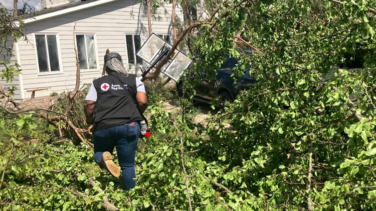
PHOTOS | Storm damage in Rockdale County


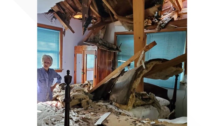


Her granddaughter and son in the basement also escaped unscathed.
As we circled the surrounding streets, the National Weather Service crew stopped along the way, taking photos in a special app that geolocates the location with GPS.
It’s through that they collect dozens of data points – information about the type of damage that was sustained and the structure or integrity of the houses before the storms. That is all pieced together like a collage, along with radar data, to get the clearest picture of how the storm event unfolded.
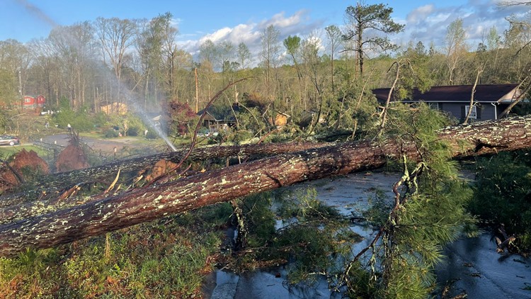
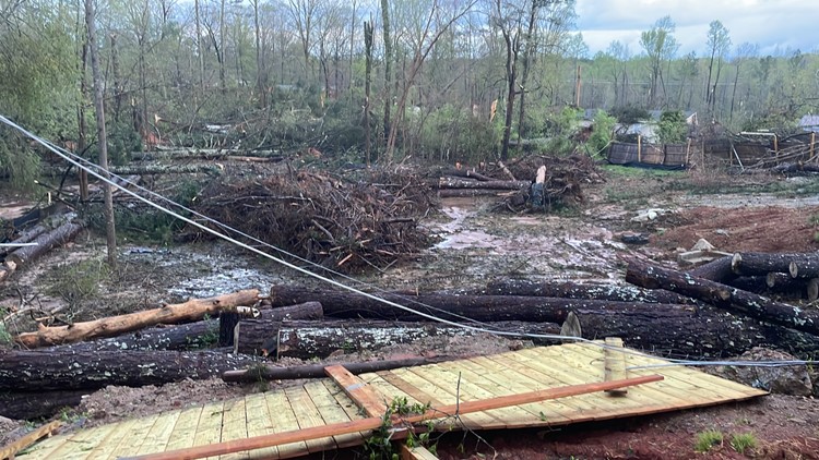
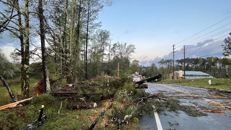
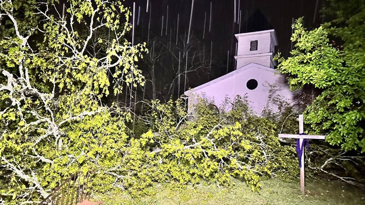
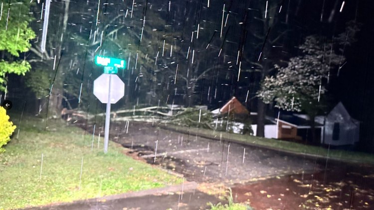
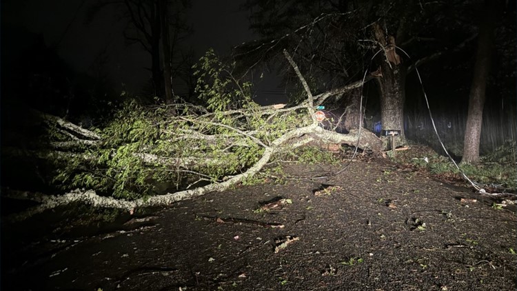
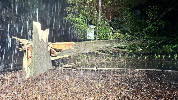
Many trees north of I-20 were uprooted, leaving huge root balls exposed and holes in the ground. These were largely huge hardwood trees, which have much more foliage on top and more surface area to be swept up by stronger winds.
Some of those trees ended up in homes but there was little in the way of wind damage to houses themselves.
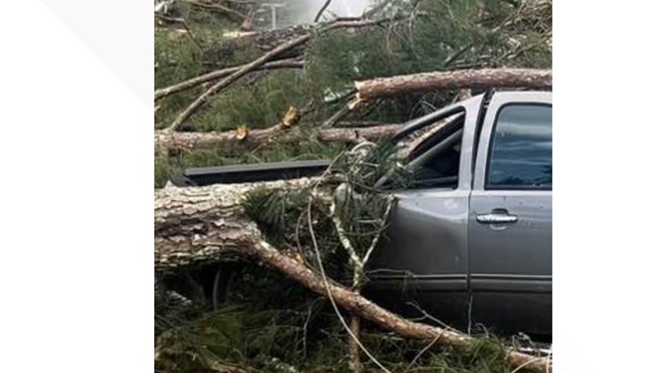
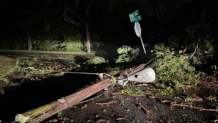
A few blocks away on Northside Drive – more trees littered the ground and road. And we saw two cars mangled underneath the weight of several trees.
After wrapping up that part of the storm’s path, it was time to circle back around to the storm's peak intensity, closer to Briarwood Circle.
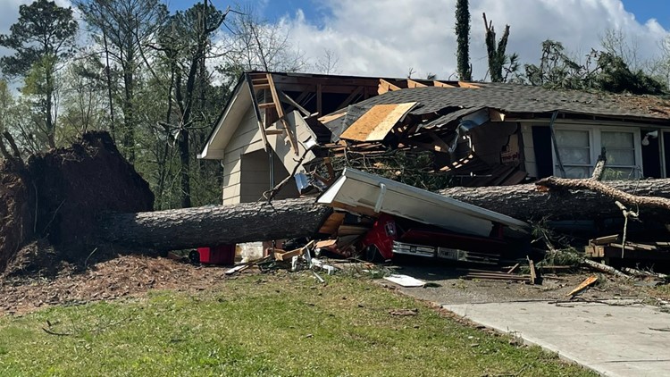
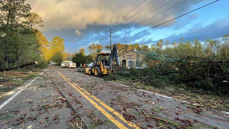
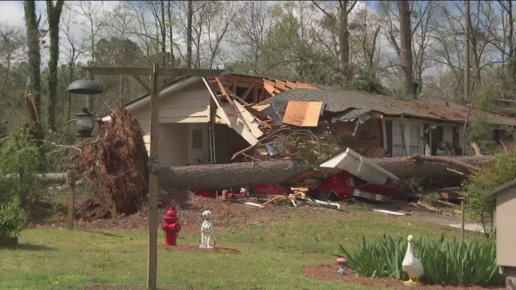
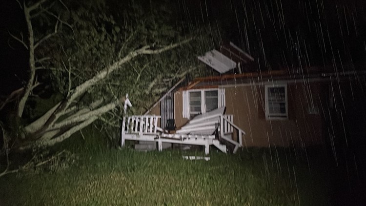
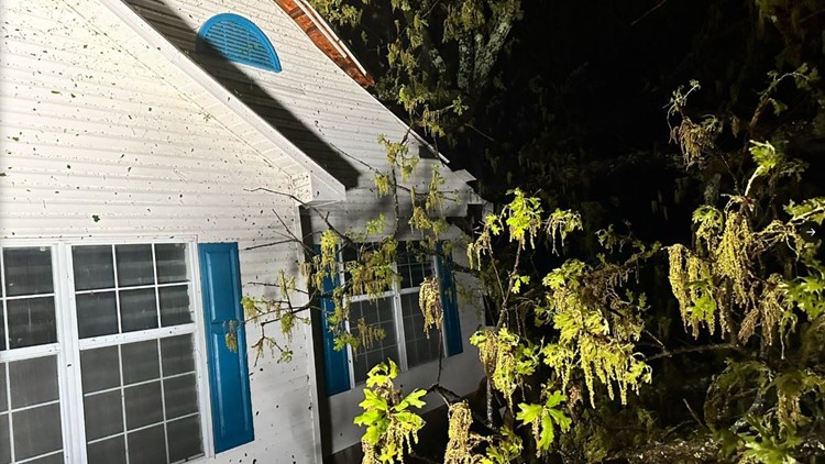
There, we saw a big difference in the span of the damage. Left and right, pine trees were snapped in half. Bigger hardwoods were also uprooted. Several houses had trees crashing down onto them. And there was siding and minor roof damage.
The Franklin family was home at the time. Craig and Lary Nae Franklin were home at the time. Craig was on the phone with his mom the entire time, who lives just a few miles away.
"It was so loud. It was just so terrifying. Then we heard the wind, and before you knew it, the doors just went flying open," Franklin said.
By a miracle, the large pine tree missed their bedroom window. They had just spent Easter Sunday afternoon on the back patio and deck, enjoying the afternoon. Shingles were plucked off the roof. A glass door was broken. The pillars holding up the awning on the front porch were knocked over. But the family itself – all safe and thankful to be that way. The Franklins have lived in this house for over 20 years.
As we walked along Briarwood, the tree damage was everywhere.
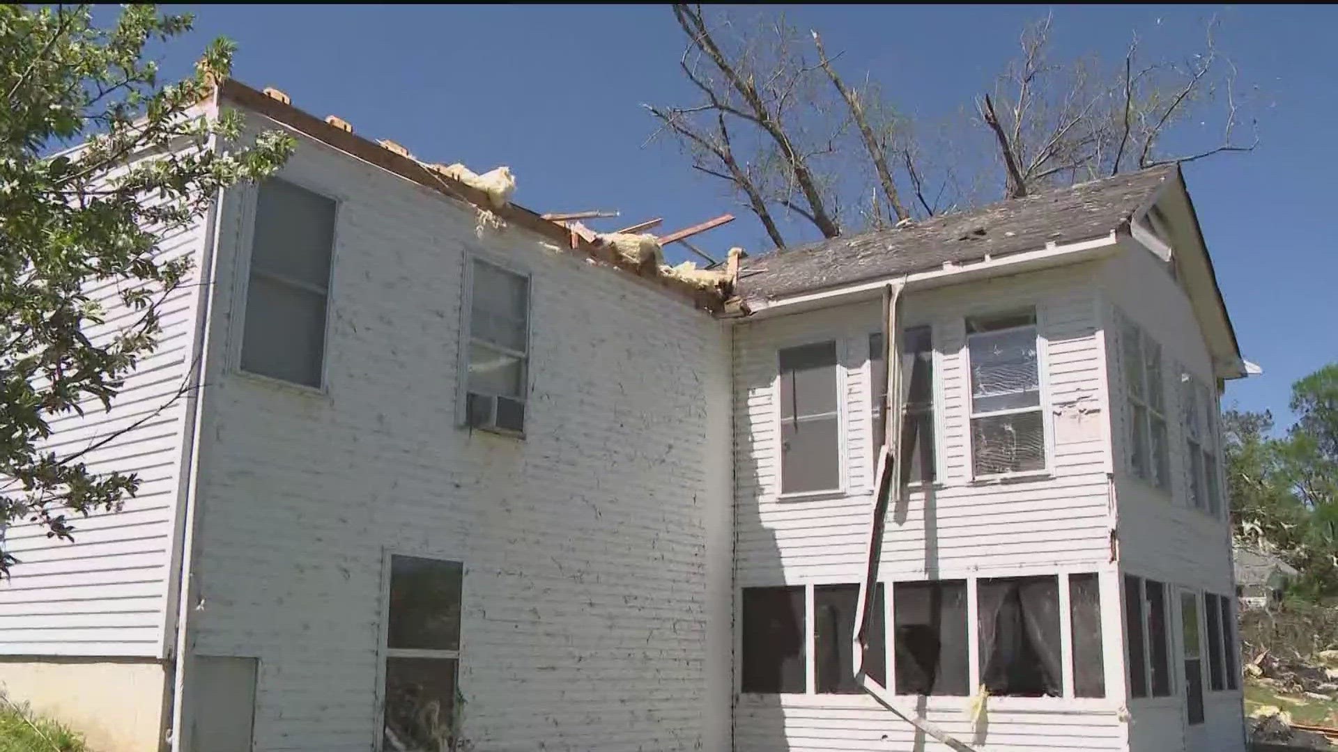
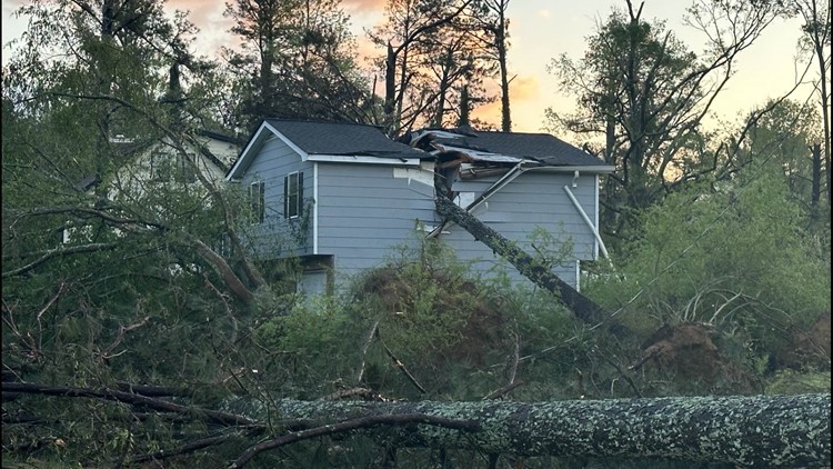
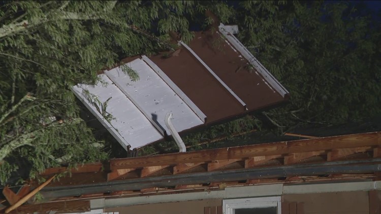
But it was one house off of McDaniel Mill Road that caught Keith and Sid’s eyes. The roof had partially come off.
But it was how it was assembled and then later ripped apart that they needed to get a closer look at. The roof had been fastened with bolts to joints with the walls of the top floor. The winds were so strong that they sheared off part of the roof. It left the anchor point attachments exposed. Shingles and roofing bits were strewed across the lawn. One large section of siding ended up tangled in a nearby tree. Insulation from the attic was littered throughout the yard and into other surrounding tree branches.
Homeowner Bonnie Penniman was home at the time. She got the notification on her home just moments before the storm hit. She dashed to the basement. Luckily, it was just in the nick of time. She would have otherwise been upstairs in bed, located underneath part of the torn-off roof.
This is where they had a discussion. The winds across the pond by the Briarwood Community were more indicative of high-end EF-1 damage, but here, it could have been more.
When surveying damage, there’s an entire catalog of damage ‘indicators’ that they can enter into their system: from softwood trees to hardwood trees to mobile homes and larger factories and buildings. They then look at the degree of damage to determine the rating. The Enhanced-Fujita Scale was developed and replaced by the Fujita scale in 2007, which more closely represents the windspeeds that can cause certain types of damage to various building materials.
The NWS Meteorologists determined that the wind speeds that caused the damage on McDaniel Mill Road were indicative of an EF-2 with winds of 115 mph.
After mapping out the core of the worst damage, they then circled back to get “firsts and lasts” – the starting point of the twister and then the finish point. They later mesh all of their field data points with the radar information from the event to map out the final path of the storm.
Preliminary information was released today. We will expect the final survey information and the map of the full path in the coming days.