ATLANTA — A significant storm system is moving across the southeast Monday and will bring wintry weather to parts of the area.
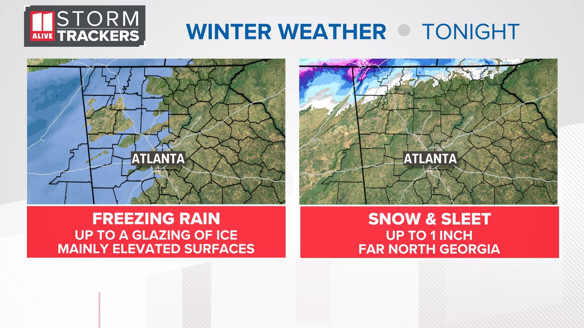
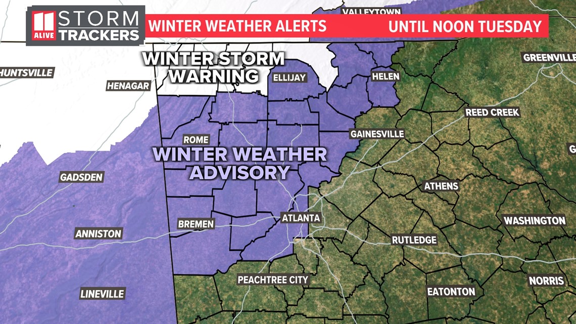
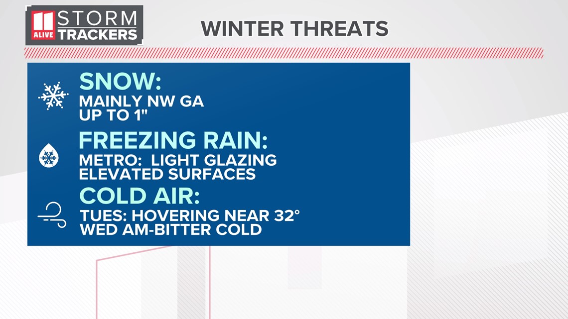
New: additional Metro Atlanta counties have been added to the Winter Weather Advisory. This now includes Fulton, Cobb, Douglas, Paulding, Cherokee, Forsyth, and others shown in purple below. Light freezing rain is possible in these metro Atlanta counties, which could lead to a glazing of ice. This would mainly happen on elevated surfaces like tree branches and decks. Slick spots could develop on untreated bridges and overpasses.
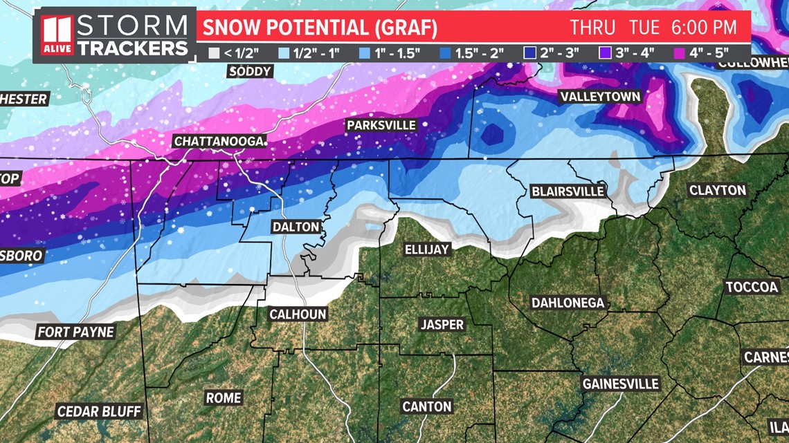
Winter Storm Warning: Some far north Georgia counties, including Murray, Whitfield and Fannin counties, are under a Winter Storm Warning, which is where some spots could get up to two inches of snow with a small amount of freezing rain as well. This could lead to hazardous travel on many roads with slippery conditions. This would be especially noticed in the higher elevations of the north Georgia mountains.
Winter Weather Advisory: Those counties shaded in purple, including Haralson, Polk, Floyd, Chattooga, Gordon, Bartow, Cherokee, Pickens, Gilmer, Forsyth, Dawson, Lumpkin, White, Union and Towns counties may get very light accumulations of snow/sleet and a glazing of freezing rain. While this wouldn't make for hazardous conditions across all roads, we may have hazardous travel with slick spots on some bridges.
Winter weather breakdown in north Georgia

Those that do get the snow could expect possible higher totals into the upper elevations and a significant amount of snow is possible for our neighbors in Tennessee.

Here are the main impacts we are watching.

Timeline
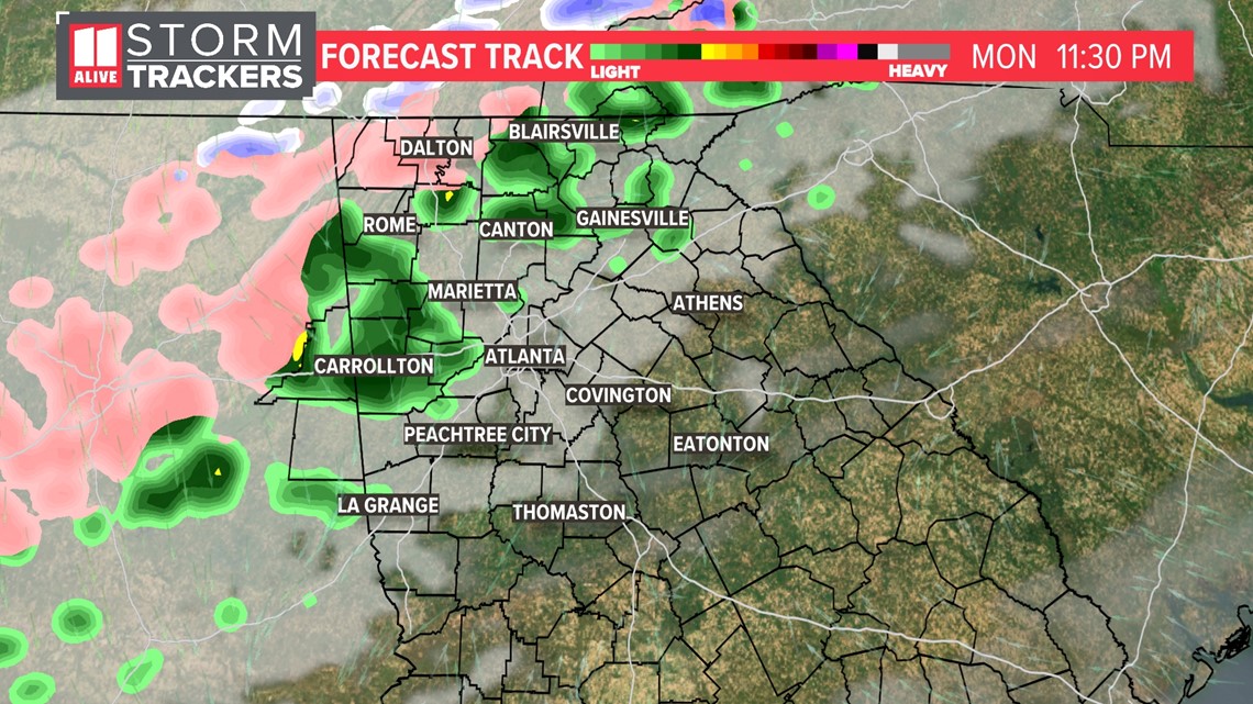
Monday evening into the overnight, the arctic front sags further south and the moisture works its way in across the Atlanta area. Some light rain showers start to move in with mixing far NW.

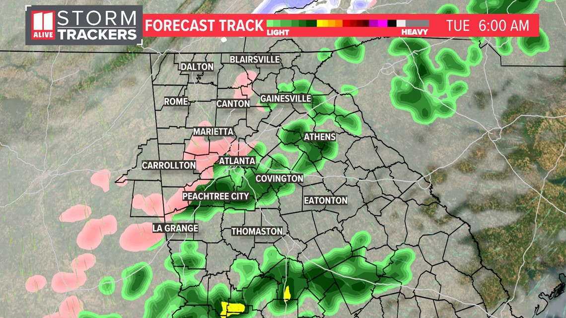
Early Tuesday morning a light mix is possible across portions of the metro. We feel that the road temps stay above freezing in the metro, so the roads should stay wet and anything that falls would be light. Untreated Bridges and overpasses along with other elevated surfaces could have a glazing of ice accretion. The commute may be impacted more in far north Georgia where temps remain colder.

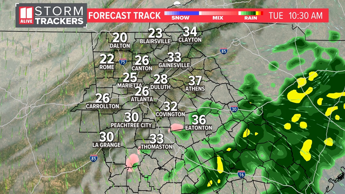
By the late morning on Tuesday, the wintry mix should be dried out and moving out of our region with frigid conditions moving in.

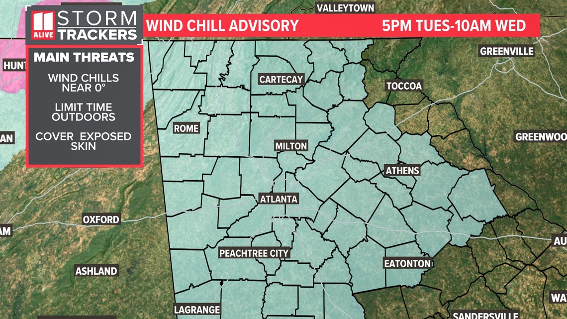
After the moisture moves out, it will be COLD. Temperatures will hover around freezing all day Tuesday, then drop quickly as the NW wind whips up. There is a wind chill advisory in effect beginning at 5pm Tuesday through 10am Wednesday. Wind chill readings will be near zero.

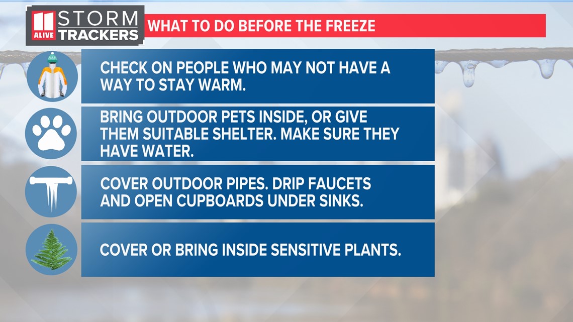
Temperatures will fall to the teens on Wednesday morning, and this can be considered a dangerous cold. Be sure to make preparations to protect people, pets, pipes and plants from the cold.